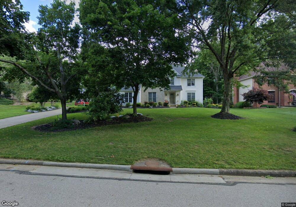
1771 Sawgrass Dr Uniontown, OH 44685
Estimated Value: $434,000 - $579,000
4
Beds
3
Baths
3,111
Sq Ft
$169/Sq Ft
Est. Value
About This Home
This home is located at 1771 Sawgrass Dr, Uniontown, OH 44685 and is currently estimated at $526,126, approximately $169 per square foot. 1771 Sawgrass Dr is a home located in Summit County with nearby schools including Greenwood Elementary School, Green Primary School, and Green Intermediate Elementary School.
Ownership History
Date
Name
Owned For
Owner Type
Purchase Details
Closed on
Feb 26, 1999
Sold by
Shultz Peggy L
Bought by
White Terry R and Schwarze Christine L
Current Estimated Value
Home Financials for this Owner
Home Financials are based on the most recent Mortgage that was taken out on this home.
Original Mortgage
$165,000
Interest Rate
6.92%
Create a Home Valuation Report for This Property
The Home Valuation Report is an in-depth analysis detailing your home's value as well as a comparison with similar homes in the area
Home Values in the Area
Average Home Value in this Area
Purchase History
| Date | Buyer | Sale Price | Title Company |
|---|---|---|---|
| White Terry R | $250,000 | Bond & Associates Title Agen |
Source: Public Records
Mortgage History
| Date | Status | Borrower | Loan Amount |
|---|---|---|---|
| Closed | White Terry R | $165,000 |
Source: Public Records
Tax History Compared to Growth
Tax History
| Year | Tax Paid | Tax Assessment Tax Assessment Total Assessment is a certain percentage of the fair market value that is determined by local assessors to be the total taxable value of land and additions on the property. | Land | Improvement |
|---|---|---|---|---|
| 2025 | $7,144 | $134,607 | $22,666 | $111,941 |
| 2024 | $6,803 | $134,607 | $22,666 | $111,941 |
| 2023 | $7,144 | $134,607 | $22,666 | $111,941 |
| 2022 | $5,810 | $103,632 | $17,437 | $86,195 |
| 2021 | $5,545 | $103,632 | $17,437 | $86,195 |
| 2020 | $5,486 | $103,640 | $17,440 | $86,200 |
| 2019 | $5,743 | $100,160 | $17,440 | $82,720 |
| 2018 | $5,841 | $100,160 | $17,440 | $82,720 |
| 2017 | $5,435 | $100,160 | $17,440 | $82,720 |
| 2016 | $5,639 | $91,340 | $17,440 | $73,900 |
| 2015 | $5,435 | $91,340 | $17,440 | $73,900 |
| 2014 | $5,145 | $91,340 | $17,440 | $73,900 |
| 2013 | $5,279 | $93,280 | $17,440 | $75,840 |
Source: Public Records
Map
Nearby Homes
- 3523 Parfoure Blvd
- 0 Raber Terrace
- 1959 Fairway Dr
- 3544 Raber Terrace
- 3083 Massillon Rd
- 4009 Troon Dr
- 2189 E Park Dr
- 3117 Imrek Dr
- 2245 Glenross Dr
- 3598 Elmhurst Cir
- 1457 5th Ave
- 3375 Buckeye Trail
- 3117 Vermont Place
- 3374 Buckeye Trail
- 3609 Glenshire Cir Unit 55B
- 1362 Maple Grove Ln
- 3109 Vermont Place
- 1352 Sassafras Place
- Brantwood Plan at Forest Lakes - The Enclave at Forest Lakes
- Hanover Plan at Forest Lakes - The Enclave at Forest Lakes
- 1783 Sawgrass Dr
- 1759 Sawgrass Dr
- 1795 Sawgrass Dr
- 1770 Sawgrass Dr
- 1782 Sawgrass Dr
- 1747 Sawgrass Dr
- 1758 Sawgrass Dr
- 1756 Sand Dr
- 1794 Sawgrass Dr
- 1746 Sand Dr
- 1807 Sawgrass Dr
- 1744 Sawgrass Dr
- 1772 Sand Dr
- 1735 Sawgrass Dr
- 1736 Sand Dr
- 1804 Sawgrass Dr
- V/L Sawgrass Dr
- 1734 Sawgrass Dr
- 1819 Sawgrass Dr
- 1783 Sand Dr