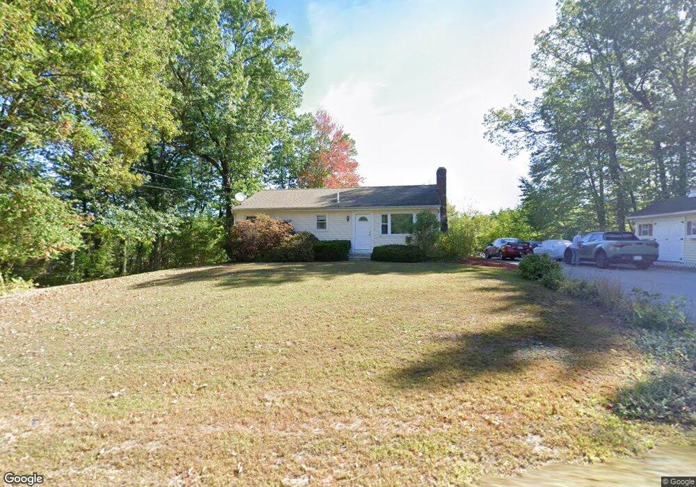
1771 Shirley Rd Lancaster, MA 01523
Estimated Value: $475,000 - $541,000
3
Beds
1
Bath
1,096
Sq Ft
$453/Sq Ft
Est. Value
About This Home
This home is located at 1771 Shirley Rd, Lancaster, MA 01523 and is currently estimated at $496,064, approximately $452 per square foot. 1771 Shirley Rd is a home located in Worcester County with nearby schools including Mary Rowlandson Elementary School, Luther Burbank Middle School, and Nashoba Regional High School.
Ownership History
Date
Name
Owned For
Owner Type
Purchase Details
Closed on
Jun 19, 2000
Sold by
Hazelriggs John P
Bought by
Cullinane Mary A
Current Estimated Value
Home Financials for this Owner
Home Financials are based on the most recent Mortgage that was taken out on this home.
Original Mortgage
$135,300
Interest Rate
8.24%
Mortgage Type
Purchase Money Mortgage
Purchase Details
Closed on
Jun 18, 1997
Sold by
Peik Ronald
Bought by
Hazelrigg John P
Purchase Details
Closed on
Apr 13, 1992
Sold by
Hazelrigg Daniel K and Hazelrigg Miyoko
Bought by
Ronald Peik
Create a Home Valuation Report for This Property
The Home Valuation Report is an in-depth analysis detailing your home's value as well as a comparison with similar homes in the area
Home Values in the Area
Average Home Value in this Area
Purchase History
| Date | Buyer | Sale Price | Title Company |
|---|---|---|---|
| Cullinane Mary A | $169,900 | -- | |
| Hazelrigg John P | $110,500 | -- | |
| Ronald Peik | $100,000 | -- |
Source: Public Records
Mortgage History
| Date | Status | Borrower | Loan Amount |
|---|---|---|---|
| Open | Ronald Peik | $151,000 | |
| Closed | Ronald Peik | $135,000 | |
| Closed | Ronald Peik | $135,300 | |
| Previous Owner | Ronald Peik | $125,250 |
Source: Public Records
Tax History Compared to Growth
Tax History
| Year | Tax Paid | Tax Assessment Tax Assessment Total Assessment is a certain percentage of the fair market value that is determined by local assessors to be the total taxable value of land and additions on the property. | Land | Improvement |
|---|---|---|---|---|
| 2025 | $6,760 | $418,300 | $102,600 | $315,700 |
| 2024 | $6,820 | $390,600 | $93,400 | $297,200 |
| 2023 | $6,269 | $364,700 | $84,900 | $279,800 |
| 2022 | $5,691 | $292,600 | $79,100 | $213,500 |
| 2021 | $5,534 | $277,000 | $79,100 | $197,900 |
| 2020 | $5,502 | $277,200 | $79,200 | $198,000 |
| 2019 | $5,062 | $256,300 | $79,200 | $177,100 |
| 2018 | $4,635 | $232,000 | $79,200 | $152,800 |
| 2016 | $3,758 | $192,200 | $78,300 | $113,900 |
| 2015 | $3,576 | $190,600 | $78,300 | $112,300 |
| 2014 | $3,542 | $187,300 | $78,300 | $109,000 |
Source: Public Records
Map
Nearby Homes
- 95 Old Union Turnpike
- 0 Windsor Rd
- 7 Lawson Ave
- 27 Lancaster Rd
- 3 Mill St
- 25 Front St
- 30 Ayer Rd
- 40 Ayer Rd
- 1497 Lunenburg Rd
- 35 Mcgovern Blvd
- 3 Ambrose Way Unit 3
- 6 Ambrose Way Unit 3
- 19 Ambrose Way Unit 19
- 9 Ambrose Way Unit 9
- 1 Ambrose Way Unit 1
- 7 Ambrose Way Unit 5
- 4 Ambrose Way Unit 4
- 5 Ambrose Way Unit 5
- 13 Ambrose Way Unit 13
- 45 Clark Rd
- 1789 Shirley Rd
- 1764 Shirley Rd
- 1786 Shirley Rd
- 1754 Shirley Rd
- 1798 Shirley Rd
- 1803 Shirley Rd
- 1744 Shirley Rd
- 1808 Shirley Rd
- 1813 Shirley Rd
- 141 Grant Way
- 1734 Shirley Rd
- 165 Grant Way
- 1822 Shirley Rd
- 1724 Shirley Rd
- 123 Grant Way
- 187 Grant Way
- 105 Grant Way
- 1832 Shirley Rd
- 17 Grant Way
- 1725 Shirley Rd