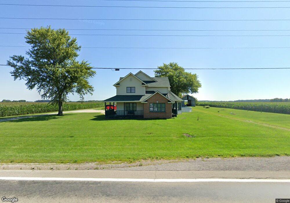
17724 State Route 49 Antwerp, OH 45813
Estimated Value: $243,630 - $352,000
3
Beds
3
Baths
2,691
Sq Ft
$107/Sq Ft
Est. Value
About This Home
This home is located at 17724 State Route 49, Antwerp, OH 45813 and is currently estimated at $286,908, approximately $106 per square foot. 17724 State Route 49 is a home located in Paulding County with nearby schools including Antwerp Local Elementary School and Antwerp Local High School.
Ownership History
Date
Name
Owned For
Owner Type
Purchase Details
Closed on
Aug 14, 2023
Sold by
Michael & Sons Farms Llc
Bought by
Michael Daniel L and Michael Ramona Kay
Current Estimated Value
Purchase Details
Closed on
May 31, 2023
Sold by
Michael Daniel L and Michael Ramona Kay
Bought by
Michael & Sons Farms Llc
Purchase Details
Closed on
Oct 9, 1996
Bought by
Michael Daniel L Michael Ramona Kay
Create a Home Valuation Report for This Property
The Home Valuation Report is an in-depth analysis detailing your home's value as well as a comparison with similar homes in the area
Home Values in the Area
Average Home Value in this Area
Purchase History
| Date | Buyer | Sale Price | Title Company |
|---|---|---|---|
| Michael Daniel L | -- | None Listed On Document | |
| Michael & Sons Farms Llc | -- | None Listed On Document | |
| Michael & Sons Farms Llc | -- | None Listed On Document | |
| Michael Daniel L Michael Ramona Kay | $65,000 | -- |
Source: Public Records
Tax History Compared to Growth
Tax History
| Year | Tax Paid | Tax Assessment Tax Assessment Total Assessment is a certain percentage of the fair market value that is determined by local assessors to be the total taxable value of land and additions on the property. | Land | Improvement |
|---|---|---|---|---|
| 2024 | $2,294 | $65,350 | $7,560 | $57,790 |
| 2023 | $2,294 | $65,350 | $7,560 | $57,790 |
| 2022 | $2,207 | $65,350 | $7,560 | $57,790 |
| 2021 | $2,064 | $55,930 | $7,070 | $48,860 |
| 2020 | $2,120 | $55,930 | $7,070 | $48,860 |
| 2019 | $2,149 | $49,560 | $7,070 | $42,490 |
| 2018 | $1,874 | $49,560 | $7,070 | $42,490 |
| 2017 | $1,876 | $49,560 | $7,070 | $42,490 |
| 2016 | $1,877 | $49,560 | $7,070 | $42,490 |
| 2015 | $1,811 | $49,320 | $6,650 | $42,670 |
| 2014 | $1,794 | $49,320 | $6,650 | $42,670 |
| 2013 | $2,102 | $51,560 | $6,650 | $44,910 |
Source: Public Records
Map
Nearby Homes
- 3190 Road 204
- 136 Maumee Ln
- 11309 State Route 49
- 11234 State Route 49
- 309 N Madison St
- 16453 Road 63
- 208 W River St
- 13149 Road 27b
- 319 W High St
- 217 W Edgerton St
- TBD Allen Rd
- 5092 Road 176
- 110 Sholl Terrace
- 338 Chicago Ave
- 307 Spencerville St
- 516 Ogen St
- 24502 Indiana 37
- 26100 Worden Rd
- 410 N Bryan St
- 614 E Cornelia St
- 17967 State Route 49
- 3562 County Road 230
- 3524 County Road 230
- 3524 Road 230
- 3510 County Road 230
- 17736 Road 35
- 18354 State Route 49
- 18308 Road 33
- 3056 County Road 230
- 17026 State Route 49
- 3481 Road 220
- 4197 Road 220
- 2875 County Road 230
- 2875 County Road 230
- 2813 County Road 230
- 4281 Road 220
- 2761 County Road 230
- 4611 Road 230