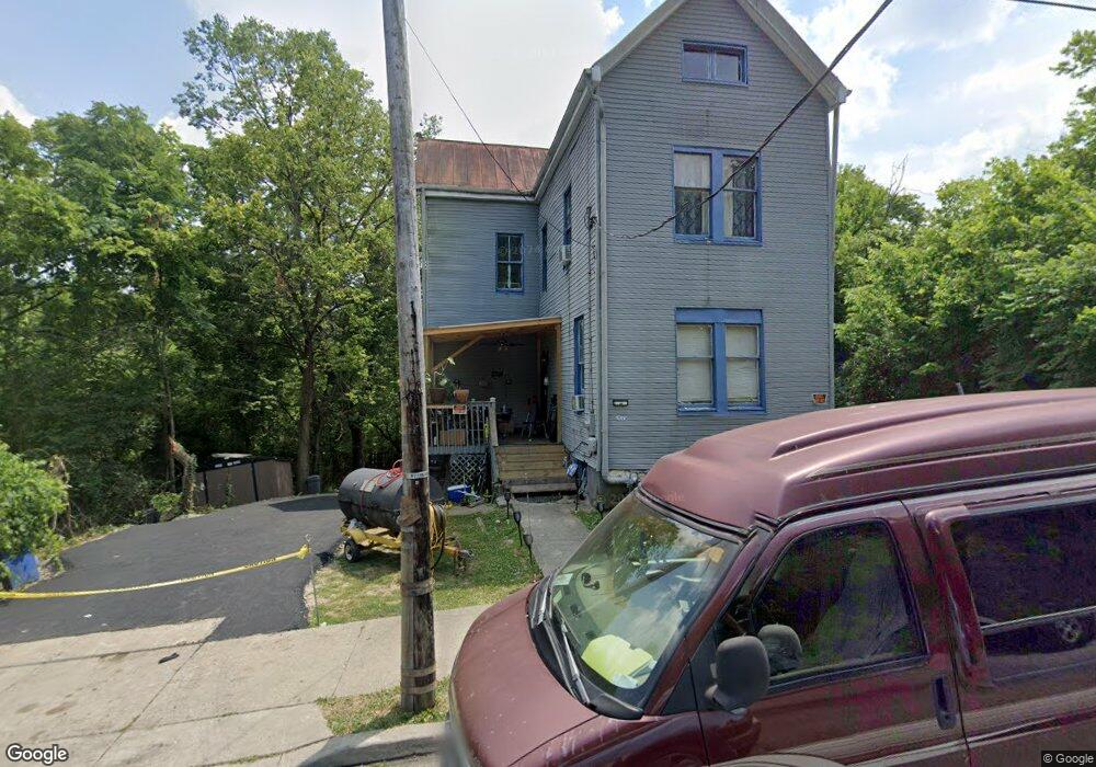
1773 Pulte St Cincinnati, OH 45225
North Fairmount NeighborhoodEstimated Value: $70,000 - $85,436
3
Beds
1
Bath
1,482
Sq Ft
$54/Sq Ft
Est. Value
About This Home
This home is located at 1773 Pulte St, Cincinnati, OH 45225 and is currently estimated at $79,479, approximately $53 per square foot. 1773 Pulte St is a home located in Hamilton County with nearby schools including Ethel M. Taylor Academy, Robert A. Taft Information Technology High School, and Western Hills High School.
Ownership History
Date
Name
Owned For
Owner Type
Purchase Details
Closed on
Dec 15, 2022
Sold by
Lockhart Cathy
Bought by
Turner Dominique
Current Estimated Value
Purchase Details
Closed on
Jun 5, 2008
Sold by
Visio Capital Llc
Bought by
Hope Nellie L
Home Financials for this Owner
Home Financials are based on the most recent Mortgage that was taken out on this home.
Original Mortgage
$9,445
Interest Rate
6.04%
Mortgage Type
Seller Take Back
Purchase Details
Closed on
Dec 31, 2007
Sold by
Econohomes Llc
Bought by
Visio Capital Llc
Purchase Details
Closed on
Sep 22, 2006
Sold by
Bryce Peters Financial Corp
Bought by
Younts Moore Ltd Co
Purchase Details
Closed on
Aug 14, 2006
Sold by
Wells Fargo Bank Na
Bought by
Bryce Peters Financial Corp
Purchase Details
Closed on
Jun 7, 2006
Sold by
Mangino Andrew
Bought by
Wells Fargo Bank Na and First Franklin Mortgage Loan Trust 2002-
Purchase Details
Closed on
Oct 10, 2002
Sold by
Reynolds Richard
Bought by
Mangino Andrew
Home Financials for this Owner
Home Financials are based on the most recent Mortgage that was taken out on this home.
Original Mortgage
$81,000
Interest Rate
7.5%
Purchase Details
Closed on
Mar 16, 2001
Sold by
Randall Rodger and Minger Steve
Bought by
Reynolds Richard
Home Financials for this Owner
Home Financials are based on the most recent Mortgage that was taken out on this home.
Original Mortgage
$68,400
Interest Rate
6.99%
Purchase Details
Closed on
Jan 22, 2001
Sold by
United Companies Lending Corp
Bought by
Minger Steve and Randall Rodger
Home Financials for this Owner
Home Financials are based on the most recent Mortgage that was taken out on this home.
Original Mortgage
$68,400
Interest Rate
6.99%
Purchase Details
Closed on
Dec 13, 2000
Sold by
Allen Ruth and Doe John
Bought by
United Companies Lending Corp
Create a Home Valuation Report for This Property
The Home Valuation Report is an in-depth analysis detailing your home's value as well as a comparison with similar homes in the area
Home Values in the Area
Average Home Value in this Area
Purchase History
| Date | Buyer | Sale Price | Title Company |
|---|---|---|---|
| Turner Dominique | -- | -- | |
| Turner Dominique | -- | None Listed On Document | |
| Hope Nellie L | -- | American Homeland Title Agen | |
| Visio Capital Llc | $1,000 | Ecom Title Agency Llc | |
| Younts Moore Ltd Co | $3,000 | Attorney | |
| Bryce Peters Financial Corp | -- | Fidelity Land Title Agency | |
| Wells Fargo Bank Na | $10,000 | None Available | |
| Mangino Andrew | $90,000 | -- | |
| Reynolds Richard | $76,000 | -- | |
| Minger Steve | $10,000 | -- | |
| United Companies Lending Corp | $14,000 | -- |
Source: Public Records
Mortgage History
| Date | Status | Borrower | Loan Amount |
|---|---|---|---|
| Previous Owner | Hope Nellie L | $9,445 | |
| Previous Owner | Mangino Andrew | $81,000 | |
| Previous Owner | Reynolds Richard | $68,400 |
Source: Public Records
Tax History Compared to Growth
Tax History
| Year | Tax Paid | Tax Assessment Tax Assessment Total Assessment is a certain percentage of the fair market value that is determined by local assessors to be the total taxable value of land and additions on the property. | Land | Improvement |
|---|---|---|---|---|
| 2024 | $690 | $11,323 | $907 | $10,416 |
| 2023 | $705 | $11,323 | $907 | $10,416 |
| 2022 | $539 | $7,508 | $910 | $6,598 |
| 2021 | $502 | $7,508 | $910 | $6,598 |
| 2020 | $516 | $7,508 | $910 | $6,598 |
| 2019 | $513 | $6,825 | $826 | $5,999 |
| 2018 | $514 | $6,825 | $826 | $5,999 |
| 2017 | $488 | $6,825 | $826 | $5,999 |
| 2016 | $220 | $2,954 | $1,029 | $1,925 |
| 2015 | $199 | $2,954 | $1,029 | $1,925 |
| 2014 | $200 | $2,954 | $1,029 | $1,925 |
| 2013 | $201 | $2,927 | $1,019 | $1,908 |
Source: Public Records
Map
Nearby Homes
- 1797 Denham St
- 1770 Carll St
- 1808 Carll St
- 1721 Sutter Ave
- 1854 Carll St
- 1704 Pulte St
- 1642 Sutter Ave
- 1646 Pulte St
- 1859 Baltimore Ave
- 2911 Moosewood Ct
- 1623 Sutter Ave
- 1674 Baltimore Ave
- 2568 Trevor Place
- 3065 Moosewood Ave
- 3069 Moosewood Ave
- 2652 Linden St
- 2650 Linden St
- 2654 Linden St
- 2658 Linden St
- 2656 Linden St