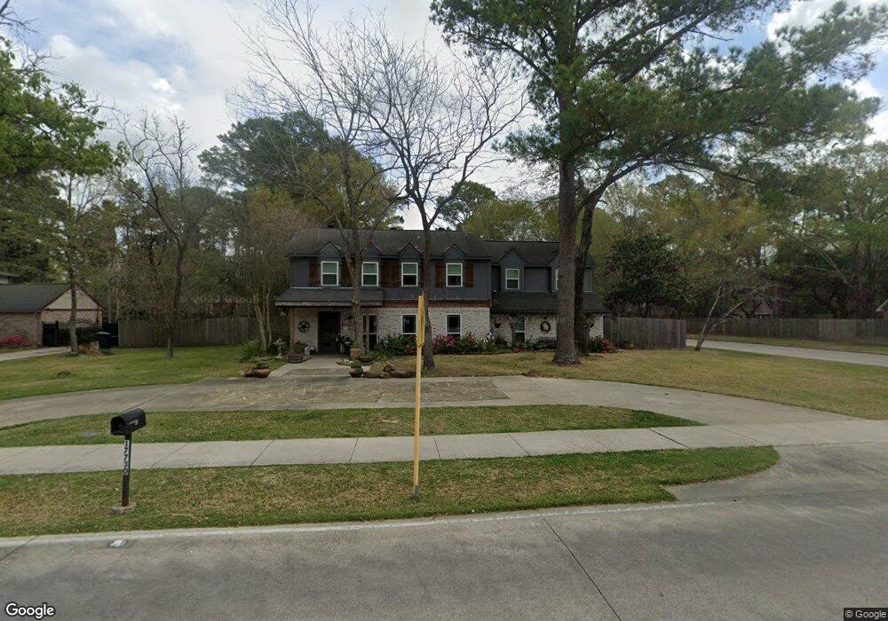
17730 Theiss Mail Route Rd Spring, TX 77379
Estimated Value: $340,000 - $364,000
4
Beds
3
Baths
2,402
Sq Ft
$146/Sq Ft
Est. Value
About This Home
This home is located at 17730 Theiss Mail Route Rd, Spring, TX 77379 and is currently estimated at $351,416, approximately $146 per square foot. 17730 Theiss Mail Route Rd is a home located in Harris County with nearby schools including Theiss Elementary School, Doerre Intermediate School, and Klein High School.
Ownership History
Date
Name
Owned For
Owner Type
Purchase Details
Closed on
Aug 25, 2009
Sold by
Romero Joseph M
Bought by
Vasquez Kristen D
Current Estimated Value
Home Financials for this Owner
Home Financials are based on the most recent Mortgage that was taken out on this home.
Original Mortgage
$144,000
Interest Rate
5.2%
Mortgage Type
New Conventional
Purchase Details
Closed on
Feb 24, 2003
Sold by
Bolt Jon C and Bolt Genie K
Bought by
Romero Joseph M
Home Financials for this Owner
Home Financials are based on the most recent Mortgage that was taken out on this home.
Original Mortgage
$140,400
Interest Rate
5.9%
Create a Home Valuation Report for This Property
The Home Valuation Report is an in-depth analysis detailing your home's value as well as a comparison with similar homes in the area
Home Values in the Area
Average Home Value in this Area
Purchase History
| Date | Buyer | Sale Price | Title Company |
|---|---|---|---|
| Vasquez Kristen D | -- | None Available | |
| Romero Joseph M | -- | Houston Title Co |
Source: Public Records
Mortgage History
| Date | Status | Borrower | Loan Amount |
|---|---|---|---|
| Closed | Vasquez Kristen D | $144,000 | |
| Previous Owner | Romero Joseph M | $140,400 |
Source: Public Records
Tax History Compared to Growth
Tax History
| Year | Tax Paid | Tax Assessment Tax Assessment Total Assessment is a certain percentage of the fair market value that is determined by local assessors to be the total taxable value of land and additions on the property. | Land | Improvement |
|---|---|---|---|---|
| 2025 | $2,018 | $329,210 | $48,264 | $280,946 |
| 2024 | $2,018 | $329,210 | $48,264 | $280,946 |
| 2023 | $2,018 | $301,488 | $48,264 | $253,224 |
| 2022 | $3,597 | $222,778 | $48,264 | $174,514 |
| 2021 | $5,003 | $215,501 | $48,264 | $167,237 |
| 2020 | $5,014 | $207,287 | $48,264 | $159,023 |
| 2019 | $5,200 | $207,287 | $48,264 | $159,023 |
| 2018 | $2,607 | $207,287 | $48,264 | $159,023 |
| 2017 | $5,115 | $207,287 | $48,264 | $159,023 |
| 2016 | $4,650 | $185,059 | $30,165 | $154,894 |
| 2015 | $3,922 | $185,059 | $30,165 | $154,894 |
| 2014 | $3,922 | $172,418 | $30,165 | $142,253 |
Source: Public Records
Map
Nearby Homes
- 17811 Running Brook Ln
- 8014 Beaufort Dr
- 8019 Beaufort Dr
- 8131 Theisswood Rd
- 8011 Beaufort Dr
- 7907 Aleta Dr
- 7906 Beaufort Dr
- 7803 Theisswood Rd
- 7930 Tizerton Ct
- 8035 White Marsh Ct
- 8011 Liberty Elm Ct
- 18014 Hampton Oak Dr
- 18119 Hampton Oak Dr
- 8114 Hidden Trail Ln
- 17902 Fernbluff Dr
- 7614 Theisswood Rd
- 8015 Democracy Ct
- 7607 Theisswood Rd
- 7610 Theisswood Rd
- 8002 Oxfordshire Dr
- 17734 Theiss Mail Route Rd
- 8022 Theisswood Rd
- 17726 Theiss Mail Route Rd
- 17738 Theiss Mail Route Rd
- 8002 Forest Breeze Ln
- 8103 Theisswood Rd
- 17718 Hidden Forest Dr
- 8023 Theisswood Rd
- 17722 Theiss Mail Route Rd
- 17714 Hidden Forest Dr
- 17803 Running Brook Ln
- 17807 Running Brook Ln
- 8107 Theisswood Rd
- 17802 Theiss Mail Route Rd
- 8006 Forest Breeze Ln
- 8019 Theisswood Rd
- 17710 Hidden Forest Dr
- 17803 Theiss Mail Route Rd
- 17815 Running Brook Ln
- 17718 Theiss Mail Route Rd