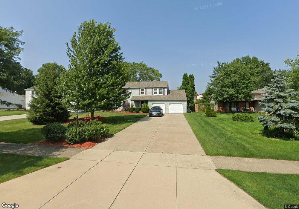
17736 Howe Rd Strongsville, OH 44136
Estimated Value: $340,879 - $406,000
4
Beds
3
Baths
2,382
Sq Ft
$157/Sq Ft
Est. Value
About This Home
This home is located at 17736 Howe Rd, Strongsville, OH 44136 and is currently estimated at $373,970, approximately $156 per square foot. 17736 Howe Rd is a home located in Cuyahoga County with nearby schools including Strongsville High School.
Ownership History
Date
Name
Owned For
Owner Type
Purchase Details
Closed on
Sep 2, 2022
Bought by
Harshbarger William Merl
Current Estimated Value
Purchase Details
Closed on
Sep 25, 1998
Sold by
Spencer William J and Spencer Pamela L
Bought by
Harshbarger William M and Harshbarger Christine A
Home Financials for this Owner
Home Financials are based on the most recent Mortgage that was taken out on this home.
Original Mortgage
$148,200
Interest Rate
6.98%
Purchase Details
Closed on
Sep 9, 1992
Sold by
Kovach Gerald H
Bought by
Spencer William J
Purchase Details
Closed on
Jan 30, 1979
Bought by
Kovach Gerald H
Purchase Details
Closed on
Jun 20, 1977
Bought by
Baycrest Homes Inc
Purchase Details
Closed on
Jan 1, 1977
Bought by
North East Land Co
Create a Home Valuation Report for This Property
The Home Valuation Report is an in-depth analysis detailing your home's value as well as a comparison with similar homes in the area
Home Values in the Area
Average Home Value in this Area
Purchase History
| Date | Buyer | Sale Price | Title Company |
|---|---|---|---|
| Harshbarger William Merl | -- | -- | |
| Harshbarger William M | $156,000 | City Title Company Agency In | |
| Spencer William J | $133,900 | -- | |
| Kovach Gerald H | $77,800 | -- | |
| Baycrest Homes Inc | $77,500 | -- | |
| North East Land Co | -- | -- |
Source: Public Records
Mortgage History
| Date | Status | Borrower | Loan Amount |
|---|---|---|---|
| Previous Owner | Harshbarger William M | $148,200 |
Source: Public Records
Tax History Compared to Growth
Tax History
| Year | Tax Paid | Tax Assessment Tax Assessment Total Assessment is a certain percentage of the fair market value that is determined by local assessors to be the total taxable value of land and additions on the property. | Land | Improvement |
|---|---|---|---|---|
| 2024 | $4,319 | $91,980 | $17,605 | $74,375 |
| 2023 | $5,181 | $82,750 | $21,180 | $61,570 |
| 2022 | $5,144 | $82,740 | $21,175 | $61,565 |
| 2021 | $5,103 | $82,740 | $21,180 | $61,570 |
| 2020 | $4,728 | $67,830 | $17,360 | $50,470 |
| 2019 | $4,590 | $193,800 | $49,600 | $144,200 |
| 2018 | $4,106 | $67,830 | $17,360 | $50,470 |
| 2017 | $4,122 | $62,130 | $13,760 | $48,370 |
| 2016 | $4,088 | $62,130 | $13,760 | $48,370 |
| 2015 | $4,146 | $62,130 | $13,760 | $48,370 |
| 2014 | $4,146 | $62,130 | $13,760 | $48,370 |
Source: Public Records
Map
Nearby Homes
- 17130 Golden Star Dr
- 18229 Howe Rd
- 16650 Lanier Ave
- 17159 Turkey Meadow Ln
- 14558 Drake Rd
- 16969 Antler Ln
- 16711 Beech Cir
- 17682 Drake Rd
- 18987 Laurell Cir
- 14985 Camden Cir
- 14132 Walking Stick Way
- 19694 Benbow Rd
- 15772 Boston Rd
- 15604-REAR Boston Rd
- 19740 Benbow Rd
- 17029 Eagles Nest Cir
- 18294 Drake Rd
- 15188 Trails Landing
- 17745 Brick Mill Run
- 18411 Yorktown Oval
- 17702 Howe Rd
- 17780 Howe Rd
- 17773 Blazing Star Dr
- 17668 Howe Rd
- 17804 Howe Rd
- 17805 Blazing Star Dr
- 17759 Blazing Star Dr
- 17838 Howe Rd
- 17634 Howe Rd
- 17831 Blazing Star Dr
- 17741 Howe Rd
- 16093 Drake Rd
- 17785 Howe Rd
- 17823 Howe Rd
- 17857 Blazing Star Dr
- 17872 Howe Rd
- 16117 Drake Rd
- 17831 Howe Rd
- 17752 Blazing Star Dr
- 16141 Drake Rd