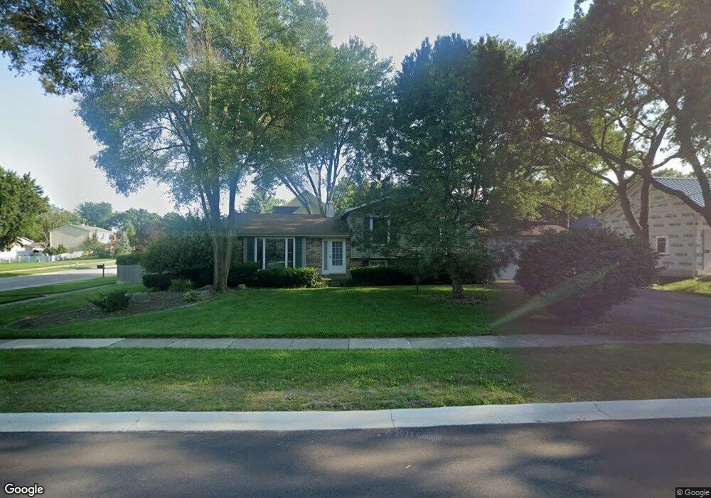
17737 W Winnebago Dr Grayslake, IL 60030
Estimated Value: $284,000 - $358,000
3
Beds
2
Baths
1,320
Sq Ft
$245/Sq Ft
Est. Value
About This Home
This home is located at 17737 W Winnebago Dr, Grayslake, IL 60030 and is currently estimated at $323,435, approximately $245 per square foot. 17737 W Winnebago Dr is a home located in Lake County with nearby schools including Woodland Primary School, Woodland Elementary School, and Woodland Intermediate School.
Ownership History
Date
Name
Owned For
Owner Type
Purchase Details
Closed on
Nov 5, 1999
Sold by
Lowery Robert and Lowery Marilyn E
Bought by
Lowery Robert and Lowery Marilyn E
Current Estimated Value
Purchase Details
Closed on
Jul 15, 1999
Sold by
Lowery Robert and Lowery Marilyn E
Bought by
Lowery Robert and Lowery Marilyn E
Home Financials for this Owner
Home Financials are based on the most recent Mortgage that was taken out on this home.
Original Mortgage
$145,000
Interest Rate
6.92%
Purchase Details
Closed on
May 20, 1999
Sold by
Esposito John V
Bought by
Lowery Robert and Burtscher Marilyn E
Home Financials for this Owner
Home Financials are based on the most recent Mortgage that was taken out on this home.
Original Mortgage
$145,000
Interest Rate
6.92%
Create a Home Valuation Report for This Property
The Home Valuation Report is an in-depth analysis detailing your home's value as well as a comparison with similar homes in the area
Home Values in the Area
Average Home Value in this Area
Purchase History
| Date | Buyer | Sale Price | Title Company |
|---|---|---|---|
| Lowery Robert | -- | -- | |
| Lowery Robert | $183,000 | -- | |
| Lowery Robert | $183,000 | Chicago Title Insurance Co |
Source: Public Records
Mortgage History
| Date | Status | Borrower | Loan Amount |
|---|---|---|---|
| Previous Owner | Lowery Robert | $145,000 |
Source: Public Records
Tax History Compared to Growth
Tax History
| Year | Tax Paid | Tax Assessment Tax Assessment Total Assessment is a certain percentage of the fair market value that is determined by local assessors to be the total taxable value of land and additions on the property. | Land | Improvement |
|---|---|---|---|---|
| 2024 | $5,627 | $109,693 | $15,479 | $94,214 |
| 2023 | $6,395 | $96,936 | $13,679 | $83,257 |
| 2022 | $6,395 | $87,242 | $14,512 | $72,730 |
| 2021 | $6,064 | $79,001 | $13,141 | $65,860 |
| 2020 | $5,994 | $77,059 | $12,818 | $64,241 |
| 2019 | $5,980 | $74,822 | $12,446 | $62,376 |
| 2018 | $6,604 | $74,825 | $16,457 | $58,368 |
| 2017 | $6,610 | $72,680 | $15,985 | $56,695 |
| 2016 | $6,580 | $69,444 | $15,273 | $54,171 |
| 2015 | $6,396 | $65,861 | $14,485 | $51,376 |
| 2014 | $6,621 | $68,190 | $14,297 | $53,893 |
| 2012 | $7,305 | $68,712 | $14,406 | $54,306 |
Source: Public Records
Map
Nearby Homes
- 17613 W Meadowbrook Dr
- 33485 N Mill Rd
- 33541 N Greentree Rd
- 33448 N Greentree Rd
- 33601 N Royal Oak Ln Unit 207
- 33720 N Royal Oak Ln Unit 206
- 17474 W Hickory Ln
- 17914 W Twin Lakes Blvd
- 33648 N Oakland Dr
- 34040 N White Oak Ln Unit 46C
- 17119 W Prairieview Ln
- 17602 W Knollwood Ct
- 34062 N Sulkey Dr
- 17429 W Chestnut Ln Unit 13A
- 34395 W Saddle Ct
- 18225 W Lindenwood Dr
- 32956 N Ashley Dr
- 17514 W Bridle Ct
- 18254 W Meander Dr
- 6359 Doral Dr
- 33584 N Almond Rd
- 33601 N Cherokee Ct
- 33585 N Cherokee Ct
- 17738 W Winnebago Dr
- 33570 N Almond Rd
- 33513 N Cherokee Ct
- 17754 W Winnebago Dr
- 17701 W Winnebago Dr
- 33561 N Cherokee Ct
- 17700 W Winnebago Dr
- 33558 N Almond Rd
- 33640 N Almond Rd
- 33560 N Cherokee Ct
- 17768 W Winnebago Dr
- 33555 N Cherokee Ct
- 17701 W Summit Dr
- 33592 N Cherokee Ct
- 17780 W Winnebago Dr
- 33546 N Almond Rd
- 17686 W Winnebago Dr