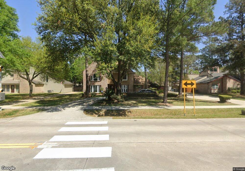
17738 Theiss Mail Route Rd Spring, TX 77379
Estimated Value: $544,000 - $667,534
4
Beds
4
Baths
3,550
Sq Ft
$173/Sq Ft
Est. Value
About This Home
This home is located at 17738 Theiss Mail Route Rd, Spring, TX 77379 and is currently estimated at $612,884, approximately $172 per square foot. 17738 Theiss Mail Route Rd is a home located in Harris County with nearby schools including Theiss Elementary School, Doerre Intermediate School, and Klein High School.
Ownership History
Date
Name
Owned For
Owner Type
Purchase Details
Closed on
May 1, 2018
Sold by
Emmons Wayne and Spurling Emmons Terri
Bought by
Dixon Christopher
Current Estimated Value
Home Financials for this Owner
Home Financials are based on the most recent Mortgage that was taken out on this home.
Original Mortgage
$351,500
Outstanding Balance
$303,001
Interest Rate
4.45%
Mortgage Type
New Conventional
Estimated Equity
$309,883
Purchase Details
Closed on
Jan 12, 2016
Sold by
Us Bank Na
Bought by
Terri Emmons Wayne and Terri Spuriling Emmons
Purchase Details
Closed on
Jun 2, 2015
Sold by
Cates Stephen W and Cates Rene S
Bought by
Us Bank Na
Create a Home Valuation Report for This Property
The Home Valuation Report is an in-depth analysis detailing your home's value as well as a comparison with similar homes in the area
Home Values in the Area
Average Home Value in this Area
Purchase History
| Date | Buyer | Sale Price | Title Company |
|---|---|---|---|
| Dixon Christopher | -- | Texas American Title Company | |
| Terri Emmons Wayne | -- | None Available | |
| Us Bank Na | $268,000 | None Available |
Source: Public Records
Mortgage History
| Date | Status | Borrower | Loan Amount |
|---|---|---|---|
| Open | Dixon Christopher | $351,500 |
Source: Public Records
Tax History Compared to Growth
Tax History
| Year | Tax Paid | Tax Assessment Tax Assessment Total Assessment is a certain percentage of the fair market value that is determined by local assessors to be the total taxable value of land and additions on the property. | Land | Improvement |
|---|---|---|---|---|
| 2025 | $8,539 | $713,173 | $64,992 | $648,181 |
| 2024 | $8,539 | $713,173 | $64,992 | $648,181 |
| 2023 | $8,539 | $649,348 | $64,992 | $584,356 |
| 2022 | $8,611 | $466,180 | $64,992 | $401,188 |
| 2021 | $8,340 | $443,842 | $64,992 | $378,850 |
| 2020 | $7,900 | $326,606 | $64,992 | $261,614 |
| 2019 | $8,193 | $326,606 | $64,992 | $261,614 |
| 2018 | $4,313 | $326,606 | $64,992 | $261,614 |
| 2017 | $8,207 | $326,606 | $64,992 | $261,614 |
| 2016 | $5,578 | $221,978 | $40,620 | $181,358 |
| 2015 | $4,074 | $221,978 | $40,620 | $181,358 |
| 2014 | $4,074 | $178,744 | $40,620 | $138,124 |
Source: Public Records
Map
Nearby Homes
- 17811 Running Brook Ln
- 8014 Beaufort Dr
- 8019 Beaufort Dr
- 8131 Theisswood Rd
- 8011 Beaufort Dr
- 7907 Aleta Dr
- 7906 Beaufort Dr
- 7803 Theisswood Rd
- 7930 Tizerton Ct
- 8035 White Marsh Ct
- 8011 Liberty Elm Ct
- 18014 Hampton Oak Dr
- 18119 Hampton Oak Dr
- 8114 Hidden Trail Ln
- 17902 Fernbluff Dr
- 7614 Theisswood Rd
- 8015 Democracy Ct
- 7607 Theisswood Rd
- 7610 Theisswood Rd
- 8002 Oxfordshire Dr
- 17802 Theiss Mail Route Rd
- 17734 Theiss Mail Route Rd
- 17806 Theiss Mail Route Rd
- 17803 Theiss Mail Route Rd
- 8103 Theisswood Rd
- 17730 Theiss Mail Route Rd
- 17807 Theiss Mail Route Rd
- 17810 Theiss Mail Route Rd
- 8022 Theisswood Rd
- 8107 Theisswood Rd
- 17815 Running Brook Ln
- 17819 Running Brook Ln
- 17811 Theiss Mail Route Rd
- 8002 Forest Breeze Ln
- 17802 Woodbark Rd
- 17807 Running Brook Ln
- 17806 Woodbark Rd
- 8006 Forest Breeze Ln
- 8111 Theisswood Rd
- 17823 Running Brook Ln