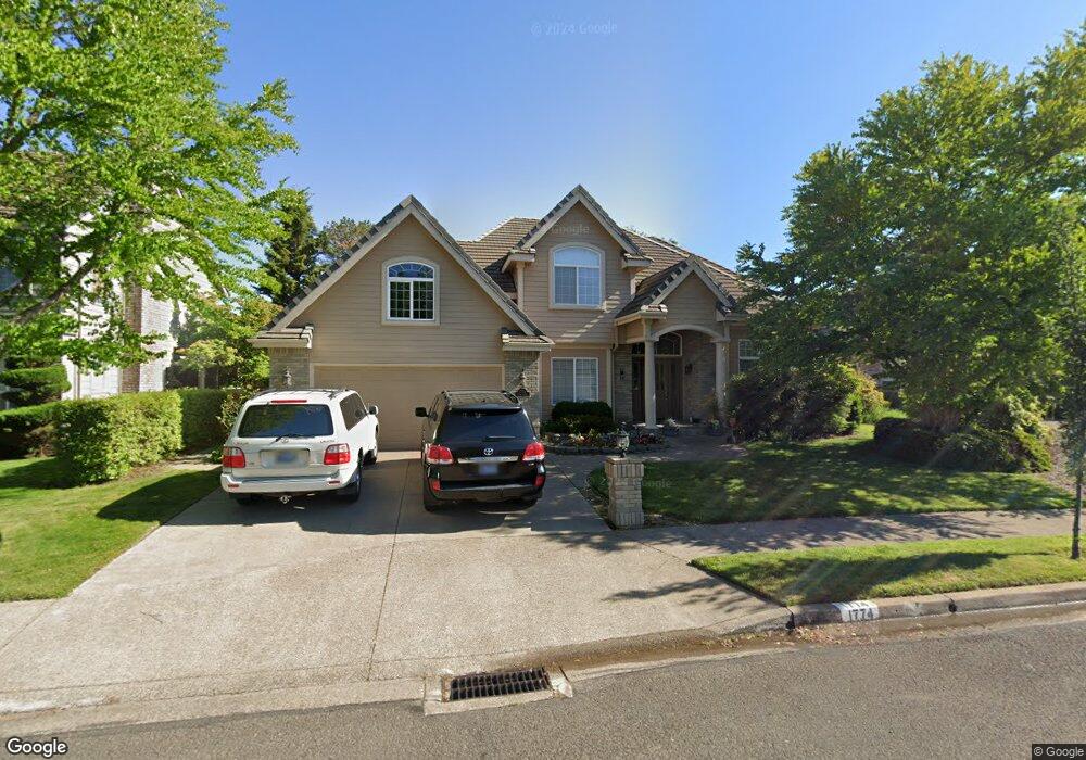
1774 River Pointe Loop Eugene, OR 97408
Cal Young NeighborhoodEstimated Value: $839,139 - $1,054,000
3
Beds
3
Baths
2,940
Sq Ft
$320/Sq Ft
Est. Value
About This Home
This home is located at 1774 River Pointe Loop, Eugene, OR 97408 and is currently estimated at $940,535, approximately $319 per square foot. 1774 River Pointe Loop is a home located in Lane County with nearby schools including Gilham Elementary School, Cal Young Middle School, and Sheldon High School.
Ownership History
Date
Name
Owned For
Owner Type
Purchase Details
Closed on
Jan 3, 2020
Sold by
Baker Gene S
Bought by
Baker Gene and Gene Wbaker Living Trust
Current Estimated Value
Purchase Details
Closed on
Oct 6, 2003
Sold by
Burton Richard H and Burton Barbara A
Bought by
Baker Gene S and Baker Janell M
Home Financials for this Owner
Home Financials are based on the most recent Mortgage that was taken out on this home.
Original Mortgage
$300,000
Outstanding Balance
$139,573
Interest Rate
6.4%
Mortgage Type
Purchase Money Mortgage
Estimated Equity
$800,962
Create a Home Valuation Report for This Property
The Home Valuation Report is an in-depth analysis detailing your home's value as well as a comparison with similar homes in the area
Home Values in the Area
Average Home Value in this Area
Purchase History
| Date | Buyer | Sale Price | Title Company |
|---|---|---|---|
| Baker Gene | -- | None Available | |
| Baker Gene S | $380,000 | Western Pioneer Title Co |
Source: Public Records
Mortgage History
| Date | Status | Borrower | Loan Amount |
|---|---|---|---|
| Open | Baker Gene S | $300,000 |
Source: Public Records
Tax History
| Year | Tax Paid | Tax Assessment Tax Assessment Total Assessment is a certain percentage of the fair market value that is determined by local assessors to be the total taxable value of land and additions on the property. | Land | Improvement |
|---|---|---|---|---|
| 2025 | $11,134 | $571,463 | -- | -- |
| 2024 | $10,996 | $554,819 | -- | -- |
| 2023 | $10,996 | $538,660 | $0 | $0 |
| 2022 | $10,301 | $522,971 | $0 | $0 |
| 2021 | $9,449 | $507,739 | $0 | $0 |
| 2020 | $9,263 | $492,951 | $0 | $0 |
| 2019 | $8,963 | $478,594 | $0 | $0 |
| 2018 | $8,421 | $451,121 | $0 | $0 |
| 2017 | $7,958 | $451,121 | $0 | $0 |
| 2016 | $7,663 | $437,982 | $0 | $0 |
| 2015 | $7,433 | $425,225 | $0 | $0 |
| 2014 | $7,314 | $412,840 | $0 | $0 |
Source: Public Records
Map
Nearby Homes
- 3428 River Pointe Dr
- 3435 Meadow View Dr
- 3328 Lakemont Dr
- 1880 Lake Cove Ave
- 3329 Lake Wood Dr
- 2063 Lake Wind Dr
- 3708 Gilham Rd
- 3540 Walton Ln
- 2099 Lake Shore Dr
- 3558 Nestucca Loop
- 2183 Ashbury Dr
- 3770 Waterbrook Way
- 2072 Lakeland Way
- 3620 Walton Ln
- 1930 Sterling Park Place
- 2053 Lakeview Dr
- 3355 N Delta Hwy Unit SP160
- 3355 N Delta Hwy Unit 105
- 2138 Country Haven Dr
- 3858 Mirror Pond Way
- 1770 River Pointe Loop
- 1782 River Pointe Loop
- 3535 River Pointe Dr
- 3547 River Pointe Dr
- 145 Ayers Rd
- 145 Ayres Rd
- 1766 River Pointe Loop
- 1786 River Pointe Loop
- 3523 River Pointe Dr
- 1757 River Pointe Loop
- 1775 River Pointe Loop
- 1925 Meadowood Dr
- 1754 River Pointe Loop
- 1783 River Pointe Loop
- 3469 River Pointe Dr
- 3511 River Pointe Dr
- 3559 River Pointe Dr
- 1727 River Pointe Loop
- 1791 River Pointe Loop
- 1715 River Pointe Loop
Your Personal Tour Guide
Ask me questions while you tour the home.