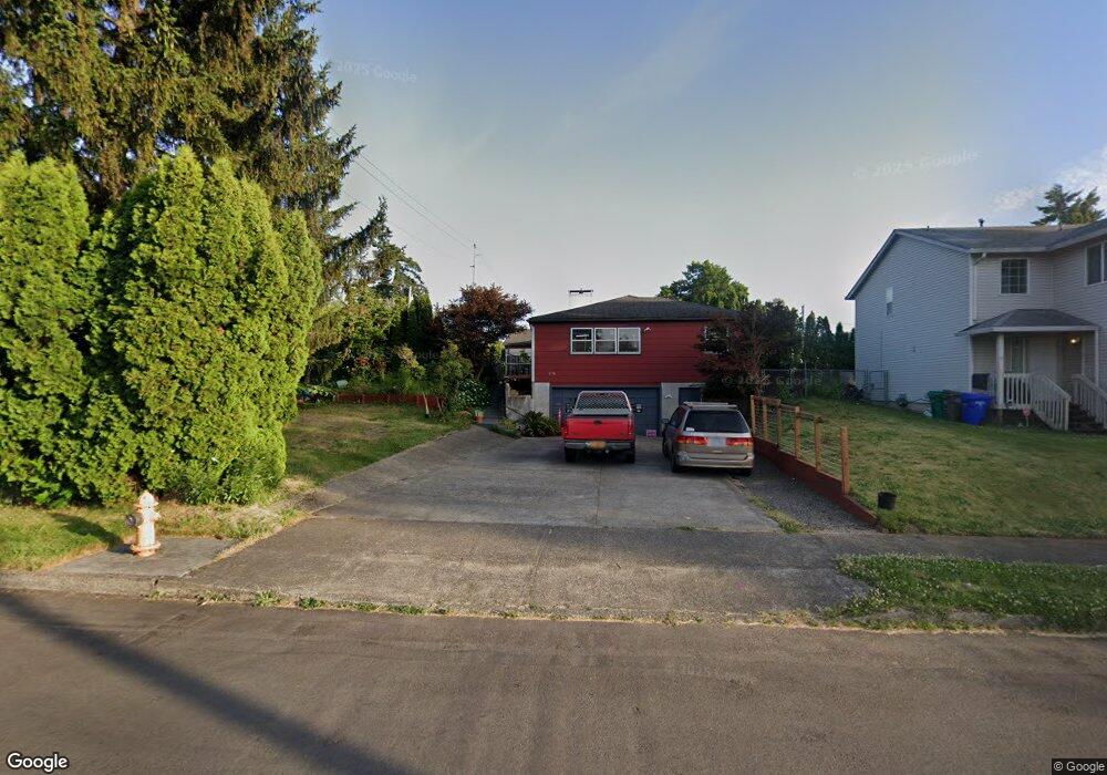
1774 SE 10th St Unit 1778 Gresham, OR 97080
Historic Southeast NeighborhoodEstimated Value: $459,830 - $506,000
3
Beds
2
Baths
2,349
Sq Ft
$207/Sq Ft
Est. Value
About This Home
This home is located at 1774 SE 10th St Unit 1778, Gresham, OR 97080 and is currently estimated at $486,208, approximately $206 per square foot. 1774 SE 10th St Unit 1778 is a home located in Multnomah County with nearby schools including East Gresham Elementary School, Dexter McCarty Middle School, and Gresham High School.
Ownership History
Date
Name
Owned For
Owner Type
Purchase Details
Closed on
Feb 14, 2005
Sold by
Riehl Keith M
Bought by
Grover Michael H and Grover Elsie F
Current Estimated Value
Home Financials for this Owner
Home Financials are based on the most recent Mortgage that was taken out on this home.
Original Mortgage
$148,000
Outstanding Balance
$75,019
Interest Rate
5.81%
Mortgage Type
Purchase Money Mortgage
Estimated Equity
$411,189
Create a Home Valuation Report for This Property
The Home Valuation Report is an in-depth analysis detailing your home's value as well as a comparison with similar homes in the area
Home Values in the Area
Average Home Value in this Area
Purchase History
| Date | Buyer | Sale Price | Title Company |
|---|---|---|---|
| Grover Michael H | $210,000 | Ticor Title Insurance Compan |
Source: Public Records
Mortgage History
| Date | Status | Borrower | Loan Amount |
|---|---|---|---|
| Open | Grover Michael H | $148,000 |
Source: Public Records
Tax History
| Year | Tax Paid | Tax Assessment Tax Assessment Total Assessment is a certain percentage of the fair market value that is determined by local assessors to be the total taxable value of land and additions on the property. | Land | Improvement |
|---|---|---|---|---|
| 2025 | $5,088 | $250,020 | -- | -- |
| 2024 | $4,870 | $242,740 | -- | -- |
| 2023 | $4,437 | $235,670 | $0 | $0 |
| 2022 | $4,313 | $228,810 | $0 | $0 |
| 2021 | $4,205 | $222,150 | $0 | $0 |
| 2020 | $3,956 | $215,680 | $0 | $0 |
| 2019 | $3,852 | $209,400 | $0 | $0 |
| 2018 | $3,673 | $203,310 | $0 | $0 |
| 2017 | $3,524 | $197,390 | $0 | $0 |
| 2016 | $3,107 | $191,650 | $0 | $0 |
| 2015 | $3,040 | $186,070 | $0 | $0 |
| 2014 | $2,966 | $180,660 | $0 | $0 |
Source: Public Records
Map
Nearby Homes
- 955 SE Hogan Rd
- 1949 SE Palmquist Rd Unit 51
- 1949 SE Palmquist Rd Unit 91
- 1949 SE Palmquist Rd Unit 7
- 1949 SE Palmquist Rd Unit 121
- 732 SE Rene Ave
- 2358 SE Palmquist Rd
- 2293 SE 15th Aly
- 2170 SE 16th St
- 1691 SE Cedar Creek Place
- 1495 SE Evelyn Ct
- 2220 SE 16th St
- 2392 SE 16th Aly
- 2125 SE 18th Aly
- 2363 SE 17th Aly
- 2696 SE Palmquist Rd
- 4733 SE 2nd St
- 4667 SE 2nd St
- 420 SE Linden Ave
- 1918 SE Regner Rd
- 1712 SE 10th St
- 1749 SE 11th St
- 1690 SE 10th St
- 1689 SE 11th St
- 1775 SE 10th St
- 1715 SE 10th St
- 1660 SE 10th St
- 1661 SE 11th St
- 1685 SE 10th St
- 1746 SE 11th St
- 1627 SE 11th St
- 1125 SE Myrtlewood Ave
- 1630 SE 10th St
- 1655 SE 10th St
- 1760 SE 9th St Unit 1780
- 1140 SE Myrtlewood Ave
- 1680 SE 9th St
- 1642 SE 11th St
- 1591 SE 11th St
- 1615 SE 10th St
Your Personal Tour Guide
Ask me questions while you tour the home.