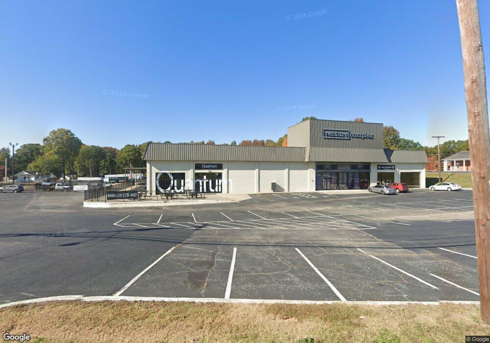
1776 Dale Earnhardt Blvd Kannapolis, NC 28083
Estimated Value: $1,856,120
--
Bed
--
Bath
49,110
Sq Ft
$38/Sq Ft
Est. Value
About This Home
This home is located at 1776 Dale Earnhardt Blvd, Kannapolis, NC 28083 and is currently estimated at $1,856,120, approximately $37 per square foot. 1776 Dale Earnhardt Blvd is a home located in Cabarrus County with nearby schools including Forest Park Elementary School, Kannapolis Middle, and A.L. Brown High School.
Ownership History
Date
Name
Owned For
Owner Type
Purchase Details
Closed on
Sep 15, 2017
Sold by
Memorial Baptist Church
Bought by
Venture Complex Llc
Current Estimated Value
Purchase Details
Closed on
Jan 7, 2011
Sold by
Thompson Charles Robert and Thompson Sandra K
Bought by
Memorial Baptist Church
Home Financials for this Owner
Home Financials are based on the most recent Mortgage that was taken out on this home.
Original Mortgage
$525,000
Interest Rate
4.48%
Mortgage Type
Commercial
Purchase Details
Closed on
Feb 26, 2003
Sold by
Mabry Phyllis C and Bleckley Nancy C
Bought by
Thompson Charles Robert and Thompson Sandra K
Home Financials for this Owner
Home Financials are based on the most recent Mortgage that was taken out on this home.
Original Mortgage
$700,000
Interest Rate
5.88%
Mortgage Type
Commercial
Create a Home Valuation Report for This Property
The Home Valuation Report is an in-depth analysis detailing your home's value as well as a comparison with similar homes in the area
Home Values in the Area
Average Home Value in this Area
Purchase History
| Date | Buyer | Sale Price | Title Company |
|---|---|---|---|
| Venture Complex Llc | $800,000 | None Available | |
| Memorial Baptist Church | $510,000 | None Available | |
| Memorial Baptist Church | -- | None Available | |
| Thompson Charles Robert | $700,000 | -- |
Source: Public Records
Mortgage History
| Date | Status | Borrower | Loan Amount |
|---|---|---|---|
| Previous Owner | Memorial Baptist Church | $525,000 | |
| Previous Owner | Thompson Charles Robert | $700,000 |
Source: Public Records
Tax History Compared to Growth
Tax History
| Year | Tax Paid | Tax Assessment Tax Assessment Total Assessment is a certain percentage of the fair market value that is determined by local assessors to be the total taxable value of land and additions on the property. | Land | Improvement |
|---|---|---|---|---|
| 2025 | -- | $2,562,370 | $1,695,310 | $867,060 |
| 2024 | $29,096 | $2,562,370 | $1,695,310 | $867,060 |
| 2023 | $30,697 | $2,240,630 | $1,356,250 | $884,380 |
| 2022 | $25,747 | $2,084,670 | $1,356,250 | $728,420 |
| 2021 | $25,747 | $2,084,670 | $1,356,250 | $728,420 |
| 2020 | $25,747 | $1,879,370 | $1,356,250 | $523,120 |
| 2019 | $15,771 | $1,151,200 | $517,620 | $633,580 |
| 2018 | $13,054 | $966,970 | $517,620 | $449,350 |
| 2017 | $0 | $966,900 | $517,550 | $449,350 |
| 2016 | -- | $833,520 | $446,160 | $387,360 |
| 2015 | -- | $833,520 | $446,160 | $387,360 |
| 2014 | -- | $833,520 | $446,160 | $387,360 |
Source: Public Records
Map
Nearby Homes
- 505 Rogers Lake Rd E
- 1008 Packard Ave
- 803 Irene Ave
- 608 Fairview St
- 500 Plymouth St
- 615 Fairview St
- 617 Fairview St
- 613 Hillside St
- 111 Landmark Dr
- 506 Ford St
- 621 Norland Ave
- 503 Eddleman Rd
- 402 Ford St
- 1050 Mclain Rd
- 1052 Mclain Rd
- 910 Fairview St
- 803 Desoto Ave
- 1500 S Ridge Ave
- 1004 S Ridge Ave
- 902 Oakshade Ave
- 1778 Dale Earnhardt Blvd
- 1774 Dale Earnhardt Blvd
- 1772 Dale Earnhardt Blvd
- 1748 Dale Earnhardt Blvd
- 1820 Dale Earnhardt Blvd
- 1400 Sedan Ave
- 1757 Dale Earnhardt Blvd
- 546 Rogers Lake Rd E
- 603 V 8 St
- 601 V 8 St
- 511 V 8 St
- 508 Cook St
- 710 Mclain Rd
- 540 Rogers Lake Rd E
- 1714 Dale Earnhardt Blvd
- 1861 Dale Earnhardt Blvd
- 506 Cook St
- 507 V 8 St
- 507 V 8 St
- 528 Rogers Lake Rd E