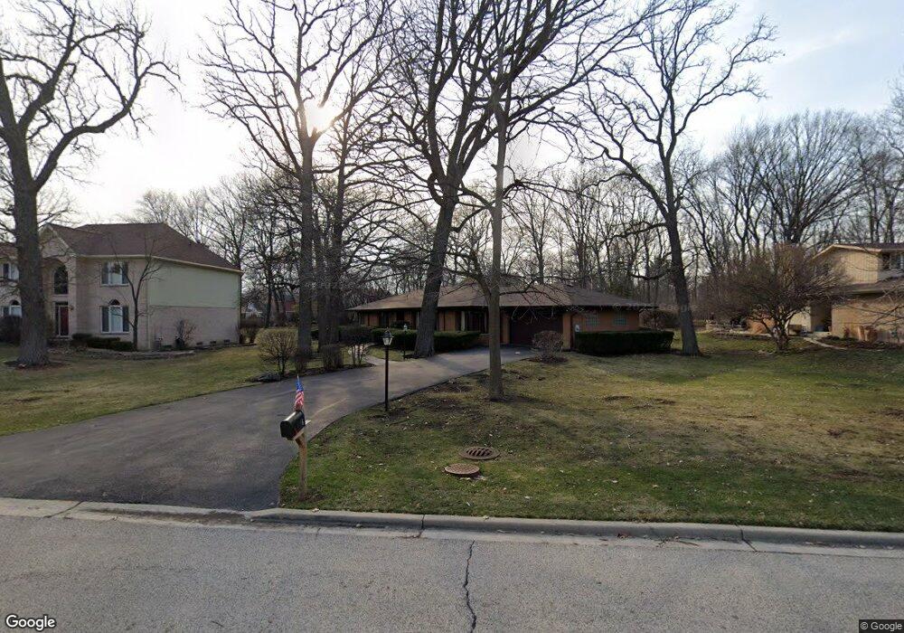
1776 S Edgar St Palatine, IL 60067
Creekside NeighborhoodEstimated Value: $487,000 - $606,000
3
Beds
2
Baths
1,805
Sq Ft
$299/Sq Ft
Est. Value
About This Home
This home is located at 1776 S Edgar St, Palatine, IL 60067 and is currently estimated at $540,384, approximately $299 per square foot. 1776 S Edgar St is a home located in Cook County with nearby schools including Central Road Elementary School, Plum Grove Jr High School, and William Fremd High School.
Ownership History
Date
Name
Owned For
Owner Type
Purchase Details
Closed on
Jul 15, 2005
Sold by
Thomas John and Thomas Mary J
Bought by
Thomas John and Thomas Mary Jane
Current Estimated Value
Purchase Details
Closed on
Apr 26, 1995
Sold by
Gettysburg Development Corp
Bought by
Capitol Bank & Trust
Purchase Details
Closed on
Jul 1, 1994
Sold by
Shoemaker Matthew
Bought by
Gettysburg Development Corp
Create a Home Valuation Report for This Property
The Home Valuation Report is an in-depth analysis detailing your home's value as well as a comparison with similar homes in the area
Home Values in the Area
Average Home Value in this Area
Purchase History
| Date | Buyer | Sale Price | Title Company |
|---|---|---|---|
| Thomas John | -- | -- | |
| Capitol Bank & Trust | -- | -- | |
| Gettysburg Development Corp | $50,000 | Ticor Title Insurance |
Source: Public Records
Tax History Compared to Growth
Tax History
| Year | Tax Paid | Tax Assessment Tax Assessment Total Assessment is a certain percentage of the fair market value that is determined by local assessors to be the total taxable value of land and additions on the property. | Land | Improvement |
|---|---|---|---|---|
| 2024 | $9,628 | $38,001 | $12,887 | $25,114 |
| 2023 | $9,235 | $38,001 | $12,887 | $25,114 |
| 2022 | $9,235 | $38,001 | $12,887 | $25,114 |
| 2021 | $9,717 | $35,997 | $8,200 | $27,797 |
| 2020 | $9,653 | $35,997 | $8,200 | $27,797 |
| 2019 | $9,625 | $40,221 | $8,200 | $32,021 |
| 2018 | $9,371 | $37,134 | $7,614 | $29,520 |
| 2017 | $11,673 | $39,381 | $7,614 | $31,767 |
| 2016 | $10,876 | $39,381 | $7,614 | $31,767 |
| 2015 | $9,869 | $37,516 | $7,029 | $30,487 |
| 2014 | $9,756 | $37,516 | $7,029 | $30,487 |
| 2013 | $9,412 | $37,516 | $7,029 | $30,487 |
Source: Public Records
Map
Nearby Homes
- 4795 Woodcliff Ln
- 208 Brookdale Ln
- 302 E Shady Dr
- 2650 Brookwood Way Dr Unit 108
- 2600 Brookwood Way Dr Unit 316
- 2600 Brookwood Way Dr Unit 305
- 2600 Brookwood Unit 314
- 112 Ironwood Ct
- 216 Still Water Ct Unit 91
- 1292 Quadrant Ln
- 1294 Catalina Ct
- 4 Eton on Oxford
- Grant Plan at Northgate at Veridian
- 4704 Euclid Ave Unit 1B
- 4301 Euclid Ave
- 1808 Plum Grove Rd Unit 1B
- 1620 Waxwing Ct
- 1609 Waxwing Ct
- 2401 Rohlwing Rd
- 1931 Prairie Square Unit 1931
- 3025 Edgar St
- 1758 S Edgar St
- 4710 Woodland Ct
- 4711 Woodland Ct
- 1736 S Edgar St
- 4660 Dawngate Ln
- 4720 Woodland Ct
- 3050 Edgar St
- 4700 Dawngate Ln
- 4721 Woodland Ct
- 100 E Kimberly Ave
- 4710 Dawngate Ln
- 1749 S Edgar St
- 4610 Dawngate Ln
- 4730 Woodland Ct
- 63 E Forest Ln
- 4731 Woodland Ct
- 47 E Forest Ln
- 1713 S Meacham Rd
- 4720 Dawngate Ln