

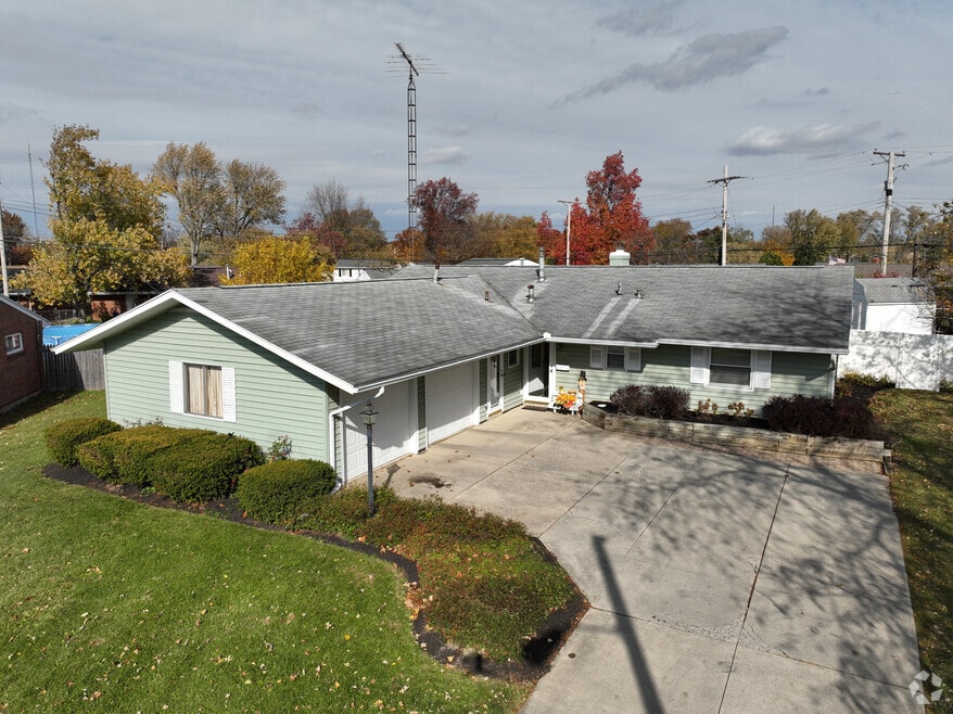

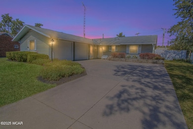
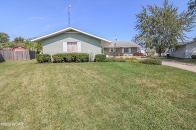
1776 Virginia Ave Lima, OH 45801
Northside Lima NeighborhoodEstimated payment $1,237/month
Total Views
19,638
3
Beds
2
Baths
1,520
Sq Ft
$135
Price per Sq Ft
Highlights
- Ranch Style House
- Enclosed Patio or Porch
- Laundry Room
- No HOA
- 2 Car Attached Garage
- Shed
About This Home
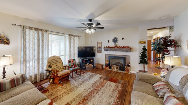
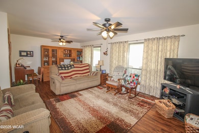
This charming ranch offers a blend of comfort and convenience with a welcoming layout and thoughtful updates. The living room features a cozy fireplace and flows seamlessly into the dining area and updated kitchen, creating a warm space for everyday living or entertaining. An enclosed sunroom at the back of the home provides the perfect spot to relax while overlooking the large backyard. The outdoor space is complete with a storage shed, landscaped beds, and plenty of room to enjoy. Additional highlights include an attached two-car garage, updated baths, and a convenient laundry room with storage. Move-in ready and well cared for—don't miss this one!
Home Details
Home Type
- Single Family
Est. Annual Taxes
- $1,877
Year Built
- Built in 1961
Lot Details
- 9,453 Sq Ft Lot
Parking
- 2 Car Attached Garage
Home Design
- Ranch Style House
- Slab Foundation
Interior Spaces
- 1,520 Sq Ft Home
- Living Room with Fireplace
- Dining Room
- Laundry Room
Kitchen
- Dinette
- Built-In or Custom Kitchen Cabinets
Bedrooms and Bathrooms
- 3 Bedrooms
- 2 Full Bathrooms
Outdoor Features
- Enclosed Patio or Porch
- Shed
Utilities
- Forced Air Heating and Cooling System
- Heating System Uses Natural Gas
Community Details
- No Home Owners Association
Listing and Financial Details
- Assessor Parcel Number 36-2409-08-037.000
3D Interior and Exterior Tours
Floorplan
Map
Create a Home Valuation Report for This Property
The Home Valuation Report is an in-depth analysis detailing your home's value as well as a comparison with similar homes in the area
Home Values in the Area
Average Home Value in this Area
Tax History
| Year | Tax Paid | Tax Assessment Tax Assessment Total Assessment is a certain percentage of the fair market value that is determined by local assessors to be the total taxable value of land and additions on the property. | Land | Improvement |
|---|---|---|---|---|
| 2024 | $1,877 | $46,800 | $5,670 | $41,130 |
| 2023 | $1,526 | $34,160 | $4,130 | $30,030 |
| 2022 | $1,551 | $34,160 | $4,130 | $30,030 |
| 2021 | $1,560 | $34,160 | $4,130 | $30,030 |
| 2020 | $1,397 | $28,670 | $3,920 | $24,750 |
| 2019 | $1,397 | $28,670 | $3,920 | $24,750 |
| 2018 | $1,312 | $28,670 | $3,920 | $24,750 |
| 2017 | $1,208 | $25,830 | $3,920 | $21,910 |
| 2016 | $1,206 | $25,830 | $3,920 | $21,910 |
| 2015 | $1,212 | $25,830 | $3,920 | $21,910 |
| 2014 | $1,142 | $23,520 | $3,780 | $19,740 |
| 2013 | $1,107 | $23,520 | $3,780 | $19,740 |
Source: Public Records
Property History
| Date | Event | Price | List to Sale | Price per Sq Ft |
|---|---|---|---|---|
| 11/13/2025 11/13/25 | Pending | -- | -- | -- |
| 10/30/2025 10/30/25 | For Sale | $205,000 | 0.0% | $135 / Sq Ft |
| 09/19/2025 09/19/25 | Pending | -- | -- | -- |
| 09/10/2025 09/10/25 | For Sale | $205,000 | -- | $135 / Sq Ft |
Source: West Central Association of REALTORS® (OH)
Purchase History
| Date | Type | Sale Price | Title Company |
|---|---|---|---|
| Deed | $82,500 | -- | |
| Deed | $75,000 | -- | |
| Deed | $61,000 | -- |
Source: Public Records
Mortgage History
| Date | Status | Loan Amount | Loan Type |
|---|---|---|---|
| Open | $61,750 | New Conventional |
Source: Public Records
About the Listing Agent
A second-generation Realtor with Cowan Realtors in Lima, OH, offers clients a blend of expertise, integrity, and personalized service. Starting her real estate career in Louisiana in 2016, Heather returned to her hometown of LIma, OH after her husband retired from the Marine Corps, bringing with her a deep understanding of the relocation challenges families face. Heather’s approach centers on listening closely to each client’s unique needs, providing honest advice and comprehensive market
HEATHER's Other Listings
Source: West Central Association of REALTORS® (OH)
MLS Number: 308205
APN: 36-24-09-08-037.000
Nearby Homes
- 2104 Virginia Ave
- 700 Lewis Blvd
- 410 W Northern Ave
- 400 W Northern Ave
- 610 W Robb Ave
- 340 W Robb Ave
- 105 Watt Ave
- 608 W O'Connor Ave
- 2371 Mandolin Dr
- 168 Lyre Bird Ln
- 128 E Lane Ave
- 765 W O'Connor Ave
- 1200 N Main St
- 849 Runyan Ave
- 1116 Belvidere Ave
- 939 N West St
- 0 Sherman Ave
- 576 Cortlandt Ave
- 676 Cortlandt Ave
- 1580 W Robb Ave