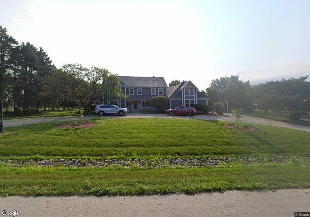
17765 S Robert Emmett Dr Homer Glen, IL 60491
South Homer Glen NeighborhoodEstimated Value: $619,000 - $713,000
--
Bed
--
Bath
5,710
Sq Ft
$115/Sq Ft
Est. Value
About This Home
This home is located at 17765 S Robert Emmett Dr, Homer Glen, IL 60491 and is currently estimated at $655,892, approximately $114 per square foot. 17765 S Robert Emmett Dr is a home located in Will County with nearby schools including William J. Butler, Hadley Middle School, and Homer Jr High School.
Ownership History
Date
Name
Owned For
Owner Type
Purchase Details
Closed on
Apr 21, 1998
Sold by
West David E and West Kimberly
Bought by
West David E
Current Estimated Value
Home Financials for this Owner
Home Financials are based on the most recent Mortgage that was taken out on this home.
Original Mortgage
$320,000
Outstanding Balance
$61,171
Interest Rate
7.18%
Estimated Equity
$594,721
Purchase Details
Closed on
Jul 17, 1997
Sold by
Wunderlich Gary L and Wunderlich Michele
Bought by
West David E and West Kimberly
Home Financials for this Owner
Home Financials are based on the most recent Mortgage that was taken out on this home.
Original Mortgage
$314,500
Interest Rate
11.45%
Create a Home Valuation Report for This Property
The Home Valuation Report is an in-depth analysis detailing your home's value as well as a comparison with similar homes in the area
Home Values in the Area
Average Home Value in this Area
Purchase History
| Date | Buyer | Sale Price | Title Company |
|---|---|---|---|
| West David E | -- | Chicago Title Insurance Co | |
| West David E | $370,000 | Chicago Title Insurance Co |
Source: Public Records
Mortgage History
| Date | Status | Borrower | Loan Amount |
|---|---|---|---|
| Open | West David E | $320,000 | |
| Closed | West David E | $314,500 |
Source: Public Records
Tax History Compared to Growth
Tax History
| Year | Tax Paid | Tax Assessment Tax Assessment Total Assessment is a certain percentage of the fair market value that is determined by local assessors to be the total taxable value of land and additions on the property. | Land | Improvement |
|---|---|---|---|---|
| 2024 | $16,634 | $230,693 | $30,186 | $200,507 |
| 2023 | $16,634 | $209,112 | $27,362 | $181,750 |
| 2022 | $15,733 | $195,249 | $25,548 | $169,701 |
| 2021 | $15,004 | $184,983 | $24,205 | $160,778 |
| 2020 | $15,018 | $178,176 | $23,314 | $154,862 |
| 2019 | $14,323 | $171,405 | $22,428 | $148,977 |
| 2018 | $13,867 | $165,151 | $22,171 | $142,980 |
| 2017 | $13,607 | $160,527 | $21,550 | $138,977 |
| 2016 | $13,300 | $155,173 | $20,831 | $134,342 |
| 2015 | $12,905 | $149,348 | $20,049 | $129,299 |
| 2014 | $12,905 | $146,262 | $19,635 | $126,627 |
| 2013 | $12,905 | $146,262 | $19,635 | $126,627 |
Source: Public Records
Map
Nearby Homes
- 0 W Bruce Rd
- 17358 S Sprucewood Dr
- 15456 W Amelia Cir
- 17356 S Sprucewood Dr
- 17366 S Sprucewood Dr
- 17430 Victoria Ln
- 17355 S Sprucewood Dr
- 17430 S Victoria Ln
- Essex Plan at Sadie Ridge
- Campbell Plan at Sadie Ridge - The Townes at Sadie
- Braeden Plan at Sadie Ridge - The Townes at Sadie
- Brighton Plan at Sadie Ridge - The Townes at Sadie
- Danbury II Plan at Sadie Ridge - The Townes at Sadie
- Hudson Plan at Sadie Ridge
- Dunbar Plan at Sadie Ridge
- Easton Plan at Sadie Ridge
- Lyndale Plan at Sadie Ridge
- Barclay Plan at Sadie Ridge
- Fairchild Plan at Sadie Ridge
- 17355 Sprucewood Dr
- 17747 S Robert Emmett Dr
- 17823 S Robert Emmett Dr
- 17758 S Robert Emmett Dr
- 15048 W Oconnell Dr
- 17744 S Robert Emmett Dr
- 17731 S Robert Emmett Dr
- 17820 S Robert Emmett Dr
- 17841 S Robert Emmett Dr
- 17730 S Robert Emmett Dr
- 17834 S Robert Emmett Dr
- 17709 S Robert Emmett Dr
- 17718 S Robert Emmett Dr
- 17850 S Robert Emmett Dr
- 17857 S Robert Emmett Dr
- 15114 W Oconnell Dr
- 17860 S Robert Emmett Dr
- 17704 S Robert Emmett Dr
- 17660 S Robert Emmett Dr
- 17815 S Mccarron Rd
- 15126 O Connell Dr