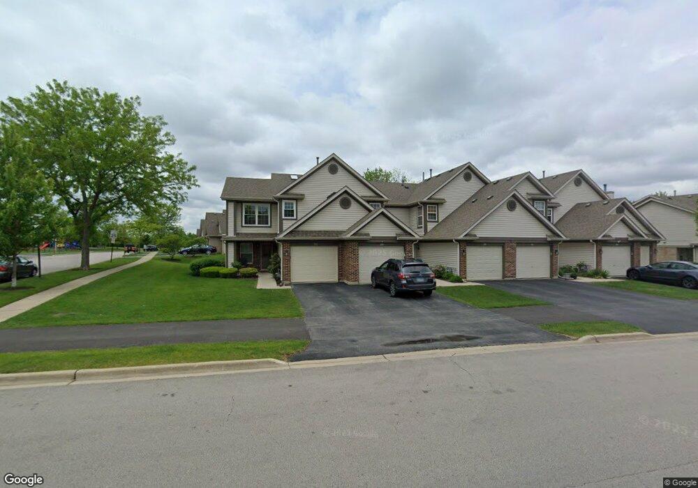
1777 Grove Ave Unit 79B177 Schaumburg, IL 60193
South Schaumburg NeighborhoodEstimated Value: $277,666 - $316,000
2
Beds
2
Baths
1,400
Sq Ft
$216/Sq Ft
Est. Value
About This Home
This home is located at 1777 Grove Ave Unit 79B177, Schaumburg, IL 60193 and is currently estimated at $302,667, approximately $216 per square foot. 1777 Grove Ave Unit 79B177 is a home located in Cook County with nearby schools including Hanover Highlands Elementary School, Robert Frost Junior High School, and Schaumburg High School.
Ownership History
Date
Name
Owned For
Owner Type
Purchase Details
Closed on
Oct 14, 2005
Sold by
Lucarelli Michael
Bought by
Buran James R
Current Estimated Value
Purchase Details
Closed on
Dec 19, 2001
Sold by
Napoli Michael A
Bought by
Lucarelli Michael
Home Financials for this Owner
Home Financials are based on the most recent Mortgage that was taken out on this home.
Original Mortgage
$136,800
Interest Rate
6.12%
Purchase Details
Closed on
Nov 6, 1996
Sold by
Ziebell Lance C
Bought by
Napoli Michael A
Purchase Details
Closed on
Sep 14, 1995
Sold by
Parkway Bank & Trust Company
Bought by
Napoli Michael A and Ziebell Lance C
Home Financials for this Owner
Home Financials are based on the most recent Mortgage that was taken out on this home.
Original Mortgage
$102,500
Interest Rate
8%
Create a Home Valuation Report for This Property
The Home Valuation Report is an in-depth analysis detailing your home's value as well as a comparison with similar homes in the area
Home Values in the Area
Average Home Value in this Area
Purchase History
| Date | Buyer | Sale Price | Title Company |
|---|---|---|---|
| Buran James R | $227,500 | -- | |
| Lucarelli Michael | $171,000 | -- | |
| Napoli Michael A | -- | -- | |
| Napoli Michael A | $121,000 | -- |
Source: Public Records
Mortgage History
| Date | Status | Borrower | Loan Amount |
|---|---|---|---|
| Previous Owner | Lucarelli Michael | $136,800 | |
| Previous Owner | Napoli Michael A | $102,500 | |
| Closed | Lucarelli Michael | $17,100 |
Source: Public Records
Tax History Compared to Growth
Tax History
| Year | Tax Paid | Tax Assessment Tax Assessment Total Assessment is a certain percentage of the fair market value that is determined by local assessors to be the total taxable value of land and additions on the property. | Land | Improvement |
|---|---|---|---|---|
| 2024 | $5,186 | $21,829 | $1,924 | $19,905 |
| 2023 | $5,000 | $21,829 | $1,924 | $19,905 |
| 2022 | $5,000 | $21,829 | $1,924 | $19,905 |
| 2021 | $4,220 | $17,253 | $1,257 | $15,996 |
| 2020 | $4,215 | $17,253 | $1,257 | $15,996 |
| 2019 | $4,259 | $19,319 | $1,257 | $18,062 |
| 2018 | $3,291 | $14,402 | $1,035 | $13,367 |
| 2017 | $3,257 | $14,402 | $1,035 | $13,367 |
| 2016 | $3,288 | $14,402 | $1,035 | $13,367 |
| 2015 | $3,055 | $12,836 | $961 | $11,875 |
| 2014 | $3,038 | $12,836 | $961 | $11,875 |
| 2013 | $2,401 | $12,836 | $961 | $11,875 |
Source: Public Records
Map
Nearby Homes
- 1721 Chesapeake Ln Unit 4
- 1518 Harbour Ct Unit A1
- 1471 Fairlane Dr Unit 2A
- 1662 Commodore Ct Unit 70294
- 1467 Fairlane Dr Unit 1B
- 1460 Fairlane Dr Unit 228
- 1463 Mercury Dr Unit 115
- 1463 Mercury Dr Unit 304
- 6908 Orchard Ln
- 6915 Hawthorne Ln
- 7031 Glenwood Ln
- 1410 Brownstone Place Unit 38
- 1882 Keystone Place Unit 1882
- 6938 Meadowbrook Ln
- 6925 Edgebrook Ln
- 7468 Filmore Ave
- 1102 Westover Ln Unit 1C
- 7138 Edgebrook Ln
- 1240 Winfield Ct Unit 3
- 315 Ashbury Ct Unit 3
- 1779 Grove Ave Unit 79B177
- 1775 Grove Ave Unit 79C177
- 1775 Grove Ave Unit 79C
- 1781 Grove Ave Unit 79B178
- 1783 Grove Ave Unit 79B178
- 1785 Grove Ave Unit 79C178
- 1787 Grove Ave Unit 78C178
- 1754 Heron Ave Unit 52B175
- 1741 Heron Ave Unit 51A174
- 1741 Heron Ave Unit 51C174
- 1741 Heron Ave Unit 51B174
- 1741 Heron Ave Unit 51D174
- 1741 Heron Ave Unit D
- 1741 Heron Ave Unit A
- 1741 Heron Ave Unit C
- 1752 Heron Ave Unit 52B175
- 1750 Heron Ave Unit 52C175
- 1735 Autumn Ave Unit 12D173
- 1735 Autumn Ave Unit 12A173
- 1735 Autumn Ave Unit 12D173