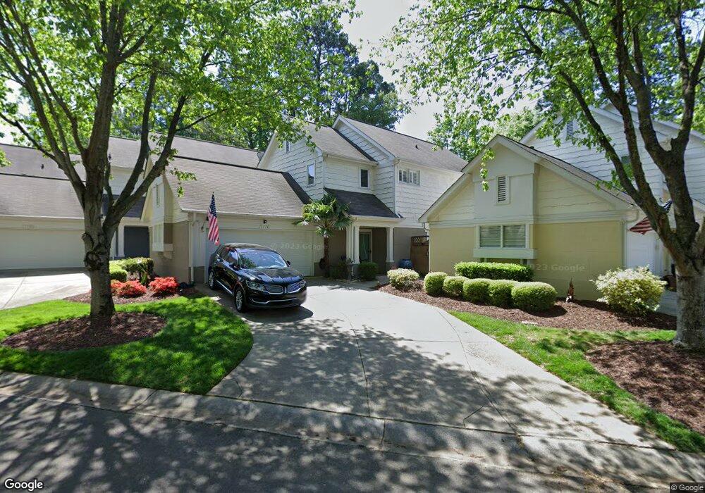
17776 Kings Point Dr Unit 7 Cornelius, NC 28031
Estimated Value: $527,000 - $597,000
3
Beds
3
Baths
1,908
Sq Ft
$293/Sq Ft
Est. Value
About This Home
This home is located at 17776 Kings Point Dr Unit 7, Cornelius, NC 28031 and is currently estimated at $559,692, approximately $293 per square foot. 17776 Kings Point Dr Unit 7 is a home located in Mecklenburg County with nearby schools including J.V. Washam Elementary School, Bailey Middle School, and William Amos Hough High School.
Ownership History
Date
Name
Owned For
Owner Type
Purchase Details
Closed on
Mar 27, 2002
Sold by
Mcneely William F
Bought by
Snyder Robert L and Snyder Mary
Current Estimated Value
Home Financials for this Owner
Home Financials are based on the most recent Mortgage that was taken out on this home.
Original Mortgage
$138,500
Interest Rate
6.85%
Mortgage Type
Purchase Money Mortgage
Purchase Details
Closed on
Mar 5, 1999
Sold by
Kennerly Development Group Llc
Bought by
Mcneely William E
Home Financials for this Owner
Home Financials are based on the most recent Mortgage that was taken out on this home.
Original Mortgage
$182,000
Interest Rate
5.25%
Mortgage Type
Adjustable Rate Mortgage/ARM
Create a Home Valuation Report for This Property
The Home Valuation Report is an in-depth analysis detailing your home's value as well as a comparison with similar homes in the area
Home Values in the Area
Average Home Value in this Area
Purchase History
| Date | Buyer | Sale Price | Title Company |
|---|---|---|---|
| Snyder Robert L | $226,000 | -- | |
| Mcneely William E | $202,500 | -- |
Source: Public Records
Mortgage History
| Date | Status | Borrower | Loan Amount |
|---|---|---|---|
| Closed | Snyder Robert L | $138,500 | |
| Previous Owner | Mcneely William E | $182,000 |
Source: Public Records
Tax History
| Year | Tax Paid | Tax Assessment Tax Assessment Total Assessment is a certain percentage of the fair market value that is determined by local assessors to be the total taxable value of land and additions on the property. | Land | Improvement |
|---|---|---|---|---|
| 2025 | $3,002 | $449,900 | -- | $449,900 |
| 2024 | $3,002 | $449,900 | -- | $449,900 |
| 2023 | $2,630 | $527,419 | $0 | $527,419 |
| 2022 | $2,630 | $305,200 | $0 | $305,200 |
| 2021 | $2,600 | $305,200 | $0 | $305,200 |
| 2020 | $2,600 | $305,200 | $0 | $305,200 |
| 2019 | $2,594 | $305,200 | $0 | $305,200 |
| 2018 | $2,656 | $243,800 | $63,000 | $180,800 |
| 2017 | $2,634 | $243,800 | $63,000 | $180,800 |
| 2016 | $2,631 | $243,800 | $63,000 | $180,800 |
| 2015 | $2,591 | $243,800 | $63,000 | $180,800 |
| 2014 | $2,589 | $243,800 | $63,000 | $180,800 |
Source: Public Records
Map
Nearby Homes
- 17919 Kings Point Dr Unit C
- 17811 Half Moon Ln Unit E
- 17811 Half Moon Ln Unit I
- 18840 Nautical Dr Unit 70
- 17810 Half Moon Ln Unit L
- 18824 Nautical Dr Unit 28
- 18009 Kings Point Dr Unit R
- 18742 Nautical Dr Unit 202
- 18742 Nautical Dr Unit 301
- 18700 Nautical Dr Unit 303
- 18709 Nautical Dr
- 18736 Nautical Dr Unit 102
- 18736 Nautical Dr Unit 203
- 17925 Kings Point Dr Unit B
- 17929 Kings Point Dr Unit F
- 18726 Bluff Point Rd
- 18225 Taffrail Way Unit 15T
- 16615 Redding Park Ln
- 7916 Village Harbor Dr
- 7912 Village Harbor Dr Unit 2T
- 17788 Kings Point Dr Unit 8
- 17768 Kings Point Dr Unit 6
- 17768 Kings Point Dr Unit 6
- 17760 Kings Point Dr Unit 5
- 17780 Kings Point Dr Unit 13
- 17752 Kings Point Dr Unit 4
- 17772 Kings Point Dr Unit 14
- 17784 Kings Point Dr Unit 12
- 17764 Kings Point Dr
- 17744 Kings Point Dr Unit 3
- 17756 Kings Point Dr Unit 16
- 17756 Kings Point Dr Unit 96/16
- 17808 Kings Point Dr Unit 11
- 17816 Kings Point Dr Unit 9
- 17812 Kings Point Dr Unit 10
- 17824 Mesa Range Dr
- 17748 Kings Point Dr Unit 17
- 17816 Mesa Range Dr
- 17816 Mesa Range Dr Unit 37
- 17736 Kings Point Dr Unit 2
Your Personal Tour Guide
Ask me questions while you tour the home.