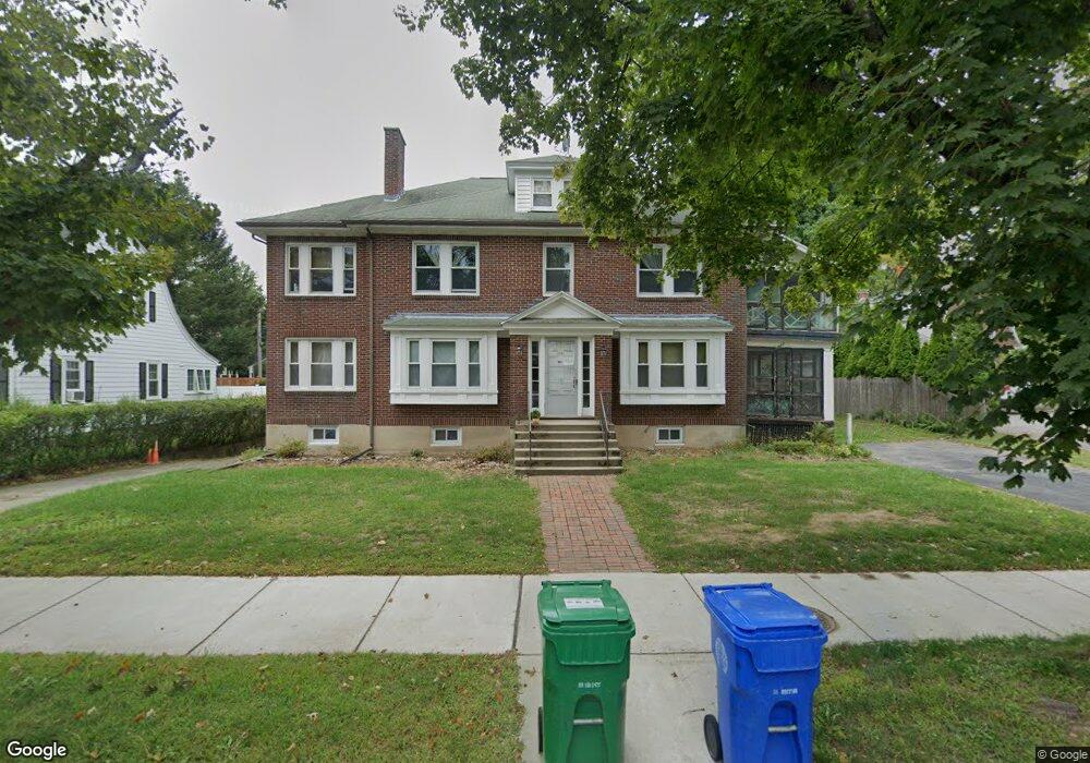
1778 Commonwealth Ave Auburndale, MA 02466
Auburndale NeighborhoodEstimated Value: $1,481,000 - $1,791,927
8
Beds
4
Baths
3,486
Sq Ft
$463/Sq Ft
Est. Value
About This Home
This home is located at 1778 Commonwealth Ave, Auburndale, MA 02466 and is currently estimated at $1,612,482, approximately $462 per square foot. 1778 Commonwealth Ave is a home located in Middlesex County with nearby schools including Williams Elementary School, Charles E Brown Middle School, and Newton South High School.
Ownership History
Date
Name
Owned For
Owner Type
Purchase Details
Closed on
Dec 12, 2022
Sold by
Seto Sun K and Seto Hok Y
Bought by
Seto Sun K and Seto Ching K
Current Estimated Value
Purchase Details
Closed on
Mar 30, 1988
Sold by
Shuman Richard
Bought by
Seto Ching K
Home Financials for this Owner
Home Financials are based on the most recent Mortgage that was taken out on this home.
Original Mortgage
$333,750
Interest Rate
9.89%
Mortgage Type
Purchase Money Mortgage
Create a Home Valuation Report for This Property
The Home Valuation Report is an in-depth analysis detailing your home's value as well as a comparison with similar homes in the area
Home Values in the Area
Average Home Value in this Area
Purchase History
| Date | Buyer | Sale Price | Title Company |
|---|---|---|---|
| Seto Sun K | -- | None Available | |
| Seto Ching K | $445,000 | -- |
Source: Public Records
Mortgage History
| Date | Status | Borrower | Loan Amount |
|---|---|---|---|
| Previous Owner | Seto Ching K | $259,000 | |
| Previous Owner | Seto Ching K | $333,750 |
Source: Public Records
Tax History Compared to Growth
Tax History
| Year | Tax Paid | Tax Assessment Tax Assessment Total Assessment is a certain percentage of the fair market value that is determined by local assessors to be the total taxable value of land and additions on the property. | Land | Improvement |
|---|---|---|---|---|
| 2025 | $11,991 | $1,223,600 | $704,100 | $519,500 |
| 2024 | $11,595 | $1,188,000 | $683,600 | $504,400 |
| 2023 | $11,156 | $1,095,900 | $553,200 | $542,700 |
| 2022 | $10,675 | $1,014,700 | $512,200 | $502,500 |
| 2021 | $4,443 | $930,900 | $469,900 | $461,000 |
| 2020 | $9,719 | $930,900 | $469,900 | $461,000 |
| 2019 | $9,092 | $870,000 | $439,200 | $430,800 |
| 2018 | $3,881 | $859,700 | $415,300 | $444,400 |
| 2017 | $8,770 | $788,700 | $381,000 | $407,700 |
| 2016 | $8,235 | $723,600 | $349,500 | $374,100 |
| 2015 | $7,852 | $676,300 | $326,600 | $349,700 |
Source: Public Records
Map
Nearby Homes
- 283 Woodland Rd
- 1639 Washington St
- 1754 Washington St
- 163 Day St
- 17 Gilbert St
- 51 Bourne St
- 179 Auburn St
- 194 Auburn St
- 13 Weir St
- 39 Hawthorne Ave
- 68 Mignon Rd
- 224 Auburn St Unit 224
- 0 Duncan Rd Unit 72925240
- 226 Auburn St Unit 226
- 62-64 Rowe St Unit B
- 157 Stanton Ave
- 17 Crescent St
- 1488 Washington St Unit 1488
- 17 Lasell St
- 10 Crescent St Unit 2
- 1774 Commonwealth Ave
- 17 Bonmar Cir
- 1790 Commonwealth Ave
- 1768 Commonwealth Ave Unit 1768
- 1766 Commonwealth Ave Unit 1768
- 1766 Commonwealth Ave Unit 1766
- 1766 Commonwealth Ave Unit 2
- 1766 Commonwealth Ave Unit 1
- 15 Bonmar Cir
- 114 Windermere Rd
- 118 Windermere Rd
- 9 Bonmar Cir
- 1781 Commonwealth Ave
- 1785 Commonwealth Ave
- 1707 Washington St
- 1785 Commonwealth Ave
- 126 Windermere Rd
- 18 Bonmar Cir
- 60 Arapahoe Rd
- 16 Bonmar Cir