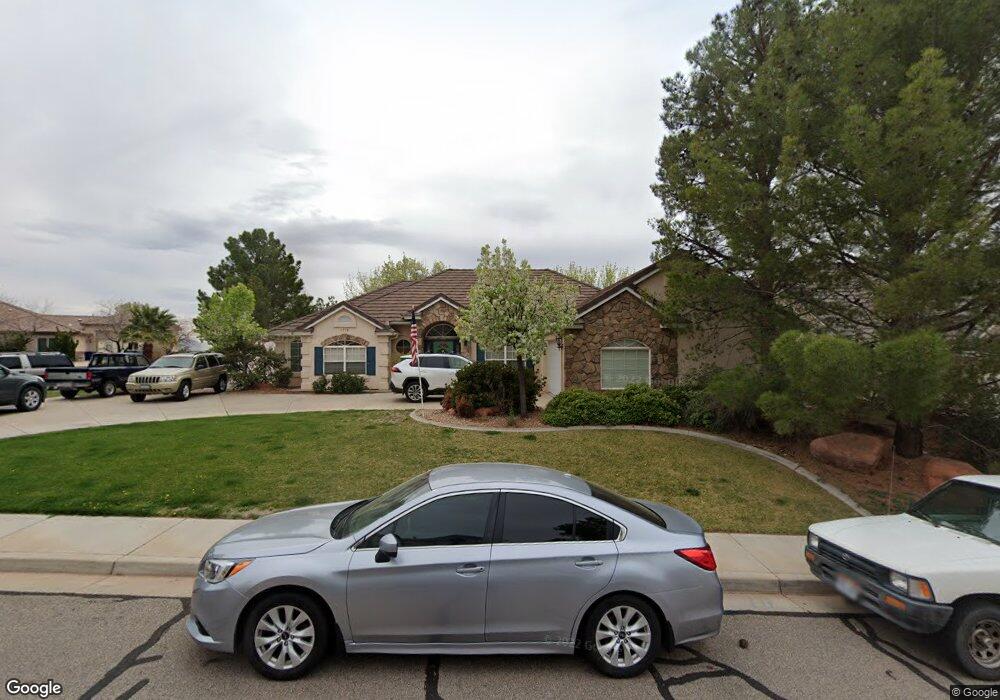
1778 E 1150 N Saint George, UT 84770
Estimated Value: $602,000 - $713,687
3
Beds
3
Baths
2,270
Sq Ft
$282/Sq Ft
Est. Value
About This Home
This home is located at 1778 E 1150 N, Saint George, UT 84770 and is currently estimated at $640,172, approximately $282 per square foot. 1778 E 1150 N is a home located in Washington County with nearby schools including Sandstone School, Pine View Middle School, and Fossil Ridge Intermediate School.
Ownership History
Date
Name
Owned For
Owner Type
Purchase Details
Closed on
Oct 12, 2017
Sold by
Simmons Robert F and Simmons Jill B
Bought by
Compton Jon S and Compton Elaine
Current Estimated Value
Home Financials for this Owner
Home Financials are based on the most recent Mortgage that was taken out on this home.
Original Mortgage
$318,250
Outstanding Balance
$265,828
Interest Rate
3.82%
Mortgage Type
New Conventional
Estimated Equity
$374,344
Purchase Details
Closed on
Mar 11, 2005
Sold by
Peters Paul M and Peters Bonnie J
Bought by
Simmons Robert F and Simmons Jill B
Home Financials for this Owner
Home Financials are based on the most recent Mortgage that was taken out on this home.
Original Mortgage
$223,920
Interest Rate
5.62%
Mortgage Type
Adjustable Rate Mortgage/ARM
Create a Home Valuation Report for This Property
The Home Valuation Report is an in-depth analysis detailing your home's value as well as a comparison with similar homes in the area
Home Values in the Area
Average Home Value in this Area
Purchase History
| Date | Buyer | Sale Price | Title Company |
|---|---|---|---|
| Compton Jon S | -- | Vanguard Title Ins Agency Ll | |
| Simmons Robert F | -- | Guardian Title Co |
Source: Public Records
Mortgage History
| Date | Status | Borrower | Loan Amount |
|---|---|---|---|
| Open | Compton Jon S | $318,250 | |
| Previous Owner | Simmons Robert F | $223,920 |
Source: Public Records
Tax History Compared to Growth
Tax History
| Year | Tax Paid | Tax Assessment Tax Assessment Total Assessment is a certain percentage of the fair market value that is determined by local assessors to be the total taxable value of land and additions on the property. | Land | Improvement |
|---|---|---|---|---|
| 2025 | $2,470 | $362,340 | $111,375 | $250,965 |
| 2023 | $2,452 | $366,410 | $111,375 | $255,035 |
| 2022 | $2,600 | $365,255 | $92,840 | $272,415 |
| 2021 | $2,279 | $477,500 | $114,800 | $362,700 |
| 2020 | $2,137 | $421,800 | $101,300 | $320,500 |
| 2019 | $1,861 | $358,700 | $101,300 | $257,400 |
| 2018 | $3,009 | $296,000 | $0 | $0 |
| 2017 | $1,511 | $146,025 | $0 | $0 |
| 2016 | $1,544 | $137,995 | $0 | $0 |
| 2015 | $1,533 | $131,450 | $0 | $0 |
| 2014 | $1,429 | $123,310 | $0 | $0 |
Source: Public Records
Map
Nearby Homes
- 1761 E 1150 N
- 1976 E 1200 Cir N
- 2031 E Colorado Dr
- 2031 E Colorado Dr Unit 209
- 2031 E Colorado Dr Unit 204
- 2031 E Colorado Dr Unit 406
- 0 Unit 25-264406
- 0 Grand Heights Lot #53 Unit 25-264407
- 991 Redrock Rd
- 1009 N 2050 E
- 948 N 2050 East Cir
- 26 Dellcorero Dr
- 0 Grand Heights Lot #66 Unit 25-264410
- 951 Grand Heights Dr
- 840 Twin Lakes Dr Unit 431
- 840 Twin Lakes Dr Unit 424
- 840 Twin Lakes Dr Unit 430
- 840 Twin Lakes Dr
- 840 Twin Lakes Dr Unit 225
- 840 Twin Lakes Dr Unit 228
- 1766 E 1150 N
- 1790 1790 Cir E
- 1125 N 1790 East Cir
- 1775 E 1150 N
- 1140 N 1790 East Cir
- 1754 E 1150 N
- 1128 N 1790 East Cir
- 1128 N 1790 East Cir
- 1156 N 1790 East Cir
- 1761 E 1150 N Unit 24
- 1761 E 1150 N Unit 24
- 1761 E 1150 N Unit LOT
- 1761 E 1150 N
- 1772 E 1200 N
- 1747 E 1150 N
- 1070 N 1700 E
- 1742 E 1150 N
- 1820 E Fenway Cir
- 0 E 1150 N
- 1161 E 1150 N