Estimated Value: $625,000 - $678,000
4
Beds
3
Baths
1,625
Sq Ft
$401/Sq Ft
Est. Value
About This Home
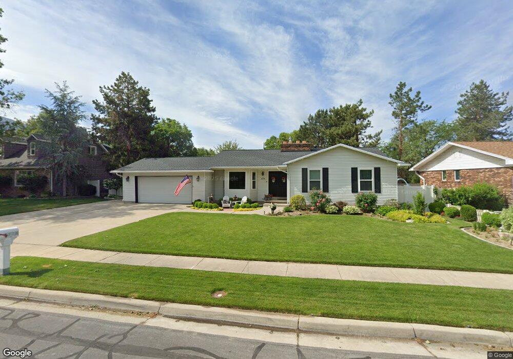
This home is located at 1778 Kimsbrough Rd, Sandy, UT 84092 and is currently estimated at $652,190, approximately $401 per square foot. 1778 Kimsbrough Rd is a home located in Salt Lake County with nearby schools including Willow Canyon Elementary School, Eastmont Middle School, and Jordan High.
Ownership History
Date
Name
Owned For
Owner Type
Purchase Details
Closed on
Feb 11, 2009
Sold by
Earl J Craig and Earl Maridee
Bought by
Earl Craig and Earl Maridee
Current Estimated Value
Home Financials for this Owner
Home Financials are based on the most recent Mortgage that was taken out on this home.
Original Mortgage
$181,000
Interest Rate
5.01%
Mortgage Type
New Conventional
Purchase Details
Closed on
Apr 10, 2003
Sold by
Earl J Carl and Earl Maridee
Bought by
Earl Craig and Earl Maridee
Create a Home Valuation Report for This Property
The Home Valuation Report is an in-depth analysis detailing your home's value as well as a comparison with similar homes in the area
Home Values in the Area
Average Home Value in this Area
Purchase History
| Date | Buyer | Sale Price | Title Company |
|---|---|---|---|
| Earl Craig | -- | United Title Services | |
| Earl J Craig | -- | United Title Services | |
| Earl Craig | -- | Superior Title |
Source: Public Records
Mortgage History
| Date | Status | Borrower | Loan Amount |
|---|---|---|---|
| Closed | Earl J Craig | $181,000 |
Source: Public Records
Tax History
| Year | Tax Paid | Tax Assessment Tax Assessment Total Assessment is a certain percentage of the fair market value that is determined by local assessors to be the total taxable value of land and additions on the property. | Land | Improvement |
|---|---|---|---|---|
| 2025 | $3,175 | $620,100 | $240,100 | $380,000 |
| 2024 | $3,175 | $617,400 | $231,100 | $386,300 |
| 2023 | $3,175 | $562,800 | $222,200 | $340,600 |
| 2022 | $3,018 | $568,300 | $217,800 | $350,500 |
| 2021 | $2,909 | $466,900 | $174,200 | $292,700 |
| 2020 | $2,446 | $370,600 | $174,200 | $196,400 |
| 2019 | $2,419 | $357,900 | $164,300 | $193,600 |
| 2018 | $2,183 | $338,500 | $164,300 | $174,200 |
| 2017 | $2,033 | $301,700 | $164,300 | $137,400 |
| 2016 | $1,938 | $278,500 | $148,100 | $130,400 |
| 2015 | -- | $258,900 | $161,400 | $97,500 |
| 2014 | $1,826 | $239,000 | $152,500 | $86,500 |
Source: Public Records
Map
Nearby Homes
- 10158 Buttercup Dr
- 10286 S Edgecliff Dr
- 1602 E Sego Lily Dr
- 2009 E Sweetbriar Ln
- 1584 Petunia Way
- 1952 E Bluffside Cir
- 10172 Snow Iris Way
- 2067 E Gyrfalcon Ln
- 2078 E 10140 S
- 10293 Ashley Mesa Ln
- 9968 S Blossom Dr
- 2170 E Borg Ct
- 1835 E Dimple Dell Rd
- 1779 E Mombo Dr
- 2197 E Thistlewood Way
- 9650 S Buttonwood Dr
- 1798 E Sunrise Meadow Dr
- 10557 S Primrose Dr
- 2342 Karalee Way
- 9633 S 1210 E
- 1786 Kimsbrough Rd
- 1770 Kimsbrough Rd
- 1779 Faunsdale Dr
- 1769 Faunsdale Dr
- 1787 Faunsdale Dr
- 1796 Kimsbrough Rd
- 1783 Kimsbrough Rd
- 1791 Kimsbrough Rd
- 1775 Kimsbrough Rd
- 10069 Heytesbury Ln
- 10069 S Heytesbury Ln
- 10083 Heytesbury Ln
- 1795 Faunsdale Dr
- 1799 Kimsbrough Rd
- 1767 Kimsbrough Rd
- 10054 Kimsbrough Ct
- 1804 E Kimsbrough Rd
- 1804 Kimsbrough Rd
- 1774 Faunsdale Dr
- 1774 E Faunsdale Dr
Your Personal Tour Guide
Ask me questions while you tour the home.