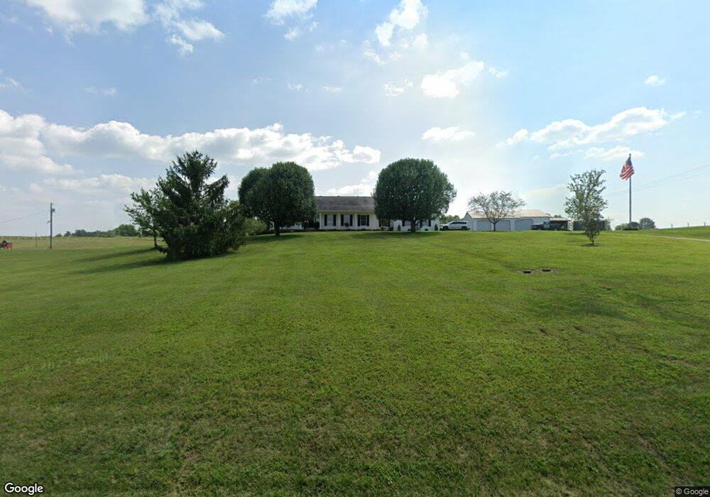
1778 Talmage Mayo Rd Harrodsburg, KY 40330
Estimated Value: $424,000 - $1,108,746
3
Beds
2
Baths
2,471
Sq Ft
$275/Sq Ft
Est. Value
About This Home
This home is located at 1778 Talmage Mayo Rd, Harrodsburg, KY 40330 and is currently estimated at $679,937, approximately $275 per square foot. 1778 Talmage Mayo Rd is a home located in Mercer County with nearby schools including Mercer County Elementary School, Mercer County Intermediate School, and King Middle School.
Ownership History
Date
Name
Owned For
Owner Type
Purchase Details
Closed on
Jan 1, 2022
Sold by
Murphy Tina Marie and Murphy William B
Bought by
Goodpaster Jordan Ransdell and Goodpaster Kimberly Ann
Current Estimated Value
Purchase Details
Closed on
Dec 15, 2020
Sold by
Goodlett Betty
Bought by
Murphy Tina Marie and Murphy William B
Home Financials for this Owner
Home Financials are based on the most recent Mortgage that was taken out on this home.
Original Mortgage
$752,000
Outstanding Balance
$669,504
Interest Rate
2.7%
Mortgage Type
New Conventional
Estimated Equity
$10,433
Create a Home Valuation Report for This Property
The Home Valuation Report is an in-depth analysis detailing your home's value as well as a comparison with similar homes in the area
Home Values in the Area
Average Home Value in this Area
Purchase History
| Date | Buyer | Sale Price | Title Company |
|---|---|---|---|
| Goodpaster Jordan Ransdell | $835,000 | None Listed On Document | |
| Murphy Tina Marie | $835,000 | None Available |
Source: Public Records
Mortgage History
| Date | Status | Borrower | Loan Amount |
|---|---|---|---|
| Open | Murphy Tina Marie | $752,000 |
Source: Public Records
Tax History Compared to Growth
Tax History
| Year | Tax Paid | Tax Assessment Tax Assessment Total Assessment is a certain percentage of the fair market value that is determined by local assessors to be the total taxable value of land and additions on the property. | Land | Improvement |
|---|---|---|---|---|
| 2024 | $2,847 | $238,250 | $11,600 | $226,650 |
| 2023 | $2,873 | $238,250 | $0 | $0 |
| 2022 | $2,814 | $238,250 | $0 | $0 |
| 2021 | $2,833 | $238,250 | $0 | $0 |
| 2020 | $2,177 | $183,908 | $11,600 | $172,308 |
| 2019 | $2,211 | $183,908 | $11,600 | $172,308 |
| 2018 | $2,161 | $183,908 | $0 | $0 |
| 2017 | $2,087 | $183,908 | $0 | $0 |
| 2016 | $2,049 | $183,908 | $0 | $0 |
| 2015 | $1,992 | $183,908 | $11,600 | $172,308 |
| 2014 | $1,992 | $183,908 | $0 | $0 |
| 2010 | -- | $192,976 | $11,600 | $181,376 |
Source: Public Records
Map
Nearby Homes
- 420 Cole Ln
- 380 Parsons Ln
- Tract 3 Cole Rd
- Tract 3a Cole Rd
- 935 Keenon Rd
- 306 Parsons Ln
- 346 Parsons Ln
- 161 Central Pike
- 860 Central Pike
- 151 Man-O-war Dr
- 127 Man-O-war Dr
- 1047 Jackson Pike
- 1256 Jackson Pike
- 750 Bardstown Rd
- 110 Gracelynn Cir
- 651 Fairview Rd
- 3062 Louisville Rd
- 143 Providence Rd
- 280 Talmage Mayo Rd
- 1111 Jackson Pike
- 1588 Talmage Mayo Rd
- 1875 Talmage Mayo Rd
- 1715 Talmage Mayo Rd
- 1715 Talmage Mayo Rd
- 1662 Talmage Mayo Rd
- 1770 Talmage Mayo Rd
- 1943 Talmage Mayo Rd
- 1972 Talmage Mayo Rd
- 1592 Talmage Mayo Rd
- 1990 Talmage Mayo Rd
- 710 Davenport Rd
- 1542 Talmage Mayo Rd
- 2014 Talmage Mayo Rd
- 1989 Talmage Mayo Rd
- 1540 Talmage Mayo Rd
- 195 Davenport Rd
- 2065 Talmage Mayo Rd
- 2032 Talmage Mayo Rd
- 2050 Talmage Mayo Rd
- 2027 Talmage Mayo Rd Unit 2025