Estimated Value: $202,919 - $280,000
--
Bed
1
Bath
1,152
Sq Ft
$209/Sq Ft
Est. Value
About This Home
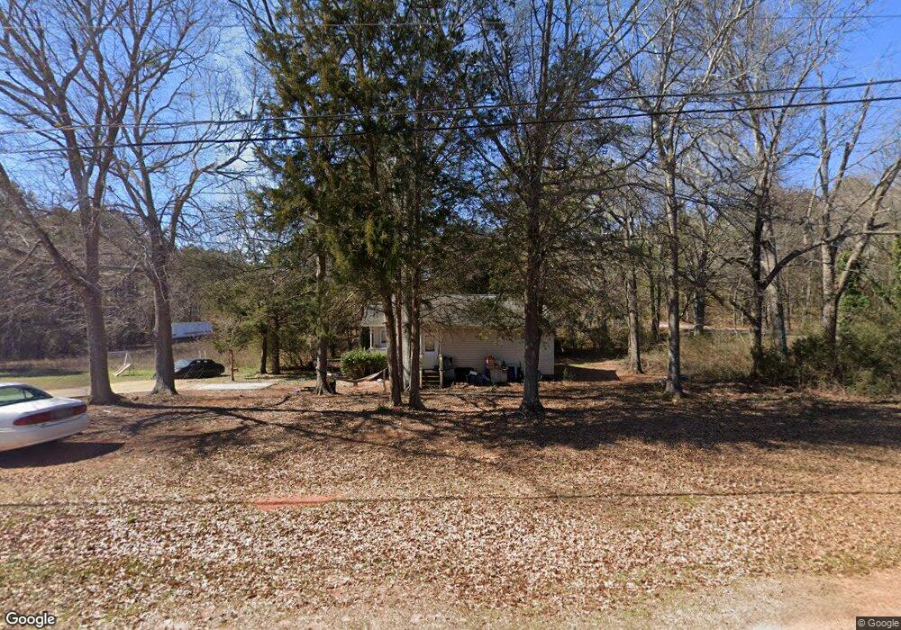
This home is located at 1779 Hill St, Comer, GA 30629 and is currently estimated at $240,980, approximately $209 per square foot. 1779 Hill St is a home located in Madison County with nearby schools including Madison County High School.
Ownership History
Date
Name
Owned For
Owner Type
Purchase Details
Closed on
Jun 1, 2006
Sold by
Madison County Habitat For
Bought by
Thomas Frances
Current Estimated Value
Home Financials for this Owner
Home Financials are based on the most recent Mortgage that was taken out on this home.
Original Mortgage
$56,555
Interest Rate
6.51%
Mortgage Type
New Conventional
Purchase Details
Closed on
Nov 20, 2003
Sold by
Fortson John
Bought by
Madison County Habitat For Humanity Inc
Create a Home Valuation Report for This Property
The Home Valuation Report is an in-depth analysis detailing your home's value as well as a comparison with similar homes in the area
Home Values in the Area
Average Home Value in this Area
Purchase History
| Date | Buyer | Sale Price | Title Company |
|---|---|---|---|
| Thomas Frances | $125,000 | -- | |
| Madison County Habitat For Humanity Inc | -- | -- | |
| Madison County Habitat For Humanity Inc | $55,000 | -- |
Source: Public Records
Mortgage History
| Date | Status | Borrower | Loan Amount |
|---|---|---|---|
| Closed | Thomas Frances | $56,555 | |
| Closed | Thomas Frances | $70,000 |
Source: Public Records
Tax History Compared to Growth
Tax History
| Year | Tax Paid | Tax Assessment Tax Assessment Total Assessment is a certain percentage of the fair market value that is determined by local assessors to be the total taxable value of land and additions on the property. | Land | Improvement |
|---|---|---|---|---|
| 2024 | $1,856 | $61,264 | $8,030 | $53,234 |
| 2023 | $2,025 | $56,089 | $6,692 | $49,397 |
| 2022 | $1,465 | $47,538 | $4,603 | $42,935 |
| 2021 | $1,222 | $35,612 | $4,603 | $31,009 |
| 2020 | $1,063 | $34,943 | $3,934 | $31,009 |
| 2019 | $1,050 | $34,179 | $3,934 | $30,245 |
| 2018 | $1,003 | $32,629 | $3,599 | $29,030 |
| 2017 | $1,148 | $33,412 | $3,346 | $30,066 |
| 2016 | $771 | $27,583 | $2,994 | $24,589 |
| 2015 | $828 | $27,583 | $2,994 | $24,589 |
| 2014 | $822 | $27,319 | $2,655 | $24,664 |
| 2013 | -- | $27,319 | $2,655 | $24,664 |
Source: Public Records
Map
Nearby Homes
- 858 Clairmont Ave
- 540 Sunset Ave
- 12 Laurel Ave
- 3 Paoli St
- 470 Gholston St
- 135 Shannons Place
- Trct 1 Paoli St
- 2649 Paoli St
- 40 Kingston Dr
- 2975 Georgia 72
- 0 Live Oak Ln Unit lot 3
- 0 Live Oak Ln Unit lot 12
- 0 Live Oak Ln Unit lot 5
- 15 Shady Oaks Ln
- 0 Lowe Rd Unit 10614126
- 5866 Highway 98 E
- 0 Paoli Rd Unit 23882833
- 3614 Georgia 72
- 35 Flint St
- 1725 Hill St
- 55 Flint St
- 71 Flint St
- lot 3A Hill St
- Lot 4 Hill St
- Lot 3 Hill St
- Lot 5 Hill St
- Lot 1 Hill St Unit 1
- Lot 2 Hill St Unit 2
- 0 Hill St Unit 2 Blk A 8313687
- 0 Hill St Unit 1 Blk B 8313698
- 0 Hill St Unit 2 A 7247756
- 0 Hill St Unit 1 A 7247746
- 0 Hill St Unit 2 8158952
- 0 Hill St Unit 1 8158932
- 0 Hill St Unit CM368844
- 0 Hill St Unit CM458438
- 0 Hill St Unit 9025449
- 0 Hill St Unit 7503932