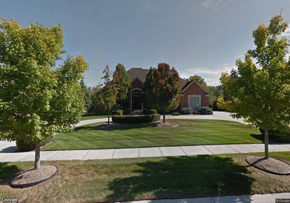
1779 Lincolnshire Dr Unit Bldg-Unit Rochester Hills, MI 48309
Estimated Value: $1,468,882 - $1,752,000
4
Beds
6
Baths
4,641
Sq Ft
$341/Sq Ft
Est. Value
About This Home
This home is located at 1779 Lincolnshire Dr Unit Bldg-Unit, Rochester Hills, MI 48309 and is currently estimated at $1,580,721, approximately $340 per square foot. 1779 Lincolnshire Dr Unit Bldg-Unit is a home located in Oakland County with nearby schools including Meadow Brook Elementary School, West Middle School, and Rochester High School.
Ownership History
Date
Name
Owned For
Owner Type
Purchase Details
Closed on
Oct 23, 2020
Sold by
Takalo Lawrence C and Takalo Judith L
Bought by
Larimer Kevin
Current Estimated Value
Purchase Details
Closed on
Jan 7, 2005
Sold by
Bella Real Estate Holdings Inc
Bought by
Takalo Lawrence C and Takalo Judith
Home Financials for this Owner
Home Financials are based on the most recent Mortgage that was taken out on this home.
Original Mortgage
$1,352,400
Interest Rate
5.25%
Mortgage Type
Construction
Purchase Details
Closed on
Jan 6, 2005
Sold by
Jensam Llc
Bought by
Bella Real Estate Holdings Inc
Home Financials for this Owner
Home Financials are based on the most recent Mortgage that was taken out on this home.
Original Mortgage
$1,352,400
Interest Rate
5.25%
Mortgage Type
Construction
Create a Home Valuation Report for This Property
The Home Valuation Report is an in-depth analysis detailing your home's value as well as a comparison with similar homes in the area
Home Values in the Area
Average Home Value in this Area
Purchase History
| Date | Buyer | Sale Price | Title Company |
|---|---|---|---|
| Larimer Kevin | $1,025,000 | None Available | |
| Takalo Lawrence C | $300,000 | Devon Title Agency | |
| Bella Real Estate Holdings Inc | -- | -- |
Source: Public Records
Mortgage History
| Date | Status | Borrower | Loan Amount |
|---|---|---|---|
| Previous Owner | Takalo Lawrence C | $1,352,400 |
Source: Public Records
Tax History Compared to Growth
Tax History
| Year | Tax Paid | Tax Assessment Tax Assessment Total Assessment is a certain percentage of the fair market value that is determined by local assessors to be the total taxable value of land and additions on the property. | Land | Improvement |
|---|---|---|---|---|
| 2022 | $10,016 | $577,210 | $0 | $0 |
| 2018 | $14,647 | $525,130 | $0 | $0 |
| 2017 | $14,360 | $515,110 | $0 | $0 |
| 2015 | -- | $548,710 | $0 | $0 |
| 2014 | -- | $523,500 | $0 | $0 |
| 2011 | -- | $414,140 | $0 | $0 |
Source: Public Records
Map
Nearby Homes
- 1699 Lincolnshire Dr
- 1578 Charter Oak Dr
- 1697 Riverside Dr Unit 15
- 1697 Riverside Dr Unit 18
- 1527 Charter Oak Dr Unit 143
- 3906 Thatcher Dr
- 3888 Thatcher Dr
- 2600 S Christian Hills Dr
- 580 Mallard St
- 584 Kinglet St
- 3875 Andover Ave Unit 14
- 2142 Kennedy Dr
- 3833 Forester Blvd Unit 37
- 3843 Andover Ave
- 3912 Forester Blvd Unit 109
- 3809 Forester Blvd
- 303 Toucan St
- 198 Jotham Ave
- 224 Jotham Ave
- 432 Flamingo St
- 1779 Lincolnshire Dr
- 1771 Lincolnshire Dr
- 1787 Lincolnshire Dr
- 1776 Lincolnshire Dr
- 1763 Lincolnshire Dr
- 3490 Lincolnshire Ct
- 1794 Lincolnshire Dr
- 3989 Piccadilly Dr
- 1755 Lincolnshire Dr
- 3478 Lincolnshire Ct
- 3970 Piccadilly Dr
- 1812 Lincolnshire Dr
- 3971 Piccadilly Dr
- 1758 Lincolnshire Dr
- 1747 Lincolnshire Dr
- 3952 Piccadilly Dr
- 1830 Lincolnshire Dr
- 1819 Lincolnshire Dr Unit Bldg-Unit
- 1819 Lincolnshire Dr
- 1750 Lincolnshire Dr
