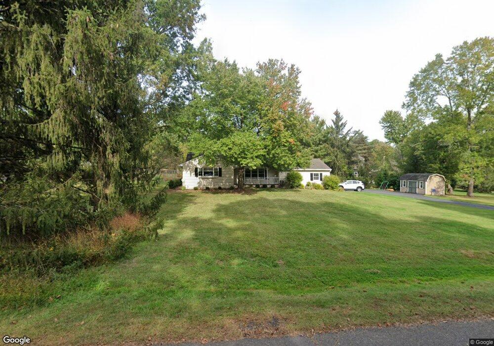
1779 W Circle Dr Martinsville, NJ 08836
Estimated Value: $650,040 - $734,000
--
Bed
--
Bath
1,367
Sq Ft
$503/Sq Ft
Est. Value
About This Home
This home is located at 1779 W Circle Dr, Martinsville, NJ 08836 and is currently estimated at $687,260, approximately $502 per square foot. 1779 W Circle Dr is a home located in Somerset County with nearby schools including Crim Primary School, Bridgewater-Raritan Middle School, and Hillside Intermediate School.
Ownership History
Date
Name
Owned For
Owner Type
Purchase Details
Closed on
Oct 15, 2010
Sold by
Vollmuth Lynn C
Bought by
Cherbonneau Gregg M and Cherbenneau Cynthia L
Current Estimated Value
Home Financials for this Owner
Home Financials are based on the most recent Mortgage that was taken out on this home.
Original Mortgage
$360,800
Outstanding Balance
$238,332
Interest Rate
4.37%
Mortgage Type
New Conventional
Estimated Equity
$448,928
Create a Home Valuation Report for This Property
The Home Valuation Report is an in-depth analysis detailing your home's value as well as a comparison with similar homes in the area
Home Values in the Area
Average Home Value in this Area
Purchase History
| Date | Buyer | Sale Price | Title Company |
|---|---|---|---|
| Cherbonneau Gregg M | $410,000 | None Available |
Source: Public Records
Mortgage History
| Date | Status | Borrower | Loan Amount |
|---|---|---|---|
| Open | Cherbonneau Gregg M | $360,800 |
Source: Public Records
Tax History Compared to Growth
Tax History
| Year | Tax Paid | Tax Assessment Tax Assessment Total Assessment is a certain percentage of the fair market value that is determined by local assessors to be the total taxable value of land and additions on the property. | Land | Improvement |
|---|---|---|---|---|
| 2025 | $9,765 | $538,400 | $313,000 | $225,400 |
| 2024 | $9,765 | $501,300 | $313,000 | $188,300 |
| 2023 | $9,198 | $463,600 | $313,000 | $150,600 |
| 2022 | $8,753 | $424,500 | $308,000 | $116,500 |
| 2021 | $8,740 | $417,800 | $308,000 | $109,800 |
| 2020 | $8,364 | $397,700 | $308,000 | $89,700 |
| 2019 | $8,740 | $411,700 | $308,000 | $103,700 |
| 2018 | $8,675 | $409,600 | $308,000 | $101,600 |
| 2017 | $8,402 | $396,300 | $308,000 | $88,300 |
| 2016 | $8,145 | $390,100 | $308,000 | $82,100 |
| 2015 | $8,137 | $389,900 | $308,000 | $81,900 |
| 2014 | $8,069 | $380,800 | $308,000 | $72,800 |
Source: Public Records
Map
Nearby Homes
- 1831 Washington Valley Rd
- 1869 Washington Valley Rd
- 10 Assante Ln
- 1899 Washington Valley Rd
- 1825 Kennesaw Way
- 7 Meyers Way
- 1930 Mountain Top Rd
- 61 Christy Dr
- 57 Christy Dr
- 112 Loft Dr Unit II112
- 1600 Mountain Top Rd
- 114 Branch Rd
- 6 Mount Horeb Rd
- 2044 Washington Valley Rd
- 499 Foothill Rd
- 6 Hardwood Ct
- 2105 Washington Valley Rd
- 2111 Washington Valley Rd
- 1 Holmes Ct
- 13 Lawton Rd
- 1771 W Circle Dr
- 947 Spring Run Ln
- 941 Spring Run Ln
- 1784 W Circle Dr
- 1774 W Circle Dr
- 951 Spring Run Ln
- 1766 W Circle Dr
- 1763 W Circle Dr
- 948 Spring Run Ln
- 1730 W Circle Dr
- 1796 Middle Rd
- 957 Spring Run Ln
- 1798 W Circle Dr
- 956 Spring Run Ln
- 1757 W Circle Dr
- 1722 W Circle Dr
- 1354 Mallard Dr
- 1358 Mallard Dr
- 1804 Middle Rd
- 963 Spring Run Ln