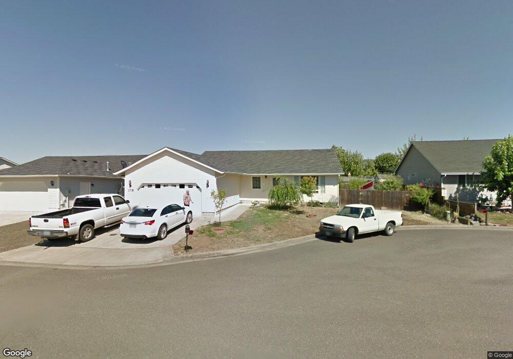
178 Carrin Layne Ct Roseburg, OR 97471
Green NeighborhoodEstimated Value: $348,177 - $386,000
3
Beds
2
Baths
1,469
Sq Ft
$248/Sq Ft
Est. Value
About This Home
This home is located at 178 Carrin Layne Ct, Roseburg, OR 97471 and is currently estimated at $364,294, approximately $247 per square foot. 178 Carrin Layne Ct is a home located in Douglas County with nearby schools including Sunnyslope Elementary School, John C. Fremont Middle School, and Roseburg High School.
Ownership History
Date
Name
Owned For
Owner Type
Purchase Details
Closed on
May 22, 2012
Sold by
Herrick Joanne
Bought by
Embertson Terry L
Current Estimated Value
Home Financials for this Owner
Home Financials are based on the most recent Mortgage that was taken out on this home.
Original Mortgage
$160,017
Outstanding Balance
$110,607
Interest Rate
3.85%
Mortgage Type
New Conventional
Estimated Equity
$253,687
Create a Home Valuation Report for This Property
The Home Valuation Report is an in-depth analysis detailing your home's value as well as a comparison with similar homes in the area
Home Values in the Area
Average Home Value in this Area
Purchase History
| Date | Buyer | Sale Price | Title Company |
|---|---|---|---|
| Embertson Terry L | $165,000 | Ticor Title |
Source: Public Records
Mortgage History
| Date | Status | Borrower | Loan Amount |
|---|---|---|---|
| Open | Embertson Terry L | $160,017 |
Source: Public Records
Tax History Compared to Growth
Tax History
| Year | Tax Paid | Tax Assessment Tax Assessment Total Assessment is a certain percentage of the fair market value that is determined by local assessors to be the total taxable value of land and additions on the property. | Land | Improvement |
|---|---|---|---|---|
| 2024 | $1,885 | $201,493 | -- | -- |
| 2023 | $1,830 | $195,625 | $0 | $0 |
| 2022 | $1,777 | $189,928 | $0 | $0 |
| 2021 | $1,725 | $184,397 | $0 | $0 |
| 2020 | $1,742 | $179,027 | $0 | $0 |
| 2019 | $1,710 | $173,813 | $0 | $0 |
| 2018 | $1,670 | $168,751 | $0 | $0 |
| 2017 | $1,621 | $163,836 | $0 | $0 |
| 2016 | $1,592 | $159,065 | $0 | $0 |
| 2015 | $1,565 | $154,433 | $0 | $0 |
| 2014 | $1,516 | $149,935 | $0 | $0 |
| 2013 | -- | $145,140 | $0 | $0 |
Source: Public Records
Map
Nearby Homes
- 2352 Castle Ave
- 129 Summerwood St
- 129 S Park Ct
- 248 Corona Loop Rd
- 225 Corona Loop Rd
- 1973 Castle Ave
- 157 Creekside Ct
- 4033 Hanna St
- 150 Maywood Ct
- 1951 Austin Rd
- 405 Corona Loop Rd
- 124 Aloha Ct
- 383 Little Valley Rd
- 2065 Bel Air Ct
- 204 Rainbow Ridge Ave
- 1927 Green Ave
- 1911 Green Ave
- 120 Littlebrook Ln
- 1895 Green Ave
- 122 Kristi Lee Ln
- 166 Carrin Layne Ct
- 194 Carrin Layne Ct
- 3742 Joe Ave
- 3768 Joe Ave
- 150 Carrin Layne Ct
- 175 Carrin Layne Ct
- 3780 Joe Ave
- 165 Carrin Layne Ct
- 193 Carrin Layne Ct
- 2180 Edna Ave
- 2196 Edna Ave
- 149 Carrin Layne Ct
- 138 Carrin Layne Ct
- 3739 Joe Ave
- 2204 Edna Ave
- 3798 Joe Ave
- 3710 Joe Ave
- 3761 Joe Ave
- 3721 Joe Ave