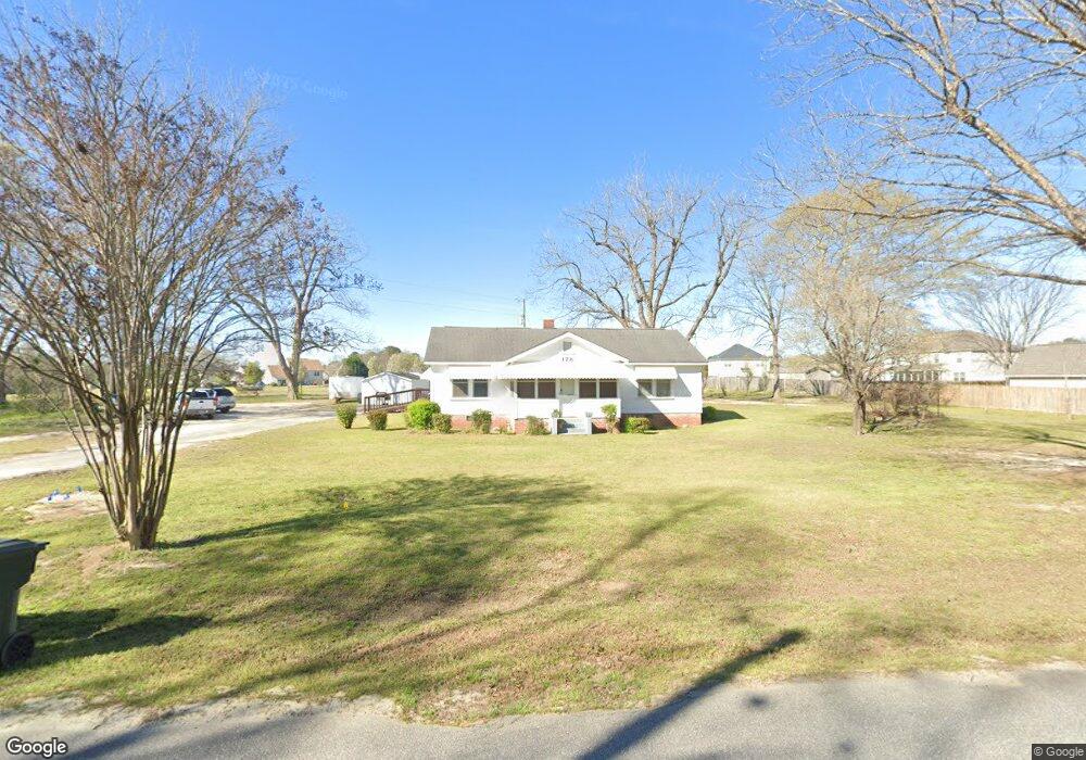
178 Davidson Rd Bonaire, GA 31005
Estimated Value: $157,449 - $236,000
--
Bed
1
Bath
1,418
Sq Ft
$141/Sq Ft
Est. Value
About This Home
This home is located at 178 Davidson Rd, Bonaire, GA 31005 and is currently estimated at $199,816, approximately $140 per square foot. 178 Davidson Rd is a home located in Houston County with nearby schools including Bonaire Elementary School, Bonaire Middle School, and Veterans High School.
Ownership History
Date
Name
Owned For
Owner Type
Purchase Details
Closed on
Dec 17, 2009
Sold by
Davidson Ruel Howard
Bought by
Davidson Ruel Howard
Current Estimated Value
Purchase Details
Closed on
Feb 7, 2003
Sold by
Greene Dorothy D Etal
Bought by
Davidson Ruel Howard
Purchase Details
Closed on
Feb 1, 2003
Sold by
Davidson J I
Bought by
Davidson Ruby H
Purchase Details
Closed on
Aug 10, 1962
Sold by
Macon Production Credit Association
Bought by
Davidson J I
Purchase Details
Closed on
Dec 6, 1945
Sold by
Nunn Sam A Executor Of Will Of Duncan Jp
Bought by
Davidson J I
Create a Home Valuation Report for This Property
The Home Valuation Report is an in-depth analysis detailing your home's value as well as a comparison with similar homes in the area
Home Values in the Area
Average Home Value in this Area
Purchase History
| Date | Buyer | Sale Price | Title Company |
|---|---|---|---|
| Davidson Ruel Howard | -- | -- | |
| Davidson Ruel Howard | $45,000 | -- | |
| Davidson Ruby H | -- | -- | |
| Davidson J I | -- | -- | |
| Davidson J I | -- | -- |
Source: Public Records
Tax History Compared to Growth
Tax History
| Year | Tax Paid | Tax Assessment Tax Assessment Total Assessment is a certain percentage of the fair market value that is determined by local assessors to be the total taxable value of land and additions on the property. | Land | Improvement |
|---|---|---|---|---|
| 2024 | $965 | $42,320 | $27,800 | $14,520 |
| 2023 | $812 | $35,600 | $23,480 | $12,120 |
| 2022 | $789 | $34,640 | $23,480 | $11,160 |
| 2021 | $793 | $34,640 | $19,080 | $15,560 |
| 2020 | $731 | $29,880 | $14,360 | $15,520 |
| 2019 | $681 | $29,880 | $14,360 | $15,520 |
| 2018 | $681 | $29,880 | $14,360 | $15,520 |
| 2017 | $681 | $29,880 | $14,360 | $15,520 |
| 2016 | $682 | $29,880 | $14,360 | $15,520 |
| 2015 | $684 | $29,880 | $14,360 | $15,520 |
| 2014 | -- | $29,880 | $14,360 | $15,520 |
| 2013 | -- | $29,880 | $14,360 | $15,520 |
Source: Public Records
Map
Nearby Homes
- 400 Avery Ct
- 412 Chelsea Leigh Ave Unit 8
- Perry Plan at Harley Farms - South
- Bedford Plan at Harley Farms - South
- Peachwood Plan at Harley Farms - South
- Auburn Plan at Harley Farms - South
- Woodbury Plan at Harley Farms - South
- Yarborough Plan at Harley Farms - South
- Kathleen Plan at Harley Farms - South
- Montrose Plan at Harley Farms - South
- 221 Olde Hickory Cir
- 701 Linda Gail Way Unit 109
- 113 Rosales Dr
- 631 Samantha Brooke Way
- 210 Ashley Nicole Ave
- 208 Ashley Nicole Ave
- 606 Samantha Brooke Way
- 206 Ashley Nicole Ave
- 814 Brittany Nichole Lot 121 Ct
- 806 Brittany Nichole Lot 125
- 0 Alder Way
- 301 Alder Way
- 0 Davidson Rd Unit 8091561
- 0 Davidson Rd Unit 7185094
- 0 Davidson Rd Unit 7618255
- 0 Davidson Rd Unit 8030470
- 0 Davidson Rd Unit 8051524
- 0 Davidson Rd Unit 95518
- 0 Davidson Rd Unit 160127
- 303 Alder Way
- 127 Olde Hickory Cir
- 175 Davidson Rd
- 125 Olde Hickory Cir
- 129 Olde Hickory Cir
- 182 Davidson Rd
- 300 Alder Way
- 600 Alexis Way
- 302 Alder Way
- 304 Alder Way
- 522 Hialeah Dr