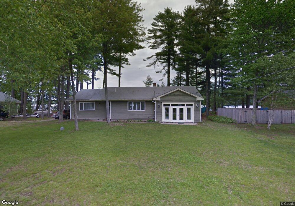
178 Lyons Point Rd Raymond, ME 04071
Estimated Value: $1,234,167 - $1,616,000
3
Beds
3
Baths
1,909
Sq Ft
$729/Sq Ft
Est. Value
About This Home
This home is located at 178 Lyons Point Rd, Raymond, ME 04071 and is currently estimated at $1,392,042, approximately $729 per square foot. 178 Lyons Point Rd is a home located in Cumberland County with nearby schools including Gray-New Gloucester High School.
Ownership History
Date
Name
Owned For
Owner Type
Purchase Details
Closed on
Jun 26, 2019
Sold by
Keith Laura E and Keith Bruce E
Bought by
Laura E Keith 2019 Ret and Keith
Current Estimated Value
Purchase Details
Closed on
Sep 30, 2009
Sold by
Nautel Scott T
Bought by
Keith Laura E and Keith Bruce E
Home Financials for this Owner
Home Financials are based on the most recent Mortgage that was taken out on this home.
Original Mortgage
$380,000
Interest Rate
5.12%
Mortgage Type
Unknown
Create a Home Valuation Report for This Property
The Home Valuation Report is an in-depth analysis detailing your home's value as well as a comparison with similar homes in the area
Home Values in the Area
Average Home Value in this Area
Purchase History
| Date | Buyer | Sale Price | Title Company |
|---|---|---|---|
| Laura E Keith 2019 Ret | -- | -- | |
| Laura E Keith 2019 Ret | -- | -- | |
| Keith Laura E | -- | -- | |
| Keith Laura E | -- | -- |
Source: Public Records
Mortgage History
| Date | Status | Borrower | Loan Amount |
|---|---|---|---|
| Closed | Keith Laura E | $364,000 | |
| Closed | Keith Laura E | $380,000 | |
| Previous Owner | Keith Laura E | $390,025 |
Source: Public Records
Tax History
| Year | Tax Paid | Tax Assessment Tax Assessment Total Assessment is a certain percentage of the fair market value that is determined by local assessors to be the total taxable value of land and additions on the property. | Land | Improvement |
|---|---|---|---|---|
| 2025 | $11,052 | $1,141,700 | $760,000 | $381,700 |
| 2024 | $11,074 | $1,141,700 | $760,000 | $381,700 |
| 2023 | $9,477 | $624,300 | $380,000 | $244,300 |
| 2022 | $8,709 | $624,300 | $380,000 | $244,300 |
| 2021 | $8,807 | $602,800 | $380,000 | $222,800 |
| 2020 | $8,891 | $602,800 | $380,000 | $222,800 |
| 2019 | $8,891 | $602,800 | $380,000 | $222,800 |
| 2018 | $8,439 | $602,800 | $380,000 | $222,800 |
| 2017 | $6,263 | $347,000 | $213,600 | $133,400 |
| 2016 | $6,350 | $347,000 | $213,600 | $133,400 |
| 2015 | $5,811 | $319,300 | $213,600 | $105,700 |
| 2014 | $5,811 | $319,300 | $213,600 | $105,700 |
| 2012 | $5,061 | $319,298 | $213,560 | $105,738 |
Source: Public Records
Map
Nearby Homes
- 15 Worcester Dr
- 2 Gore Rd
- 34 Many Oaks Ln
- M011-006 Westwood Rd
- 11-007 Westwood Rd
- 20 Bittersweet Way
- 0 Heidi Way
- 12 Presidential View
- 18 Hillside Dr
- lot #8 Bedrock Terrace
- 99 Enterprise Dr
- 4 Wheeler Rd
- 107 W Gray Rd
- 16 Peterson Rd
- 1112 Roosevelt Trail Unit 8
- 1083 Roosevelt Trail
- 127 Shaker Rd Unit 17
- 15 May Meadow Dr
- 7 Baxter Woods Trail
- 1042 Roosevelt Trail
- 180 Lyons Point Rd
- 172 Lyons Point Rd
- 182 Lyons Point Rd
- 182 Lyons Point Rd
- 6 Brads Way
- 4 Brads Way
- 1 Brads Way
- 2 Brads Way
- 168 Lyons Point Rd
- 166 Lyons Point Rd
- 166 Lyons Point Rd
- 163 Lyons Point Rd
- 164 Lyons Point Rd
- 161 Lyons Point Rd
- 162 Lyons Point Rd
- 159 Lyons Point Rd
- 155 Lyons Point Rd
- 156 Lyons Point Rd
- 153 Lyons Point Rd
- 154 Lyons Point Rd
Your Personal Tour Guide
Ask me questions while you tour the home.