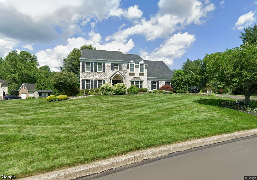
178 Sunset View Dr Doylestown, PA 18901
Estimated Value: $908,000 - $1,095,561
About This Home
This home is located at 178 Sunset View Dr, Doylestown, PA 18901 and is currently estimated at $996,140, approximately $237 per square foot. 178 Sunset View Dr is a home located in Bucks County with nearby schools including Kutz Elementary School, Lenape Middle School, and Central Bucks High School-West.
Ownership History
We collect this data history from publicly available records. To have your information removed, we recommend requesting removal directly through your county’s website.
Purchase Details
Home Financials for this Owner
Home Financials are based on the most recent Mortgage that was taken out on this home.Purchase Details
Home Values in the Area
Average Home Value in this Area
Purchase History
We collect this data history from publicly available records. To have your information removed, we recommend requesting removal directly through your county’s website.
| Date | Buyer | Sale Price | Title Company |
|---|---|---|---|
| $329,900 | Commonwealth Land Title Ins | ||
| $85,000 | -- |
Mortgage History
We collect this data history from publicly available records. To have your information removed, we recommend requesting removal directly through your county’s website.
| Date | Status | Borrower | Loan Amount |
|---|---|---|---|
| Previous Owner | $263,920 |
Tax History
We collect this data history from publicly available records. To have your information removed, we recommend requesting removal directly through your county’s website.
| Year | Tax Paid | Tax Assessment Tax Assessment Total Assessment is a certain percentage of the fair market value that is determined by local assessors to be the total taxable value of land and additions on the property. | Land | Improvement |
|---|---|---|---|---|
| 2026 | $9,471 | $50,480 | $6,960 | $43,520 |
| 2025 | $8,933 | $50,480 | $6,960 | $43,520 |
| 2024 | $8,933 | $50,480 | $6,960 | $43,520 |
| 2023 | $8,518 | $50,480 | $6,960 | $43,520 |
| 2022 | $8,423 | $50,480 | $6,960 | $43,520 |
| 2021 | $8,250 | $50,480 | $6,960 | $43,520 |
| 2020 | $8,212 | $50,480 | $6,960 | $43,520 |
| 2019 | $8,124 | $50,480 | $6,960 | $43,520 |
| 2018 | $8,098 | $50,480 | $6,960 | $43,520 |
| 2017 | $8,035 | $50,480 | $6,960 | $43,520 |
| 2016 | $7,985 | $50,480 | $6,960 | $43,520 |
| 2015 | -- | $50,480 | $6,960 | $43,520 |
| 2014 | -- | $50,480 | $6,960 | $43,520 |
Map
- 35 Radcliff Dr
- 74 Radcliff Dr
- 6 Morgan Hill Dr
- 53 Woodard Ct Unit 53
- 16 Blakemore Ct Unit 16
- 68 Steeplechase Dr
- 2401 Lower State Rd Unit 106
- 33 Bittersweet Dr
- 15 Charter Oak Ct Unit 104
- 129 Steeplechase Dr
- 19 Avalon Ct Unit 1704
- 48 Steeplechase Dr
- 13-1 Aspen Way
- 156 Vaux Dr
- 566 New Britain Rd
- 19 Addison Ct Unit 2702
- 500 Deerfield Ln
- 4 Addison Ct Unit 2603
- 158 Wooded Dr
- 1824 Turk Rd
- 31 Vale View Dr
- 176 Sunset View Dr
- 182 Sunset View Dr
- 29 Vale View Dr
- 181 Sunset View Dr
- 30 Vale View Dr
- 174 Sunset View Dr
- 179 Sunset View Dr
- 28 Vale View Dr
- 27 Vale View Dr
- 177 Sunset View Dr
- 172 Sunset View Dr
- 26 Vale View Dr
- 183 Sunset View Dr
- 175 Sunset View Dr
- 185 Sunset View Dr
- 25 Vale View Dr
- 170 Sunset View Dr
- 187 Sunset View Dr
- 173 Sunset View Dr
Ask me questions while you tour the home.