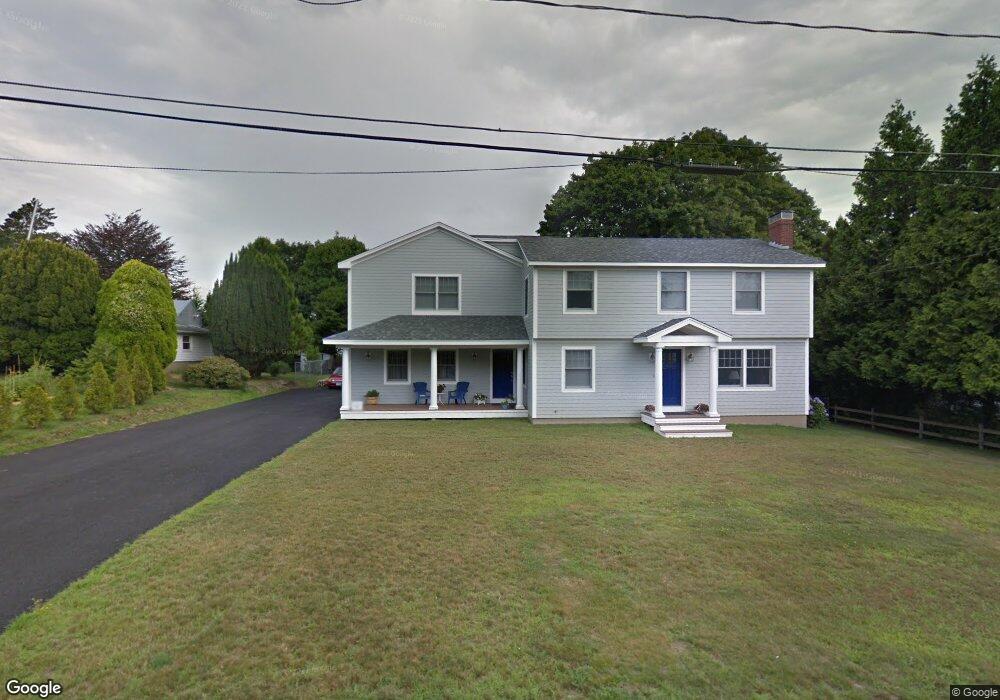
178 Vernon Ave Middletown, RI 02842
Estimated Value: $754,000 - $1,167,000
4
Beds
4
Baths
2,564
Sq Ft
$363/Sq Ft
Est. Value
About This Home
This home is located at 178 Vernon Ave, Middletown, RI 02842 and is currently estimated at $931,509, approximately $363 per square foot. 178 Vernon Ave is a home located in Newport County with nearby schools including Middletown High School, St Michael's Country Day School, and All Saints STEAM Academy.
Ownership History
Date
Name
Owned For
Owner Type
Purchase Details
Closed on
Jul 16, 2024
Sold by
Dunn Edward P and Dunn Elaine M
Bought by
Edward P Dunnn Iii Ret and Dunn
Current Estimated Value
Purchase Details
Closed on
May 4, 1983
Bought by
Dunn Edward P and Dunn Elaine M
Create a Home Valuation Report for This Property
The Home Valuation Report is an in-depth analysis detailing your home's value as well as a comparison with similar homes in the area
Home Values in the Area
Average Home Value in this Area
Purchase History
| Date | Buyer | Sale Price | Title Company |
|---|---|---|---|
| Edward P Dunnn Iii Ret | -- | None Available | |
| Dunn Edward P | -- | -- |
Source: Public Records
Mortgage History
| Date | Status | Borrower | Loan Amount |
|---|---|---|---|
| Previous Owner | Dunn Edward P | $352,000 | |
| Previous Owner | Dunn Edward P | $244,000 | |
| Previous Owner | Dunn Edward P | $40,000 | |
| Previous Owner | Dunn Edward P | $10,000 |
Source: Public Records
Tax History Compared to Growth
Tax History
| Year | Tax Paid | Tax Assessment Tax Assessment Total Assessment is a certain percentage of the fair market value that is determined by local assessors to be the total taxable value of land and additions on the property. | Land | Improvement |
|---|---|---|---|---|
| 2025 | $9,332 | $791,500 | $333,700 | $457,800 |
| 2024 | $8,912 | $791,500 | $333,700 | $457,800 |
| 2023 | $7,084 | $562,700 | $225,600 | $337,100 |
| 2022 | $6,764 | $562,700 | $225,600 | $337,100 |
| 2021 | $6,764 | $562,700 | $225,600 | $337,100 |
| 2020 | $6,521 | $473,900 | $169,400 | $304,500 |
| 2018 | $6,516 | $473,900 | $169,400 | $304,500 |
| 2016 | $6,862 | $445,000 | $152,500 | $292,500 |
| 2015 | $6,693 | $445,000 | $152,500 | $292,500 |
| 2014 | $6,473 | $402,800 | $130,900 | $271,900 |
| 2013 | $6,328 | $402,800 | $130,900 | $271,900 |
Source: Public Records
Map
Nearby Homes
- 138 Green End Ave
- 1 Shangri-La Ln
- 36 Kay Blvd
- 55 John Clarke Rd Unit 8
- 55 John Clarke Rd Unit 3
- 5 Elliot Place
- 19 Princeton St Unit 21
- 117 W Main Rd
- 149 W Main Rd
- 129 Bliss Mine Rd
- 1 Arnold Ave
- 78 Ellery Rd
- 67 Linden St
- 476 Green End Ave
- 103 Champlin Place N
- 198 Gibbs Ave
- 155 Evarts St
- 0 Honeyman Ave
- 128 Eustis Ave
- 4 Newport Ave Unit B2
- 180 Vernon Ave
- 306 Boulevard
- 292 Boulevard
- 286 Boulevard
- 316 Boulevard
- 181 Vernon Ave
- 179 Vernon Ave
- 322 Boulevard
- 187 Vernon Ave
- 278 Boulevard
- 182 Vernon Ave
- 145 Vernon Ave
- 145 Vernon Ave Unit 1
- 143 Vernon Ave
- 272 Boulevard
- 197 Vernon Ave
- 336 Boulevard
- 38 Shangri la Ln Unit 40
- 206 Vernon Ave
- 135 Vernon Ave Unit 137