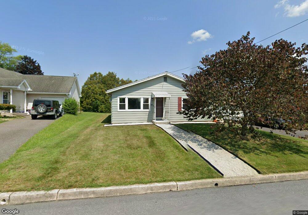
178 Westside Rd Lehighton, PA 18235
Estimated Value: $241,007 - $302,000
3
Beds
1
Bath
1,152
Sq Ft
$227/Sq Ft
Est. Value
About This Home
This home is located at 178 Westside Rd, Lehighton, PA 18235 and is currently estimated at $261,502, approximately $226 per square foot. 178 Westside Rd is a home located in Carbon County with nearby schools including Lehighton Area High School, Sts. Peter & Paul School, and Valley Ridge Academy.
Ownership History
Date
Name
Owned For
Owner Type
Purchase Details
Closed on
Dec 17, 2020
Sold by
Miller Lawrence L and Miller Karensue M
Bought by
Haas Audrey Marrie and Haas Kile Richard
Current Estimated Value
Home Financials for this Owner
Home Financials are based on the most recent Mortgage that was taken out on this home.
Original Mortgage
$139,244
Outstanding Balance
$123,969
Interest Rate
2.7%
Mortgage Type
New Conventional
Estimated Equity
$137,533
Purchase Details
Closed on
Jun 27, 1996
Bought by
Miller Lawrence L and Miller Karensue M
Create a Home Valuation Report for This Property
The Home Valuation Report is an in-depth analysis detailing your home's value as well as a comparison with similar homes in the area
Home Values in the Area
Average Home Value in this Area
Purchase History
| Date | Buyer | Sale Price | Title Company |
|---|---|---|---|
| Haas Audrey Marrie | $161,000 | Carbon Search & Stlmt Svcs I | |
| Miller Lawrence L | $78,000 | -- |
Source: Public Records
Mortgage History
| Date | Status | Borrower | Loan Amount |
|---|---|---|---|
| Open | Haas Audrey Marrie | $139,244 |
Source: Public Records
Tax History Compared to Growth
Tax History
| Year | Tax Paid | Tax Assessment Tax Assessment Total Assessment is a certain percentage of the fair market value that is determined by local assessors to be the total taxable value of land and additions on the property. | Land | Improvement |
|---|---|---|---|---|
| 2025 | $3,156 | $41,250 | $14,550 | $26,700 |
| 2024 | $3,033 | $41,250 | $14,550 | $26,700 |
| 2023 | $3,002 | $41,250 | $14,550 | $26,700 |
| 2022 | $2,960 | $41,250 | $14,550 | $26,700 |
| 2021 | $2,873 | $41,250 | $14,550 | $26,700 |
| 2020 | $2,800 | $41,250 | $14,550 | $26,700 |
| 2019 | $2,656 | $41,250 | $14,550 | $26,700 |
| 2018 | $2,625 | $41,250 | $14,550 | $26,700 |
| 2017 | $2,625 | $41,250 | $14,550 | $26,700 |
| 2016 | -- | $41,250 | $14,550 | $26,700 |
| 2015 | -- | $41,250 | $14,550 | $26,700 |
| 2014 | -- | $41,250 | $14,550 | $26,700 |
Source: Public Records
Map
Nearby Homes
- 17 Mahoning Dr E
- 0 Emily Plan at Summit Point Unit PACC2005480
- 0 Copper Beech Plan at Summit Ridge Unit PACC2005478
- 0 Black Cherry Plan at Summit Ridge Unit PACC2005474
- 0 Ridge
- 70 W Highland Ln
- 410 S 8th St
- 639 Iron St
- 470 N 8th St
- 0 Pine Hollow Dr Unit PACC2006714
- 0 Pine Hollow Dr Unit PM-135085
- 0 Pine Hollow Dr Unit 763487
- 522 Iron St
- 193 S 4th St
- 193 S 4th St Unit 191-193
- 117 N 4th St
- 0 Pine Hollow Unit PACC2006556
- 215 N 4th St
- 196 S 3rd St
- 344 Ochre St
- 164 Westside Rd
- 158 Westside Rd
- 194 Westside Rd
- 160 Westside Rd
- A4 W Side Rd
- 149 Center Rd
- 44 Willard Dr
- 171 Westside Rd
- 171 Center Rd
- 133 Westside Rd
- 189 Westside Rd
- 212 Westside Rd
- 125 Center Rd
- 212 W Side Rd
- 155 Westside Rd
- 212 Westside Rd
- 14 Willard St
- 14 Willard Dr
- 152 Center Rd
- 225 Westside Rd