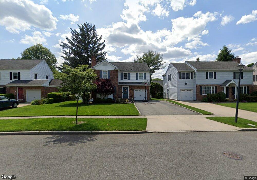
178 Wetherill Rd Garden City, NY 11530
Estimated Value: $1,701,110 - $1,860,000
--
Bed
3
Baths
2,601
Sq Ft
$685/Sq Ft
Est. Value
About This Home
This home is located at 178 Wetherill Rd, Garden City, NY 11530 and is currently estimated at $1,780,555, approximately $684 per square foot. 178 Wetherill Rd is a home located in Nassau County with nearby schools including Hemlock School, Stewart School, and Garden City Middle School.
Ownership History
Date
Name
Owned For
Owner Type
Purchase Details
Closed on
May 11, 2009
Sold by
Cartus Financial Corp
Bought by
Macchio Francis J and Macchio Diana
Current Estimated Value
Purchase Details
Closed on
Mar 25, 2009
Sold by
Schottenheimer Bria D and Schottenheimer Gemmi A
Bought by
Cartus Financial Corp
Purchase Details
Closed on
Mar 21, 2006
Sold by
Janne Ninimaa
Bought by
Schottenheimer Brian
Purchase Details
Closed on
Oct 5, 2005
Sold by
Mccoyd Sean
Bought by
Niinimaa Janne
Purchase Details
Closed on
Feb 16, 2001
Sold by
Heaney Sue Ann
Bought by
Mccoyd Sean R
Create a Home Valuation Report for This Property
The Home Valuation Report is an in-depth analysis detailing your home's value as well as a comparison with similar homes in the area
Home Values in the Area
Average Home Value in this Area
Purchase History
| Date | Buyer | Sale Price | Title Company |
|---|---|---|---|
| Macchio Francis J | $999,000 | -- | |
| Cartus Financial Corp | $999,000 | -- | |
| Schottenheimer Brian | $1,215,000 | -- | |
| Niinimaa Janne | $1,100,000 | -- | |
| Mccoyd Sean R | $416,000 | Susan Baciagalupo |
Source: Public Records
Tax History Compared to Growth
Tax History
| Year | Tax Paid | Tax Assessment Tax Assessment Total Assessment is a certain percentage of the fair market value that is determined by local assessors to be the total taxable value of land and additions on the property. | Land | Improvement |
|---|---|---|---|---|
| 2025 | $17,296 | $1,101 | $298 | $803 |
| 2024 | $2,472 | $1,101 | $298 | $803 |
| 2023 | $17,557 | $1,073 | $298 | $775 |
| 2022 | $17,557 | $1,073 | $298 | $775 |
| 2021 | $26,298 | $1,041 | $289 | $752 |
| 2020 | $19,860 | $2,018 | $1,128 | $890 |
| 2019 | $20,030 | $2,018 | $1,128 | $890 |
| 2018 | $17,866 | $2,018 | $0 | $0 |
| 2017 | $12,909 | $2,018 | $1,128 | $890 |
| 2016 | $15,938 | $2,018 | $1,128 | $890 |
| 2015 | $2,915 | $2,018 | $1,128 | $890 |
| 2014 | $2,915 | $2,018 | $1,128 | $890 |
| 2013 | $2,754 | $2,018 | $1,128 | $890 |
Source: Public Records
Map
Nearby Homes
- 68 Kenwood Rd
- 5 Birchwood Ct Unit 3 N
- 1 Birchwood Ct Unit 5 H
- 60 Pell Terrace
- 6 Birchwood Ct Unit 4N
- 6 Birchwood Ct Unit 3H
- 4 Birchwood Ct Unit 5A
- 2 Birchwood Ct Unit 1O
- 34 East Dr
- 84 2nd St Unit 80
- 87 Roosevelt Place
- 132 Arthur St
- 123 15th St Unit A-1
- 101 Clinton Ave Unit 1A
- 101 Clinton Ave Unit 2-J
- 129 15th St Unit B2
- 127 15th St Unit E 2
- 100 Clinton Ave Unit 3-0
- 100 Clinton Ave Unit 1V
- 100 Clinton Ave Unit 2J
- 176 Wetherill Rd
- 180 Wetherill Rd
- 7 Prescott St
- 174 Wetherill Rd
- 182 Wetherill Rd
- 9 Prescott St
- 5 Prescott St
- 175 Wetherill Rd
- 179 Wetherill Rd
- 11 Prescott St
- 53 Mulberry Ave
- 173 Wetherill Rd
- 184 Wetherill Rd
- 57 Mulberry Ave
- 51 Mulberry Ave
- 183 Wetherill Rd
- 171 Wetherill Rd
- 15 Prescott St
- 186 Wetherill Rd
- 8 Maple St