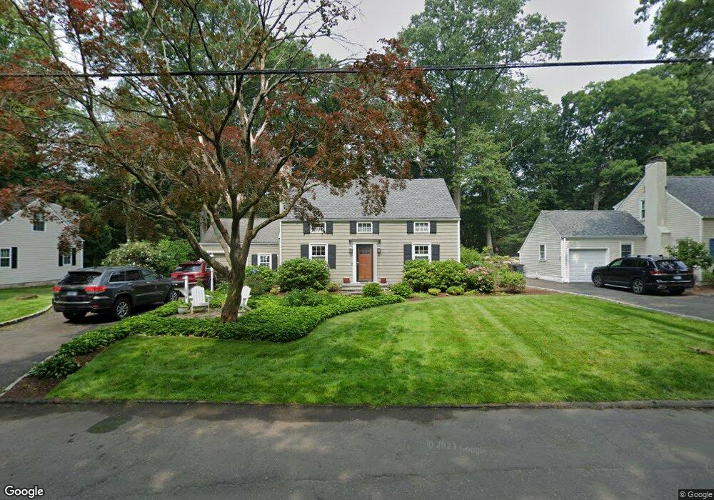
178 Woodbury Ave Stamford, CT 06907
Springdale NeighborhoodEstimated Value: $821,000 - $930,834
3
Beds
3
Baths
2,588
Sq Ft
$340/Sq Ft
Est. Value
About This Home
This home is located at 178 Woodbury Ave, Stamford, CT 06907 and is currently estimated at $878,709, approximately $339 per square foot. 178 Woodbury Ave is a home located in Fairfield County with nearby schools including Springdale Elementary School, Dolan School, and Stamford High School.
Ownership History
Date
Name
Owned For
Owner Type
Purchase Details
Closed on
May 5, 2005
Sold by
Tymon Mark D and Tymon Darcie C
Bought by
Murray Graham and Murray Susan G
Current Estimated Value
Purchase Details
Closed on
Nov 30, 1995
Sold by
Coleman Michael Andre and Coleman Pamela
Bought by
Bergen Elizabeth J
Purchase Details
Closed on
Apr 29, 1992
Sold by
Murphy Thomas and Murphy Patricia
Bought by
Molino Michael and Faivus Pamela
Create a Home Valuation Report for This Property
The Home Valuation Report is an in-depth analysis detailing your home's value as well as a comparison with similar homes in the area
Home Values in the Area
Average Home Value in this Area
Purchase History
| Date | Buyer | Sale Price | Title Company |
|---|---|---|---|
| Murray Graham | $609,500 | -- | |
| Murray Graham | $609,500 | -- | |
| Bergen Elizabeth J | $253,000 | -- | |
| Bergen Elizabeth J | $253,000 | -- | |
| Molino Michael | $232,000 | -- |
Source: Public Records
Mortgage History
| Date | Status | Borrower | Loan Amount |
|---|---|---|---|
| Open | Molino Michael | $453,280 | |
| Closed | Molino Michael | $457,500 |
Source: Public Records
Tax History Compared to Growth
Tax History
| Year | Tax Paid | Tax Assessment Tax Assessment Total Assessment is a certain percentage of the fair market value that is determined by local assessors to be the total taxable value of land and additions on the property. | Land | Improvement |
|---|---|---|---|---|
| 2025 | $11,370 | $480,540 | $251,070 | $229,470 |
| 2024 | $11,120 | $480,540 | $251,070 | $229,470 |
| 2023 | $11,946 | $480,540 | $251,070 | $229,470 |
| 2022 | $10,663 | $398,750 | $188,970 | $209,780 |
| 2021 | $10,547 | $398,750 | $188,970 | $209,780 |
| 2020 | $10,276 | $398,750 | $188,970 | $209,780 |
| 2019 | $10,276 | $398,750 | $188,970 | $209,780 |
| 2018 | $9,897 | $398,750 | $188,970 | $209,780 |
| 2017 | $9,501 | $365,430 | $174,980 | $190,450 |
| 2016 | $9,234 | $365,430 | $174,980 | $190,450 |
| 2015 | $8,993 | $365,430 | $174,980 | $190,450 |
| 2014 | $8,694 | $365,430 | $174,980 | $190,450 |
Source: Public Records
Map
Nearby Homes
- 44 Brundage St
- 970 Hope St Unit 4J
- 83 Mulberry St
- 900 Hope St Unit 8C
- 910 Hope St Unit 5B
- 825 Hope St Unit 4
- 393 Upper Haig Ave
- 31 Gray Farms Rd
- 1148 Hope St
- 1157 Hope St
- 78 Elizabeth Ave
- 31 Sussex Place
- 172 Joffre Ave
- 31 Chatfield St
- 143 Overbrook Dr
- 24 Haig Ave
- 23 Oenoke Place
- 16 Columbus Place
- 22 Hastings Ln
- 17 Oenoke Place
- 184 Woodbury Ave
- 92 Lawton Ave
- 181 Woodbury Ave
- 173 Woodbury Ave
- 162 Woodbury Ave
- 94 Birchwood Rd
- 86 Birchwood Rd
- 159 Woodbury Ave
- 156 Woodbury Ave
- 85 Lawton Ave
- 71 Lawton Ave
- 93 Lawton Ave
- 78 Birchwood Rd
- 153 Woodbury Ave
- 150 Woodbury Ave
- 74 Birchwood Rd
- 95 Lawton Ave
- 91 Birchwood Rd
- 68 Birchwood Rd
- 87 Birchwood Rd