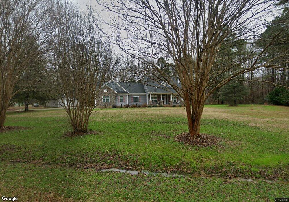
1780 Allison Cir Rock Hill, SC 29732
Estimated Value: $258,000 - $684,000
2
Beds
1
Bath
800
Sq Ft
$677/Sq Ft
Est. Value
About This Home
This home is located at 1780 Allison Cir, Rock Hill, SC 29732 and is currently estimated at $541,250, approximately $676 per square foot. 1780 Allison Cir is a home located in York County with nearby schools including Mount Gallant Elementary School, Dutchman Creek Middle School, and Northwestern High School.
Ownership History
Date
Name
Owned For
Owner Type
Purchase Details
Closed on
Oct 16, 2015
Sold by
Tong Shelly
Bought by
Lindsey Paul A and Lindsey Renita D
Current Estimated Value
Purchase Details
Closed on
May 28, 2010
Sold by
Citifinancial Inc
Bought by
Tong Shelly
Purchase Details
Closed on
Dec 17, 2009
Sold by
Holler Iris M and Holler James T
Bought by
Citifinancial Inc
Purchase Details
Closed on
Sep 2, 2004
Sold by
Mathis Paul Arnold
Bought by
Holler Iris M
Create a Home Valuation Report for This Property
The Home Valuation Report is an in-depth analysis detailing your home's value as well as a comparison with similar homes in the area
Home Values in the Area
Average Home Value in this Area
Purchase History
| Date | Buyer | Sale Price | Title Company |
|---|---|---|---|
| Lindsey Paul A | $39,000 | -- | |
| Tong Shelly | $35,000 | -- | |
| Citifinancial Inc | $5,000 | -- | |
| Holler Iris M | -- | -- | |
| Mathis Paul Arnold | -- | -- | |
| Mathis Paul Arnold | -- | -- | |
| Holler Iris M | -- | -- |
Source: Public Records
Tax History Compared to Growth
Tax History
| Year | Tax Paid | Tax Assessment Tax Assessment Total Assessment is a certain percentage of the fair market value that is determined by local assessors to be the total taxable value of land and additions on the property. | Land | Improvement |
|---|---|---|---|---|
| 2024 | $2,204 | $15,732 | $1,318 | $14,414 |
| 2023 | $2,261 | $15,732 | $1,318 | $14,414 |
| 2022 | $2,269 | $15,732 | $1,318 | $14,414 |
| 2021 | -- | $15,732 | $1,318 | $14,414 |
| 2020 | $2,264 | $15,732 | $0 | $0 |
| 2019 | $2,062 | $13,680 | $0 | $0 |
| 2018 | $2,049 | $13,680 | $0 | $0 |
| 2017 | $1,932 | $13,680 | $0 | $0 |
| 2016 | $1,782 | $3,390 | $0 | $0 |
| 2014 | $492 | $3,760 | $1,880 | $1,880 |
| 2013 | $492 | $3,860 | $1,880 | $1,980 |
Source: Public Records
Map
Nearby Homes
- 2060 Covered Bridge Ct
- 2035 Covered Bridge Ct
- 2028 Covered Bridge Ct
- 516 Cool Creek Dr
- 2019 Covered Bridge Ct Unit 107
- 233 Tributary Dr
- 1767 Hands Mill Hwy
- 305 White Water Dr
- 675 Winding Branch Rd
- 885 Regulus Ct
- 885 Regulus Ct Unit 42
- 881 Regulus Ct Unit 43
- 877 Regulus Ct Unit 44
- 725 Sirius Ln
- 725 Sirius Ln Unit 90
- 733 Sirius Ln
- 745 Sirius Ln Unit 95
- 249 Blue Heron Dr
- 626 Amberjack Place
- 626 Amberjack Place Unit 79
- 1800 Allison Cir
- 00 Old Eury Rd
- 1790 Allison Cir
- 2091 Covered Bridge Ct
- 2091 Covered Bridge Ct Unit 90
- 2087 Covered Bridge Ct
- 2083 Covered Bridge Ct
- 2079 Covered Bridge Ct
- 2099 Covered Bridge Ct
- 2075 Covered Bridge Ct
- 2071 Covered Bridge Ct
- 2071 Covered Bridge Ct Unit 95
- 2084 Covered Bridge Ct
- 2080 Covered Bridge Ct
- 2092 Covered Bridge Ct
- 2088 Covered Bridge Ct
- 2076 Covered Bridge Ct
- 2072 Covered Bridge Ct
- 2063 Covered Bridge Ct
- 1826 Allison Cir