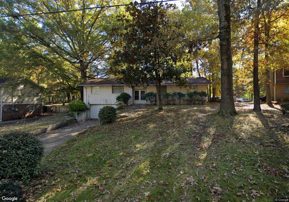
1780 Camperdown Cir Decatur, GA 30035
Southwest DeKalb NeighborhoodEstimated Value: $227,204 - $280,000
3
Beds
2
Baths
1,820
Sq Ft
$140/Sq Ft
Est. Value
About This Home
This home is located at 1780 Camperdown Cir, Decatur, GA 30035 and is currently estimated at $255,301, approximately $140 per square foot. 1780 Camperdown Cir is a home located in DeKalb County with nearby schools including Snapfinger Elementary School, Columbia Middle School, and Columbia High School.
Ownership History
Date
Name
Owned For
Owner Type
Purchase Details
Closed on
Dec 19, 2011
Sold by
Federal National Mortgage Association
Bought by
Herbert Richer
Current Estimated Value
Purchase Details
Closed on
Jun 7, 2011
Sold by
Residential Credit Solutions I
Bought by
Federal Natl Mtg Assn Fnma
Purchase Details
Closed on
Nov 29, 2006
Sold by
Moore Carrie
Bought by
Moore Willie
Home Financials for this Owner
Home Financials are based on the most recent Mortgage that was taken out on this home.
Original Mortgage
$129,200
Interest Rate
8.4%
Mortgage Type
New Conventional
Purchase Details
Closed on
Dec 24, 2004
Sold by
Moore Carrie
Bought by
Moore Carrie and Moore Willie
Home Financials for this Owner
Home Financials are based on the most recent Mortgage that was taken out on this home.
Original Mortgage
$63,700
Interest Rate
5.63%
Mortgage Type
Stand Alone Second
Create a Home Valuation Report for This Property
The Home Valuation Report is an in-depth analysis detailing your home's value as well as a comparison with similar homes in the area
Home Values in the Area
Average Home Value in this Area
Purchase History
| Date | Buyer | Sale Price | Title Company |
|---|---|---|---|
| Herbert Richer | $14,000 | -- | |
| Federal Natl Mtg Assn Fnma | -- | -- | |
| Residential Credit Solutions I | $178,162 | -- | |
| Moore Willie | $139,200 | -- | |
| Moore Carrie | -- | -- |
Source: Public Records
Mortgage History
| Date | Status | Borrower | Loan Amount |
|---|---|---|---|
| Previous Owner | Moore Willie | $129,200 | |
| Previous Owner | Moore Carrie | $63,700 |
Source: Public Records
Tax History Compared to Growth
Tax History
| Year | Tax Paid | Tax Assessment Tax Assessment Total Assessment is a certain percentage of the fair market value that is determined by local assessors to be the total taxable value of land and additions on the property. | Land | Improvement |
|---|---|---|---|---|
| 2025 | $4,083 | $83,040 | $14,000 | $69,040 |
| 2024 | $3,352 | $66,400 | $8,000 | $58,400 |
| 2023 | $3,352 | $66,400 | $8,000 | $58,400 |
| 2022 | $2,294 | $69,040 | $8,000 | $61,040 |
| 2021 | $2,294 | $44,480 | $4,240 | $40,240 |
| 2020 | $1,395 | $24,000 | $4,080 | $19,920 |
| 2019 | $1,395 | $24,000 | $4,080 | $19,920 |
| 2018 | $1,483 | $24,000 | $4,080 | $19,920 |
| 2017 | $1,930 | $31,960 | $4,240 | $27,720 |
| 2016 | $1,603 | $28,560 | $4,120 | $24,440 |
| 2014 | $918 | $12,720 | $4,120 | $8,600 |
Source: Public Records
Map
Nearby Homes
- 3905 Kirksford Dr
- 1751 Woodsloe Dr
- 3992 Kirksford Dr
- 1749 Meadowglades Dr
- 1714 Camperdown Cir
- 3964 Gretna Green Dr
- 156 Glen Acres Ct
- 4009 Kirksford Dr
- 1701 Corey Blvd
- 1681 Atherton Cir
- 1667 Atherton Cir
- 105 Glen Acres Ct
- 1705 Atherton Dr
- 1788 Danrich Dr
- 4029 Moffat Ct
- 1688 Danrich Dr
- 1752 Atherton Dr
- 1774 Austin Dr
- 1715 Lee St
- 1774 Camperdown Cir
- 1786 Camperdown Cir
- 1768 Camperdown Cir
- 3930 Kirksford Dr
- 3942 Kirksford Dr
- 1703 Derwin Brown Dr
- 1721 Camperdown Place
- 3922 Kirksford Dr
- 1760 Camperdown Cir
- 1695 Derwin Brown Dr
- 3956 Kirksford Dr
- 1600 Agape Way
- 1761 Camperdown Cir
- 3914 Kirksford Dr
- 1687 Derwin Brown Dr
- 3931 Kirksford Dr
- 3939 Kirksford Dr
- 3919 Kirksford Dr
- 1755 Camperdown Cir
- 3945 Kirksford Dr