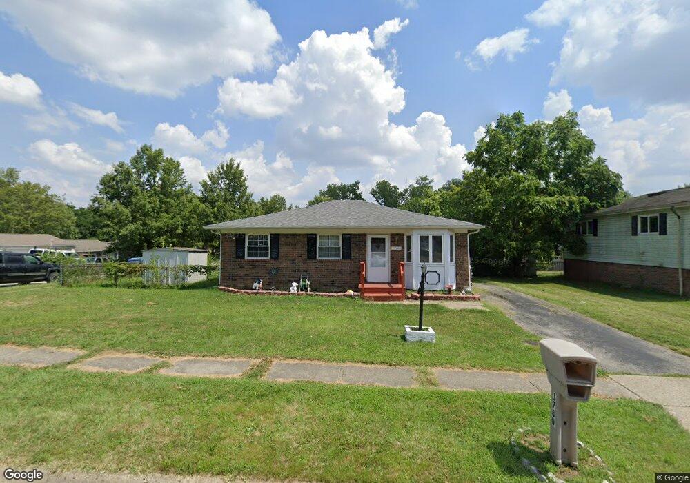
1780 Creekside Dr Columbus, OH 43223
Riverbend NeighborhoodEstimated Value: $158,000 - $235,000
3
Beds
2
Baths
1,033
Sq Ft
$198/Sq Ft
Est. Value
About This Home
This home is located at 1780 Creekside Dr, Columbus, OH 43223 and is currently estimated at $204,147, approximately $197 per square foot. 1780 Creekside Dr is a home located in Franklin County with nearby schools including James A Harmon Elementary School, Franklin Woods Intermediate School, and Finland Middle School.
Ownership History
Date
Name
Owned For
Owner Type
Purchase Details
Closed on
May 22, 1997
Sold by
Dixon Mcbride Brenda J and Dixon Abram
Bought by
Randall Mark W and Randall Shelley L
Current Estimated Value
Home Financials for this Owner
Home Financials are based on the most recent Mortgage that was taken out on this home.
Original Mortgage
$74,100
Interest Rate
8.24%
Purchase Details
Closed on
Mar 31, 1988
Create a Home Valuation Report for This Property
The Home Valuation Report is an in-depth analysis detailing your home's value as well as a comparison with similar homes in the area
Home Values in the Area
Average Home Value in this Area
Purchase History
| Date | Buyer | Sale Price | Title Company |
|---|---|---|---|
| Randall Mark W | $78,000 | Amerititle Mill Run | |
| -- | -- | -- |
Source: Public Records
Mortgage History
| Date | Status | Borrower | Loan Amount |
|---|---|---|---|
| Previous Owner | Randall Mark W | $74,100 |
Source: Public Records
Tax History
| Year | Tax Paid | Tax Assessment Tax Assessment Total Assessment is a certain percentage of the fair market value that is determined by local assessors to be the total taxable value of land and additions on the property. | Land | Improvement |
|---|---|---|---|---|
| 2025 | $1,993 | $64,470 | $17,710 | $46,760 |
| 2024 | $1,993 | $64,470 | $17,710 | $46,760 |
| 2023 | $1,981 | $64,470 | $17,710 | $46,760 |
| 2022 | $1,919 | $39,310 | $11,760 | $27,550 |
| 2021 | $1,957 | $39,310 | $11,760 | $27,550 |
| 2020 | $1,946 | $39,310 | $11,760 | $27,550 |
| 2019 | $1,763 | $31,430 | $9,800 | $21,630 |
| 2018 | $1,650 | $31,430 | $9,800 | $21,630 |
| 2017 | $1,569 | $31,430 | $9,800 | $21,630 |
| 2016 | $1,546 | $25,550 | $5,110 | $20,440 |
| 2015 | $1,546 | $25,550 | $5,110 | $20,440 |
| 2014 | $1,547 | $25,550 | $5,110 | $20,440 |
| 2013 | $853 | $28,385 | $5,670 | $22,715 |
Source: Public Records
Map
Nearby Homes
- 2112 Sondra Ln
- 0 Glencreek Rd
- 3116 Musket Ridge Dr
- 2800 Alkire Rd
- 3017 Moyer Ln
- 2255 Harrisburg Pike
- 1638 Tall Meadows Dr
- 2103 Keller Place W
- 1605 Greenville Rd
- 3407 Western Hill Rd
- 2937 Rundell Dr
- 1360 Hafton Woods Dr
- 1657 Ripplebrook Rd
- 1335 Hafton Woods Dr
- 2856 Chesfield Dr
- 2500 Harrisburg Pike Unit Lot 8
- 2407 Bluff Run Dr
- 2436 Onyx Ct
- 3816 Miltonsburg Dr
- 2430 Chateau St
- 1788 Creekside Dr
- 2991 Valley Creek Dr
- 1760 Creekside Dr
- 1760 Creekside Dr Unit ROCK
- 1800 Creekside Dr Unit ROCK
- 1800 Creekside Dr
- 1781 Creekside Dr
- 2985 Valley Creek Dr
- 1787 Creekside Dr
- 2992 Valley Creek Dr
- 1752 Creekside Dr Unit ROCK
- 1752 Creekside Dr
- 1763 Creekside Dr
- 1801 Glenmate Ct
- 1808 Creekside Dr
- 1789 Creekside Dr
- 2984 Valley Creek Dr
- 1807 Glenmate Ct
- 1757 Creekside Dr
- 3035 Valley Creek Dr
Your Personal Tour Guide
Ask me questions while you tour the home.