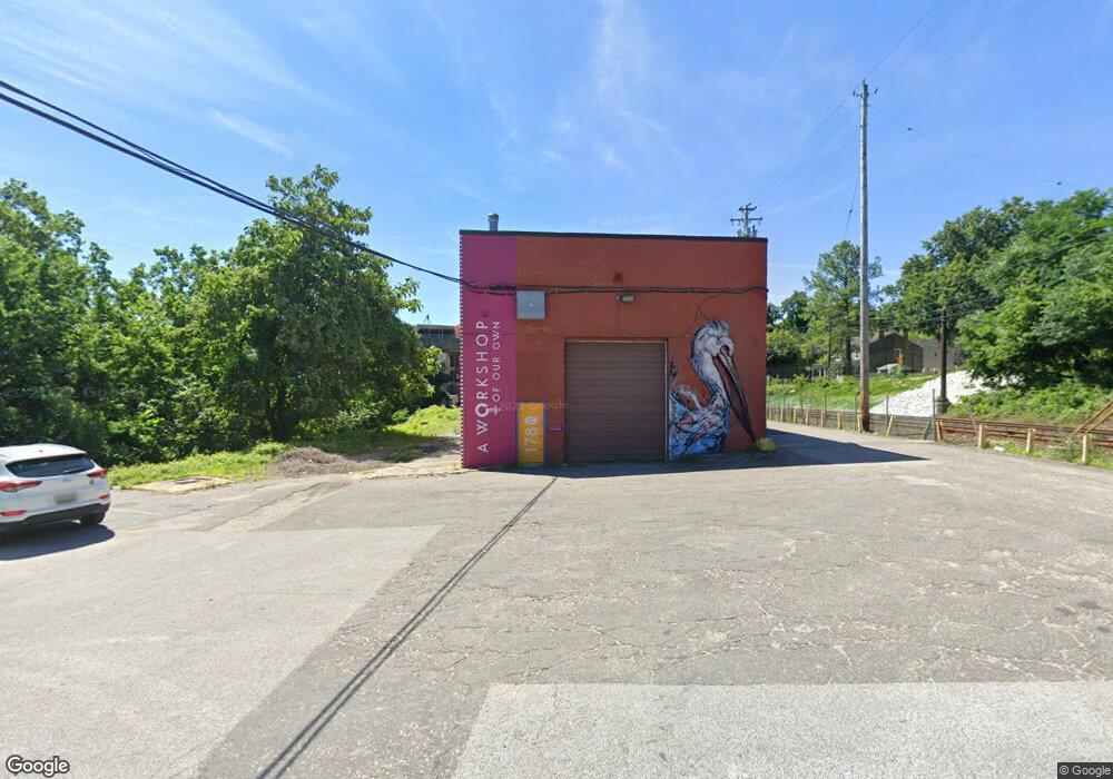
1780 Union Ave Unit 2 Baltimore, MD 21211
Woodberry NeighborhoodEstimated Value: $3,200,391
--
Bed
--
Bath
77,620
Sq Ft
$41/Sq Ft
Est. Value
About This Home
This home is located at 1780 Union Ave Unit 2, Baltimore, MD 21211 and is currently priced at $3,200,391, approximately $41 per square foot. 1780 Union Ave Unit 2 is a home located in Baltimore City with nearby schools including Medfield Heights Elementary School, Booker T. Washington Middle School, and Frederick Douglass High School.
Ownership History
Date
Name
Owned For
Owner Type
Purchase Details
Closed on
May 30, 2019
Sold by
Grp 1780 Union Ave Llc
Bought by
Xd2 Investments Llc
Current Estimated Value
Home Financials for this Owner
Home Financials are based on the most recent Mortgage that was taken out on this home.
Original Mortgage
$3,750,000
Outstanding Balance
$3,297,167
Interest Rate
4.1%
Mortgage Type
Commercial
Purchase Details
Closed on
Sep 7, 2017
Sold by
Remington Clipper Mill Llc
Bought by
Grp 1780 Union Ave Llc
Home Financials for this Owner
Home Financials are based on the most recent Mortgage that was taken out on this home.
Original Mortgage
$1,500,000
Interest Rate
3.89%
Mortgage Type
Purchase Money Mortgage
Create a Home Valuation Report for This Property
The Home Valuation Report is an in-depth analysis detailing your home's value as well as a comparison with similar homes in the area
Home Values in the Area
Average Home Value in this Area
Purchase History
| Date | Buyer | Sale Price | Title Company |
|---|---|---|---|
| Xd2 Investments Llc | $4,242,000 | Residential T&E Co | |
| Grp 1780 Union Ave Llc | $2,200,000 | Residential Title & Escrow |
Source: Public Records
Mortgage History
| Date | Status | Borrower | Loan Amount |
|---|---|---|---|
| Open | Xd2 Investments Llc | $3,750,000 | |
| Previous Owner | Grp 1780 Union Ave Llc | $1,500,000 |
Source: Public Records
Tax History Compared to Growth
Tax History
| Year | Tax Paid | Tax Assessment Tax Assessment Total Assessment is a certain percentage of the fair market value that is determined by local assessors to be the total taxable value of land and additions on the property. | Land | Improvement |
|---|---|---|---|---|
| 2025 | $102,227 | $4,674,100 | $327,600 | $4,346,500 |
| 2024 | $102,227 | $4,502,867 | $0 | $0 |
| 2023 | $102,227 | $4,331,633 | $0 | $0 |
| 2022 | $98,185 | $4,160,400 | $327,600 | $3,832,800 |
| 2021 | $82,518 | $3,496,533 | $0 | $0 |
| 2020 | $66,851 | $2,832,667 | $0 | $0 |
| 2019 | $50,940 | $2,168,800 | $327,600 | $1,841,200 |
| 2018 | $44,611 | $1,890,300 | $0 | $0 |
Source: Public Records
Map
Nearby Homes
- 4215 La Plata Ave
- 1511 Roland Heights Ave
- 2072 Rockrose Ave
- 4309 La Plata Ave
- 4334 Roland Heights Ave
- 1407 Redfern Ave
- 4341 Laplata Ave
- 4402 Roland Heights Ave
- 1431 Medfield Ave
- 4404 Roland Heights Ave
- 4347 Laplata Ave
- 4351 Laplata Ave
- 4412 Roland Heights Ave
- 4353 La Plata Ave
- 3515 Foundry Mews
- 2007 Clipper Park Rd Unit 112
- 3411 Woodberry Ave
- 1318 W 41st St
- 4306 Newport Ave
- 4419 Buena Vista Ave
- 3711 Clipper Rd
- 3713 Clipper Rd
- 1630 W 41st St
- 3710 Clipper Rd
- 3708 Clipper Rd
- 3700 Clipper Rd
- 2000 Rockrose Ave
- 2002 Rockrose Ave
- 2004 Rockrose Ave
- 2006 Rockrose Ave
- 2008 Rockrose Ave
- 2010 Rockrose Ave
- 2012 Rockrose Ave
- 3654 Clipper Rd
- 2014 Rockrose Ave
- 2016 Rockrose Ave
- 2018 Rockrose Ave
- 1600 W 41st St
- 3652 Clipper Rd
- 1700 W 41st St