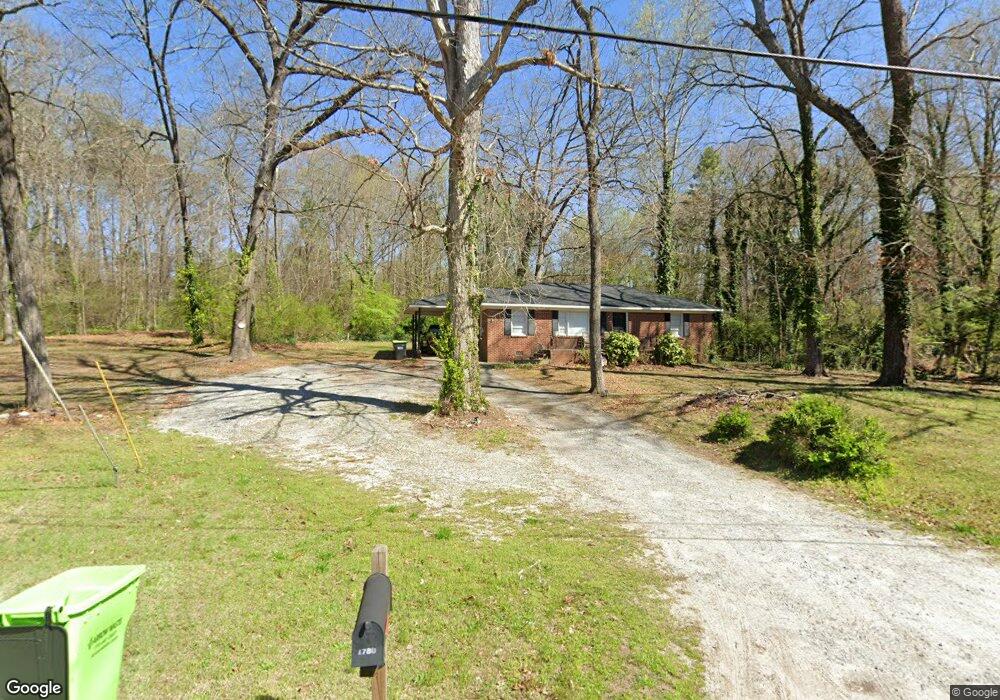
1780 Witt Cir Austell, GA 30168
Estimated Value: $175,000 - $219,000
2
Beds
1
Bath
1,100
Sq Ft
$175/Sq Ft
Est. Value
About This Home
This home is located at 1780 Witt Cir, Austell, GA 30168 and is currently estimated at $192,950, approximately $175 per square foot. 1780 Witt Cir is a home located in Cobb County with nearby schools including Mableton Elementary School, Garrett Middle School, and Pebblebrook High School.
Ownership History
Date
Name
Owned For
Owner Type
Purchase Details
Closed on
Nov 9, 2022
Sold by
Minnick Michael L
Bought by
Edwards Joseph D
Current Estimated Value
Home Financials for this Owner
Home Financials are based on the most recent Mortgage that was taken out on this home.
Original Mortgage
$158,000
Outstanding Balance
$137,407
Interest Rate
6.09%
Mortgage Type
Seller Take Back
Estimated Equity
$55,543
Purchase Details
Closed on
Aug 15, 2007
Sold by
Godfrey Robert T and Godfrey Sara A
Bought by
Mininick Michale L and Mininick Teresa E
Create a Home Valuation Report for This Property
The Home Valuation Report is an in-depth analysis detailing your home's value as well as a comparison with similar homes in the area
Home Values in the Area
Average Home Value in this Area
Purchase History
| Date | Buyer | Sale Price | Title Company |
|---|---|---|---|
| Edwards Joseph D | $173,000 | -- | |
| Mininick Michale L | $73,000 | -- |
Source: Public Records
Mortgage History
| Date | Status | Borrower | Loan Amount |
|---|---|---|---|
| Open | Edwards Joseph D | $158,000 |
Source: Public Records
Tax History Compared to Growth
Tax History
| Year | Tax Paid | Tax Assessment Tax Assessment Total Assessment is a certain percentage of the fair market value that is determined by local assessors to be the total taxable value of land and additions on the property. | Land | Improvement |
|---|---|---|---|---|
| 2025 | $2,241 | $74,384 | $36,828 | $37,556 |
| 2024 | $2,243 | $74,384 | $36,828 | $37,556 |
| 2023 | $1,544 | $51,200 | $29,600 | $21,600 |
| 2022 | $1,466 | $48,296 | $23,260 | $25,036 |
| 2021 | $1,262 | $41,584 | $20,160 | $21,424 |
| 2020 | $1,121 | $36,932 | $15,508 | $21,424 |
| 2019 | $1,121 | $36,932 | $15,508 | $21,424 |
| 2018 | $872 | $28,732 | $8,916 | $19,816 |
| 2017 | $594 | $20,676 | $5,816 | $14,860 |
| 2016 | $594 | $20,676 | $5,816 | $14,860 |
| 2015 | $581 | $19,728 | $3,876 | $15,852 |
| 2014 | $526 | $17,704 | $0 | $0 |
Source: Public Records
Map
Nearby Homes
- 6084 S Gordon Rd
- 2023 Lee Dr
- 1582 Pine Cir
- 1628 Pendley Dr
- 1550 Greenbrook Dr
- 1984 Brenda Dr
- 6083 Oak Hill Dr
- 1995 Matt Dr
- 1995 Oak Ct
- 1426 Thunderwood Ln SW
- 2145 Venesa Cir
- 1397 Jewell Ct SW
- 0 Dogwood Cir Unit 7671035
- 0 Dogwood Cir Unit 10630776
- 1972 Cox Dr Unit 5
- 1676 Veterans Memorial Hwy SW
- 2072 Woodbine Cir
- 6445 Sherwood Trail
- 6243 David Ln SW
- 1155 Elowen Dr
- 1768 Witt Cir
- 1808 Witt Cir
- 1777 Witt Cir
- 1747 Witt Cir
- 1759 Witt Cir
- 1746 Witt Cir
- 1811 Witt Cir
- 1816 Witt Cir
- 1801 Blossom Ln
- 1767 Blossom Ln
- 1781 Blossom Ln
- 1776 Old Alabama Rd
- 1791 Blossom Ln
- 1757 Blossom Ln
- 1756 Old Alabama Rd
- 1811 Blossom Ln
- 1737 Blossom Ln
- 1742 Old Alabama Rd
- LOT 2 Blossom Ln
- LOT 1 Blossom Ln