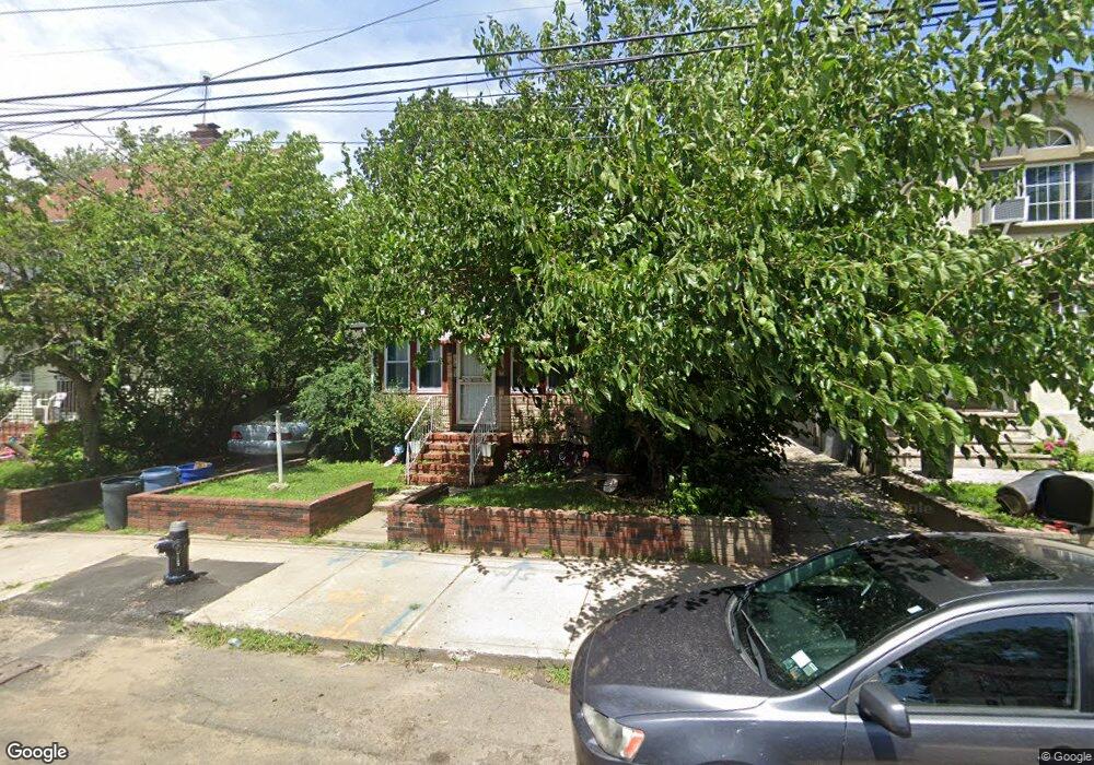
17803 119th Rd Jamaica, NY 11434
Saint Albans NeighborhoodEstimated Value: $654,551 - $956,000
--
Bed
--
Bath
1,388
Sq Ft
$576/Sq Ft
Est. Value
About This Home
This home is located at 17803 119th Rd, Jamaica, NY 11434 and is currently estimated at $799,138, approximately $575 per square foot. 17803 119th Rd is a home located in Queens County with nearby schools including Ps 36 St Albans School, Is 59 Springfield Gardens, and Rochdale Early Advantage Charter School.
Ownership History
Date
Name
Owned For
Owner Type
Purchase Details
Closed on
Sep 1, 2004
Sold by
Sargent Deidre F and Sargent Ernest
Bought by
Johnson Paula
Current Estimated Value
Home Financials for this Owner
Home Financials are based on the most recent Mortgage that was taken out on this home.
Original Mortgage
$216,000
Interest Rate
6.02%
Mortgage Type
Purchase Money Mortgage
Purchase Details
Closed on
Feb 23, 1998
Sold by
Sargent Deidre F
Bought by
Sargent Ernest and Sargent Mary
Home Financials for this Owner
Home Financials are based on the most recent Mortgage that was taken out on this home.
Original Mortgage
$109,500
Interest Rate
9.25%
Purchase Details
Closed on
Apr 24, 1997
Sold by
Sargent Ernest and Sargent Mary P
Bought by
Sargent Deidre F
Create a Home Valuation Report for This Property
The Home Valuation Report is an in-depth analysis detailing your home's value as well as a comparison with similar homes in the area
Home Values in the Area
Average Home Value in this Area
Purchase History
| Date | Buyer | Sale Price | Title Company |
|---|---|---|---|
| Johnson Paula | $240,000 | -- | |
| Johnson Paula | $240,000 | -- | |
| Sargent Ernest | -- | -- | |
| Sargent Ernest | -- | -- | |
| Sargent Deidre F | -- | Commonwealth Land Title Ins | |
| Sargent Deidre F | -- | Commonwealth Land Title Ins |
Source: Public Records
Mortgage History
| Date | Status | Borrower | Loan Amount |
|---|---|---|---|
| Previous Owner | Johnson Paula | $216,000 | |
| Previous Owner | Sargent Ernest | $109,500 |
Source: Public Records
Tax History Compared to Growth
Tax History
| Year | Tax Paid | Tax Assessment Tax Assessment Total Assessment is a certain percentage of the fair market value that is determined by local assessors to be the total taxable value of land and additions on the property. | Land | Improvement |
|---|---|---|---|---|
| 2025 | $5,591 | $29,238 | $8,941 | $20,297 |
| 2024 | $5,603 | $29,237 | $10,157 | $19,080 |
| 2023 | $5,440 | $28,483 | $8,931 | $19,552 |
| 2022 | $5,078 | $36,840 | $13,320 | $23,520 |
| 2021 | $5,133 | $35,880 | $13,320 | $22,560 |
| 2020 | $4,861 | $35,400 | $13,320 | $22,080 |
| 2019 | $4,804 | $32,100 | $13,320 | $18,780 |
| 2018 | $4,541 | $23,736 | $9,069 | $14,667 |
| 2017 | $4,265 | $22,394 | $9,786 | $12,608 |
| 2016 | $3,987 | $22,394 | $9,786 | $12,608 |
| 2015 | $2,328 | $20,304 | $10,808 | $9,496 |
| 2014 | $2,328 | $20,304 | $9,814 | $10,490 |
Source: Public Records
Map
Nearby Homes
- 119-48 178th St
- 119-72 178th St
- 11819 179th St
- 11984 178th Place
- 179-01 120th Ave
- 119-60 177th St
- 176-43 120th Ave
- 176-27 Sunbury Rd
- 17715 Troutville Rd
- 186-02 Foch Blvd
- 12126 Irwin Place
- 17710 Troutville Rd
- 17955 Anderson Rd
- 18822 119th Ave
- 17918 Selover Rd
- 17720 Leslie Rd
- 174-41 125th Ave
- 119-73 Merrill St
- 11942 189th St
- 179-47 Zoller Rd
- 17807 119th Rd
- 17753 119th Rd
- 178-07 119th Rd
- 178-41 119 Rd
- 178-11 119th Rd
- 17811 119th Rd
- 17747 119th Rd
- 17815 119th Rd
- 17756 Baisley Blvd
- 17814 Baisley Blvd
- 17752 Baisley Blvd
- 178-02 119th Rd
- 17818 Baisley Blvd
- 17748 Baisley Blvd
- 11922 178th Place
- 17802 119th Rd
- 17806 119th Rd
- 17819 119th Rd
- 17819 119th Rd
- 17810 119th Rd