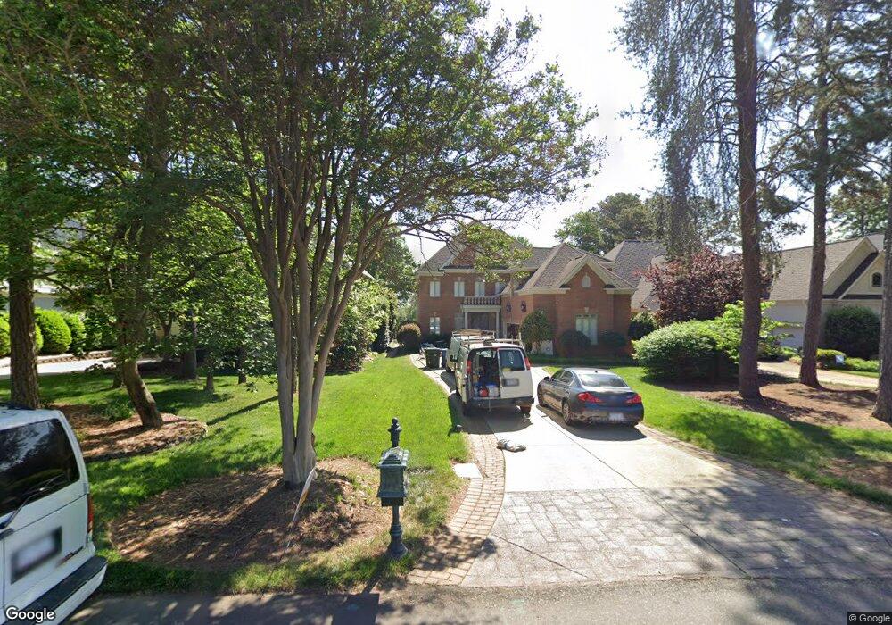
17806 John Connor Rd Unit 13 Cornelius, NC 28031
Estimated Value: $2,993,000 - $3,157,000
About This Home
This home is located at 17806 John Connor Rd Unit 13, Cornelius, NC 28031 and is currently estimated at $3,067,234, approximately $684 per square foot. 17806 John Connor Rd Unit 13 is a home located in Mecklenburg County with nearby schools including Cornelius Elementary School, Bailey Middle School, and William Amos Hough High School.
Ownership History
Purchase Details
Home Financials for this Owner
Home Financials are based on the most recent Mortgage that was taken out on this home.Purchase Details
Purchase Details
Purchase Details
Purchase Details
Home Financials for this Owner
Home Financials are based on the most recent Mortgage that was taken out on this home.Purchase Details
Home Financials for this Owner
Home Financials are based on the most recent Mortgage that was taken out on this home.Purchase Details
Home Financials for this Owner
Home Financials are based on the most recent Mortgage that was taken out on this home.Home Values in the Area
Average Home Value in this Area
Purchase History
We collect this data history from publicly available records. To have your information removed, we recommend requesting removal directly through your county’s website.
| Date | Buyer | Sale Price | Title Company |
|---|---|---|---|
| Tuttle Michael M | $3,021,000 | Allied Title Group Llc | |
| Tuttle Michael M | $3,021,000 | Allied Title Group Llc | |
| Jeffrey K Howald And Tamarie D Howald Trust | -- | None Listed On Document | |
| Jeffrey K Howald And Tamarie D Howald Trust | -- | None Listed On Document | |
| Howald Jeffrey | $1,945,000 | Investors Title Insurance Co | |
| Williams John D | $1,777,000 | None Available | |
| Schembechler Kathryn A | $1,199,000 | Investors Title | |
| Holland Brian R | $1,225,000 | None Available | |
| Sloan Raymond M | $680,000 | -- |
Mortgage History
We collect this data history from publicly available records. To have your information removed, we recommend requesting removal directly through your county’s website.
| Date | Status | Borrower | Loan Amount |
|---|---|---|---|
| Open | Tuttle Michael M | $2,416,720 | |
| Closed | Tuttle Michael M | $2,416,720 | |
| Previous Owner | Schembechler Kathryn A | $959,200 | |
| Previous Owner | Holland Brian R | $700,000 | |
| Previous Owner | Sloan Raymond M | $540,000 |
Tax History
| Year | Tax Paid | Tax Assessment Tax Assessment Total Assessment is a certain percentage of the fair market value that is determined by local assessors to be the total taxable value of land and additions on the property. | Land | Improvement |
|---|---|---|---|---|
| 2025 | -- | $2,427,080 | $1,102,500 | $1,324,580 |
| 2024 | -- | $2,427,080 | $1,102,500 | $1,324,580 |
| 2023 | $12,984 | $2,427,080 | $1,102,500 | $1,324,580 |
| 2022 | $12,984 | $1,547,800 | $720,000 | $827,800 |
| 2021 | $12,536 | $1,494,300 | $720,000 | $774,300 |
| 2020 | $12,575 | $1,494,300 | $720,000 | $774,300 |
| 2019 | $12,569 | $1,494,300 | $720,000 | $774,300 |
| 2018 | $9,947 | $920,000 | $350,000 | $570,000 |
| 2017 | $9,874 | $920,000 | $350,000 | $570,000 |
| 2016 | $9,871 | $920,000 | $350,000 | $570,000 |
| 2015 | $9,729 | $920,000 | $350,000 | $570,000 |
| 2014 | $9,727 | $920,000 | $350,000 | $570,000 |
Map
- 17821 Carlow Rd
- 17235 Connor Quay Ct
- 17832 Mollypop Ln
- 17426 Springwinds Dr Unit 122
- 18316 Mainsail Pointe Dr
- 18426 Peninsula Cove Ln
- 18326 Bowsprit Pointe Rd
- 17206 Players Ridge Dr
- 16318 Belle Isle Dr
- 17429 Staysail Ct
- 18710 Peninsula Cove Ln
- 18823 Peninsula Cove Ln
- 18408 Harbor Light Blvd
- 18003 Lochcarron Ln
- 16921 Jetton Rd
- 18703 Head Sail Ct
- 18103 Harbor Light Blvd
- 16821 America Cup Rd
- 18928 Peninsula Point Dr
- 17825 Spinnakers Reach Dr
- 17800 John Connor Rd
- 17812 John Connor Rd
- 17732 John Connor Rd
- 17818 John Connor Rd
- 17824 John Connor Rd
- 17830 John Connor Rd
- 17807 John Connor Rd
- 17813 John Connor Rd
- 17315 Belle Isle Dr
- 17836 John Connor Rd
- 17825 John Connor Rd
- 17904 John Connor Rd
- 17821 John Connor Rd
- 17908 John Connor Rd
- 17901 John Connor Rd
- 17311 Belle Isle Dr
- 17914 John Connor Rd
- 17923 John Connor Rd
- 17920 John Connor Rd
- 17703 John Connor Rd
Ask me questions while you tour the home.