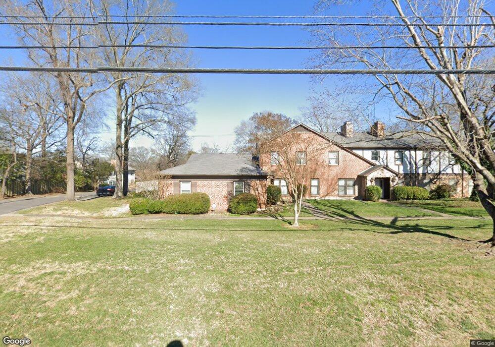
1780A Ebenezer Rd Unit A Rock Hill, SC 29732
Estimated Value: $183,000 - $288,000
3
Beds
2
Baths
1,539
Sq Ft
$150/Sq Ft
Est. Value
About This Home
This home is located at 1780A Ebenezer Rd Unit A, Rock Hill, SC 29732 and is currently estimated at $230,568, approximately $149 per square foot. 1780A Ebenezer Rd Unit A is a home located in York County with nearby schools including Ebinport Elementary School, W.C. Sullivan Middle School, and South Pointe High School.
Ownership History
Date
Name
Owned For
Owner Type
Purchase Details
Closed on
Jan 22, 2020
Sold by
Bergan Corald Christopher
Bought by
Holmes Meredith Paige
Current Estimated Value
Purchase Details
Closed on
May 17, 2018
Sold by
Benson Donald Christopher and Estate Of Janet M Benson
Bought by
Benson Donald Christopher and Benson Supplemental N Jordan C
Purchase Details
Closed on
Apr 1, 2010
Sold by
Pilcher Thomas G
Bought by
Pilcher Jeffrey Thomas
Purchase Details
Closed on
May 22, 2003
Sold by
Busbee Sadie C
Bought by
Pilcher Thomas G
Create a Home Valuation Report for This Property
The Home Valuation Report is an in-depth analysis detailing your home's value as well as a comparison with similar homes in the area
Home Values in the Area
Average Home Value in this Area
Purchase History
| Date | Buyer | Sale Price | Title Company |
|---|---|---|---|
| Holmes Meredith Paige | -- | None Available | |
| Benson Donald Christopher | -- | None Available | |
| Pilcher Jeffrey Thomas | $82,000 | -- | |
| Pilcher Thomas G | $82,000 | -- |
Source: Public Records
Tax History Compared to Growth
Tax History
| Year | Tax Paid | Tax Assessment Tax Assessment Total Assessment is a certain percentage of the fair market value that is determined by local assessors to be the total taxable value of land and additions on the property. | Land | Improvement |
|---|---|---|---|---|
| 2025 | $2,864 | $6,660 | $0 | $6,660 |
| 2024 | $2,563 | $5,791 | $0 | $5,791 |
| 2023 | $2,567 | $5,791 | $0 | $5,791 |
| 2022 | $2,446 | $5,791 | $0 | $5,791 |
| 2021 | $2,397 | $5,791 | $0 | $5,791 |
| 2020 | $2,397 | $5,791 | $0 | $0 |
| 2019 | $2,203 | $5,190 | $0 | $0 |
| 2018 | $791 | $5,190 | $0 | $0 |
| 2017 | $322 | $3,460 | $0 | $0 |
| 2016 | $659 | $3,020 | $0 | $0 |
| 2014 | $666 | $3,020 | $0 | $3,020 |
| 2013 | $666 | $3,200 | $0 | $3,200 |
Source: Public Records
Map
Nearby Homes
- 1784 Ebenezer Rd Unit C
- 1784 Ebenezer Rd Unit D
- 1806 Ebenezer Rd Unit E
- 1792 Ebenezer Rd Unit G
- 201 Pointe Cir
- 1830 Ebenezer Rd Unit 1
- 150 Brookwood Ln
- 1951 Ebenezer Rd
- 723 Winding Way
- 490 Clouds Way
- 448 Berryman Rd
- 310 Berkeley Rd
- Gable Plan at Allston
- Garland Plan at Allston
- 420 Bly St
- 412 Osborn St
- 1934 Hayes Dr
- 1580 Granville Rd
- 1904 Steeplechase Dr
- 728 Herlong Ave
- 1780 Ebenezer Rd Unit D
- 1780 Ebenezer Rd Unit C
- 1780 Ebenezer Rd
- 1780 Ebenezer Rd Unit D
- 1780 Ebenezer Rd Unit E
- 1780 Ebenezer Rd Unit 17
- 1780 Ebenezer Rd Unit 1780
- 1782 Ebenezer Rd Unit B
- 1782 Ebenezer Rd Unit 1782E
- 1782 Ebenezer Rd Unit F
- 1782 Ebenezer Rd Unit A
- 1782 Ebenezer Rd Unit D
- 1782 Ebenezer Rd Unit C
- 1782 Ebenezer Rd
- 1784 Ebenezer Rd Unit E
- 1784 Ebenezer Rd Unit A
- 1784 Ebenezer Rd Unit F
- 1784 Ebenezer Rd Unit B
- 1784 Ebenezer Rd
- 1772 Ebenezer Rd