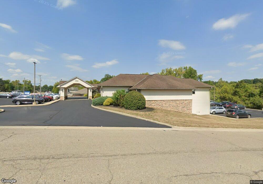
1781 Countryside Dr Lancaster, OH 43130
Estimated Value: $2,105,261
--
Bed
--
Bath
18,672
Sq Ft
$113/Sq Ft
Est. Value
About This Home
This home is located at 1781 Countryside Dr, Lancaster, OH 43130 and is currently estimated at $2,105,261, approximately $112 per square foot. 1781 Countryside Dr is a home located in Fairfield County with nearby schools including Medill Elementary School, Thomas Ewing Junior High School, and Lancaster High School.
Ownership History
Date
Name
Owned For
Owner Type
Purchase Details
Closed on
May 6, 2022
Sold by
Fairfield Realty Llc
Bought by
Bgb 1781 Countryside Lancaster Llc
Current Estimated Value
Home Financials for this Owner
Home Financials are based on the most recent Mortgage that was taken out on this home.
Original Mortgage
$1,312,500
Outstanding Balance
$1,240,127
Interest Rate
4.67%
Mortgage Type
New Conventional
Estimated Equity
$865,134
Purchase Details
Closed on
Oct 4, 2005
Sold by
Hood Henry H and Hood Eleanor V
Bought by
Fairfield Realty Llc
Home Financials for this Owner
Home Financials are based on the most recent Mortgage that was taken out on this home.
Original Mortgage
$137,475
Interest Rate
5.88%
Mortgage Type
Commercial
Create a Home Valuation Report for This Property
The Home Valuation Report is an in-depth analysis detailing your home's value as well as a comparison with similar homes in the area
Home Values in the Area
Average Home Value in this Area
Purchase History
| Date | Buyer | Sale Price | Title Company |
|---|---|---|---|
| Bgb 1781 Countryside Lancaster Llc | -- | Talon Title | |
| Fairfield Realty Llc | $137,500 | -- |
Source: Public Records
Mortgage History
| Date | Status | Borrower | Loan Amount |
|---|---|---|---|
| Open | Bgb 1781 Countryside Lancaster Llc | $1,312,500 | |
| Previous Owner | Fairfield Realty Llc | $137,475 |
Source: Public Records
Tax History Compared to Growth
Tax History
| Year | Tax Paid | Tax Assessment Tax Assessment Total Assessment is a certain percentage of the fair market value that is determined by local assessors to be the total taxable value of land and additions on the property. | Land | Improvement |
|---|---|---|---|---|
| 2024 | $29,057 | $323,210 | $34,390 | $288,820 |
| 2023 | $16,438 | $323,210 | $34,390 | $288,820 |
| 2022 | $16,576 | $323,210 | $34,390 | $288,820 |
| 2021 | $17,047 | $323,210 | $34,390 | $288,820 |
| 2020 | $16,483 | $323,210 | $34,390 | $288,820 |
| 2019 | $15,826 | $323,210 | $34,390 | $288,820 |
| 2018 | $5,112 | $360,450 | $47,250 | $313,200 |
| 2017 | $16,897 | $354,360 | $47,250 | $307,110 |
| 2016 | $16,325 | $354,360 | $47,250 | $307,110 |
| 2015 | $16,487 | $354,360 | $47,250 | $307,110 |
| 2014 | $15,758 | $354,360 | $47,250 | $307,110 |
| 2013 | $15,758 | $354,360 | $47,250 | $307,110 |
Source: Public Records
Map
Nearby Homes
- 1916 Country Place
- 1801 Pleasantview Dr NE
- 715 Sherman Bluff Way Unit 14715
- 173 Lakeview Dr NE
- 1189 Ridge Rd NE
- 2149 Pleasantview Dr NE
- 534 Overlook Dr NE
- 1799 Declaration Dr W
- 0 Declaration Dr W Unit 219044159
- 1523 Fuller Ct
- 1760 Rainbow Dr NE
- 1415 Epworth Forest Dr
- 0 Old Millersport Rd NE Unit Tract 8 224028101
- 0 Old Millersport Rd NE Unit Lot 10 225033491
- 0 Old Millersport Rd NE Unit 225010386
- 319 Greenfield Ave
- 2444 Sheridan Dr
- 100 Wilson Ave
- 1271 Huffer Ave
- 1669 Lexington Dr
- 1816 Granville Pike
- 1750 Lancaster-Newark Rd NE
- 1750 Granville Pike
- 1750 Granville Pike Unit 1756
- 690 Mondhank Rd NE
- 1911 Country Place
- 1909 Lancaster Newark Rd NE
- 1909 Granville Pike
- 1900 Country Place
- 1917 Country Place
- 1910 Country Place
- 632 Mondhank Rd NE
- 1925 Country Place
- 1745 Lancaster Newark Rd NE
- 1901 Behrens Ct
- 1901 Branch Place Unit Lot 126
- 0 Country Place Unit 2657709
- 0 Country Place Unit L-122 2652291
- 0 Country Place Unit L-116 2402122
- 0 Country Place Unit L-113 2311935