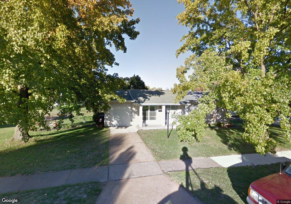
1781 Croftdale Dr Florissant, MO 63031
Estimated Value: $179,023 - $202,000
3
Beds
2
Baths
912
Sq Ft
$212/Sq Ft
Est. Value
About This Home
This home is located at 1781 Croftdale Dr, Florissant, MO 63031 and is currently estimated at $193,756, approximately $212 per square foot. 1781 Croftdale Dr is a home located in St. Louis County with nearby schools including Russell Elementary School, West Middle School, and Hazelwood West High School.
Ownership History
Date
Name
Owned For
Owner Type
Purchase Details
Closed on
Oct 20, 2003
Sold by
Wilson Paul D and Wilson Carol L
Bought by
Wilson Timothy D and Wilson Janet E
Current Estimated Value
Home Financials for this Owner
Home Financials are based on the most recent Mortgage that was taken out on this home.
Original Mortgage
$70,000
Interest Rate
6.06%
Mortgage Type
Stand Alone Refi Refinance Of Original Loan
Purchase Details
Closed on
Dec 8, 1997
Sold by
Bettis Patrick J and Bettis Mary K
Bought by
Wilson Paul D and Wilson Carol L
Create a Home Valuation Report for This Property
The Home Valuation Report is an in-depth analysis detailing your home's value as well as a comparison with similar homes in the area
Home Values in the Area
Average Home Value in this Area
Purchase History
| Date | Buyer | Sale Price | Title Company |
|---|---|---|---|
| Wilson Timothy D | $80,000 | -- | |
| Wilson Paul D | -- | -- |
Source: Public Records
Mortgage History
| Date | Status | Borrower | Loan Amount |
|---|---|---|---|
| Closed | Wilson Timothy D | $70,000 |
Source: Public Records
Tax History Compared to Growth
Tax History
| Year | Tax Paid | Tax Assessment Tax Assessment Total Assessment is a certain percentage of the fair market value that is determined by local assessors to be the total taxable value of land and additions on the property. | Land | Improvement |
|---|---|---|---|---|
| 2025 | $2,506 | $30,740 | $6,100 | $24,640 |
| 2024 | $2,506 | $28,010 | $3,140 | $24,870 |
| 2023 | $2,506 | $28,010 | $3,140 | $24,870 |
| 2022 | $2,206 | $21,980 | $4,540 | $17,440 |
| 2021 | $2,149 | $21,980 | $4,540 | $17,440 |
| 2020 | $2,037 | $19,590 | $3,500 | $16,090 |
| 2019 | $2,006 | $19,590 | $3,500 | $16,090 |
| 2018 | $1,862 | $16,710 | $2,950 | $13,760 |
| 2017 | $1,860 | $16,710 | $2,950 | $13,760 |
| 2016 | $1,895 | $16,800 | $2,950 | $13,850 |
| 2015 | $1,855 | $16,800 | $2,950 | $13,850 |
| 2014 | $1,828 | $17,060 | $3,170 | $13,890 |
Source: Public Records
Map
Nearby Homes
- 1815 Flordawn Dr
- 1978 Acorn Trail Dr
- 425 Gerald Ave
- 400 Raymond Dr
- 1790 Tahoe Dr
- 1060 Florland Dr
- 1035 Rosary Tree Ct
- 1565 Yaqui Dr
- 154 Riverwood Park Dr
- 1085 Campion Ln
- 1090 Howdershell Rd
- 1495 Yaqui Dr
- 1625 Charbonier Rd
- 1065 Keeven Ln
- 10 Garnier Ct
- 1160 Kostka Ln
- 5 Seminary Ct
- 185 Eldorado Dr
- 660 Herbst Dr
- 2128 Friendship Ct
- 1801 Croftdale Dr
- 1810 Flordawn Dr
- 1761 Croftdale Dr
- 1790 Flordawn Dr
- 1820 Flordawn Dr
- 1762 Croftdale Dr
- 1782 Croftdale Dr
- 1780 Flordawn Dr
- 1821 Croftdale Dr
- 1830 Flordawn Dr
- 1742 Croftdale Dr
- 1802 Croftdale Dr
- 1760 Flordawn Dr
- 907 Harbor Oaks Ct
- 1840 Flordawn Dr
- 1937 Timberwood Crossing Dr
- 913 Harbor Oaks Ct
- 1822 Croftdale Dr
- 1841 Croftdale Dr
- 1740 Flordawn Dr