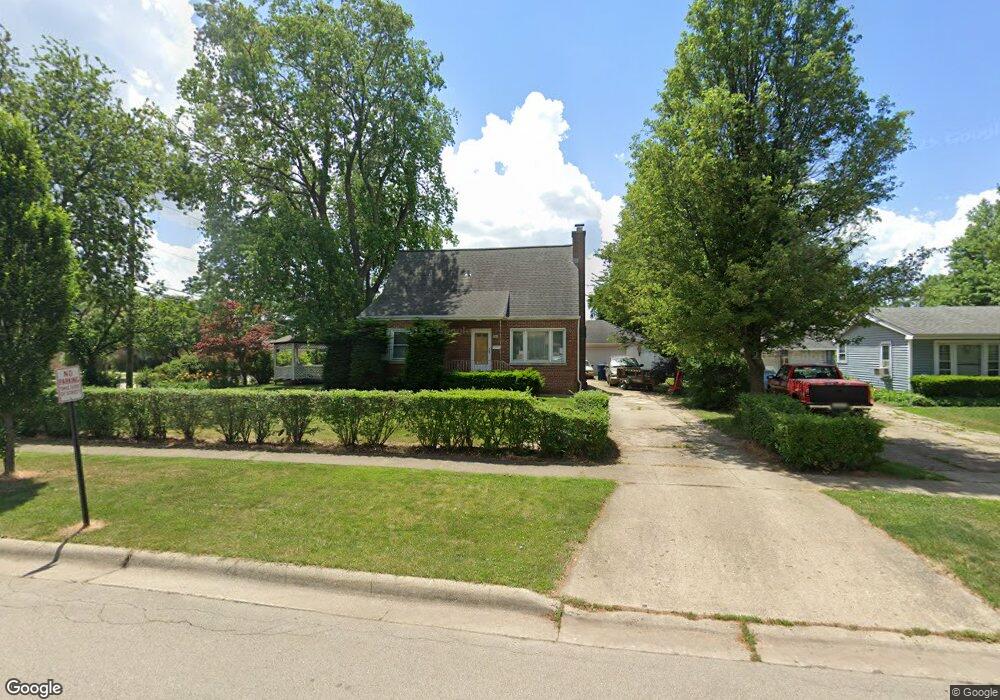
1781 Lunt Ave Des Plaines, IL 60018
Estimated Value: $425,000 - $524,000
4
Beds
2
Baths
1,981
Sq Ft
$229/Sq Ft
Est. Value
About This Home
This home is located at 1781 Lunt Ave, Des Plaines, IL 60018 and is currently estimated at $454,458, approximately $229 per square foot. 1781 Lunt Ave is a home located in Cook County with nearby schools including Orchard Place Elementary School, Algonquin Middle School, and Maine West High School.
Create a Home Valuation Report for This Property
The Home Valuation Report is an in-depth analysis detailing your home's value as well as a comparison with similar homes in the area
Home Values in the Area
Average Home Value in this Area
Tax History Compared to Growth
Tax History
| Year | Tax Paid | Tax Assessment Tax Assessment Total Assessment is a certain percentage of the fair market value that is determined by local assessors to be the total taxable value of land and additions on the property. | Land | Improvement |
|---|---|---|---|---|
| 2024 | $7,127 | $33,000 | $7,965 | $25,035 |
| 2023 | $6,907 | $33,000 | $7,965 | $25,035 |
| 2022 | $6,907 | $33,000 | $7,965 | $25,035 |
| 2021 | $5,784 | $24,812 | $6,637 | $18,175 |
| 2020 | $5,811 | $24,812 | $6,637 | $18,175 |
| 2019 | $5,842 | $27,879 | $6,637 | $21,242 |
| 2018 | $4,815 | $22,283 | $5,841 | $16,442 |
| 2017 | $6,546 | $22,283 | $5,841 | $16,442 |
| 2016 | $5,388 | $23,670 | $5,841 | $17,829 |
| 2015 | $7,693 | $25,448 | $5,044 | $20,404 |
| 2014 | $6,188 | $25,448 | $5,044 | $20,404 |
| 2013 | $7,841 | $27,171 | $5,044 | $22,127 |
Source: Public Records
Map
Nearby Homes
- 2646 Maple St
- 1757 Farwell Ave
- 2500 Maple St
- 2609 Eisenhower Dr
- 1966 Laura Ln
- 2600 S Scott St
- 1706 Buckingham Dr
- 1641 E Touhy Ave
- 1629 E Touhy Ave
- 2993 Curtis St Unit C41
- 2993 Curtis St
- 2126 David Dr
- 2945 S Scott St
- 3051 S Scott St
- 38 E Touhy Ave
- 200 Thames Pkwy Unit 1
- 201 Thames Pkwy Unit 2F
- 1928 Kennicott Ct
- 1721 Linden St
- 44 Park Ln Unit 435