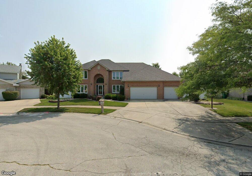
17817 92nd Ave Tinley Park, IL 60487
Central Tinley Park NeighborhoodEstimated Value: $546,000 - $601,000
4
Beds
3
Baths
3,063
Sq Ft
$187/Sq Ft
Est. Value
About This Home
This home is located at 17817 92nd Ave, Tinley Park, IL 60487 and is currently estimated at $572,846, approximately $187 per square foot. 17817 92nd Ave is a home located in Cook County with nearby schools including Christa Mcauliffe School, Prairie View Middle School, and Victor J Andrew High School.
Ownership History
Date
Name
Owned For
Owner Type
Purchase Details
Closed on
Apr 26, 1994
Sold by
Financial Properties Inc
Bought by
Shalabi Ibrahim E and Shalabi Hiam
Current Estimated Value
Home Financials for this Owner
Home Financials are based on the most recent Mortgage that was taken out on this home.
Original Mortgage
$184,000
Interest Rate
7.84%
Create a Home Valuation Report for This Property
The Home Valuation Report is an in-depth analysis detailing your home's value as well as a comparison with similar homes in the area
Home Values in the Area
Average Home Value in this Area
Purchase History
| Date | Buyer | Sale Price | Title Company |
|---|---|---|---|
| Shalabi Ibrahim E | $231,000 | -- |
Source: Public Records
Mortgage History
| Date | Status | Borrower | Loan Amount |
|---|---|---|---|
| Previous Owner | Shalabi Ibrahim E | $184,000 |
Source: Public Records
Tax History Compared to Growth
Tax History
| Year | Tax Paid | Tax Assessment Tax Assessment Total Assessment is a certain percentage of the fair market value that is determined by local assessors to be the total taxable value of land and additions on the property. | Land | Improvement |
|---|---|---|---|---|
| 2024 | $11,948 | $40,889 | $11,943 | $28,946 |
| 2023 | $8,814 | $49,000 | $11,943 | $37,057 |
| 2022 | $8,814 | $30,881 | $5,152 | $25,729 |
| 2021 | $8,586 | $30,880 | $5,151 | $25,729 |
| 2020 | $9,678 | $34,382 | $5,151 | $29,231 |
| 2019 | $8,179 | $31,392 | $4,683 | $26,709 |
| 2018 | $8,001 | $31,392 | $4,683 | $26,709 |
| 2017 | $9,136 | $35,650 | $4,683 | $30,967 |
| 2016 | $8,533 | $29,974 | $4,215 | $25,759 |
| 2015 | $8,371 | $29,974 | $4,215 | $25,759 |
| 2014 | $9,526 | $33,646 | $4,215 | $29,431 |
| 2013 | $8,200 | $31,659 | $4,215 | $27,444 |
Source: Public Records
Map
Nearby Homes
- 9313 178th St
- 17964 Upland Dr
- 17594 Windsor Pkwy Unit 58
- 9280 Windsor Pkwy Unit 92
- 17533 Pecan Ln
- 18055 Upland Dr
- 9395 Windsor Pkwy Unit 163
- 17595 Drummond Dr Unit 139
- 9201 175th St
- 9334 Drummond Dr Unit 3
- 9421 Quail Crossing
- 9058 Newcastle Ct
- 9038 Mansfield Dr Unit 8
- 18248 Murphy Cir Unit 182
- 17535 S La Grange Rd
- 17535-2 Lagrange Rd
- 9051 Mansfield Dr Unit 1
- 17631 Dover Ct
- 17412 Briar Dr
- 18233 Murphy Cir Unit 182
- 17823 92nd Ave
- 17811 92nd Ave
- 17818 Elmwood Dr Unit 17712
- 17824 Elmwood Dr
- 17812 Elmwood Dr
- 17829 92nd Ave
- 17830 Elmwood Dr
- 9200 Greenwood Dr
- 17806 Elmwood Dr
- 17836 Elmwood Dr
- 9206 Greenwood Dr
- 17835 92nd Ave
- 9131 178th St
- 9125 178th St
- 17830 92nd Ave
- 9213 Greenwood Dr
- 9137 178th St
- 17842 Elmwood Dr
- 9119 178th St
- 9060 Linden Dr