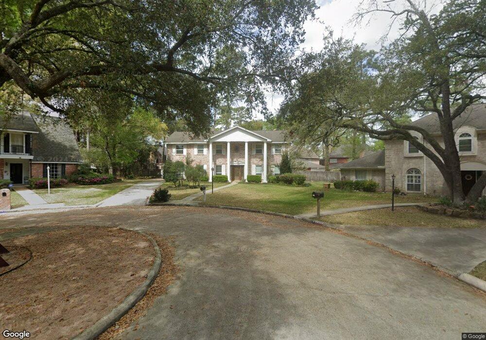
17819 Comoro Ln Spring, TX 77379
Estimated Value: $350,000 - $393,000
4
Beds
3
Baths
3,000
Sq Ft
$123/Sq Ft
Est. Value
About This Home
This home is located at 17819 Comoro Ln, Spring, TX 77379 and is currently estimated at $368,349, approximately $122 per square foot. 17819 Comoro Ln is a home located in Harris County with nearby schools including Theiss Elementary School, Doerre Intermediate School, and Klein High School.
Ownership History
Date
Name
Owned For
Owner Type
Purchase Details
Closed on
May 16, 2020
Sold by
Olsen Travis B
Bought by
Torres Elizabeth A
Current Estimated Value
Home Financials for this Owner
Home Financials are based on the most recent Mortgage that was taken out on this home.
Original Mortgage
$229,500
Interest Rate
2.8%
Mortgage Type
Construction
Purchase Details
Closed on
Jul 13, 2018
Sold by
Rolfson Don C and Rolfson Nadine W
Bought by
Olsen Travis and Torres Olsen Elizabeth A
Home Financials for this Owner
Home Financials are based on the most recent Mortgage that was taken out on this home.
Original Mortgage
$229,500
Interest Rate
4.5%
Mortgage Type
New Conventional
Create a Home Valuation Report for This Property
The Home Valuation Report is an in-depth analysis detailing your home's value as well as a comparison with similar homes in the area
Home Values in the Area
Average Home Value in this Area
Purchase History
| Date | Buyer | Sale Price | Title Company |
|---|---|---|---|
| Torres Elizabeth A | -- | None Listed On Document | |
| Torres Elizabeth A | -- | None Listed On Document | |
| Torres Elizabeth A | -- | None Available | |
| Olsen Travis | -- | Stewart Title |
Source: Public Records
Mortgage History
| Date | Status | Borrower | Loan Amount |
|---|---|---|---|
| Previous Owner | Torres Elizabeth A | $229,500 | |
| Previous Owner | Olsen Travis | $229,500 |
Source: Public Records
Tax History Compared to Growth
Tax History
| Year | Tax Paid | Tax Assessment Tax Assessment Total Assessment is a certain percentage of the fair market value that is determined by local assessors to be the total taxable value of land and additions on the property. | Land | Improvement |
|---|---|---|---|---|
| 2025 | $4,355 | $288,077 | $69,427 | $218,650 |
| 2024 | $4,355 | $283,841 | $69,427 | $214,414 |
| 2023 | $4,355 | $320,803 | $69,427 | $251,376 |
| 2022 | $5,436 | $265,677 | $69,427 | $196,250 |
| 2021 | $5,264 | $235,208 | $36,849 | $198,359 |
| 2020 | $4,986 | $206,158 | $36,849 | $169,309 |
| 2019 | $4,954 | $197,489 | $36,849 | $160,640 |
| 2018 | $1,192 | $202,107 | $36,849 | $165,258 |
| 2017 | $5,079 | $202,107 | $36,849 | $165,258 |
| 2016 | $4,990 | $202,107 | $36,849 | $165,258 |
| 2015 | $1,984 | $202,107 | $36,849 | $165,258 |
| 2014 | $1,984 | $168,320 | $33,645 | $134,675 |
Source: Public Records
Map
Nearby Homes
- 7907 Aleta Dr
- 17811 Running Brook Ln
- 7906 Beaufort Dr
- 7803 Theisswood Rd
- 8014 Beaufort Dr
- 8019 Beaufort Dr
- 8011 Beaufort Dr
- 18014 Hampton Oak Dr
- 17902 Fernbluff Dr
- 7930 Tizerton Ct
- 7614 Theisswood Rd
- 8131 Theisswood Rd
- 7610 Theisswood Rd
- 7607 Theisswood Rd
- 8011 Liberty Elm Ct
- 18119 Hampton Oak Dr
- 7531 Ralick Ct
- 8035 White Marsh Ct
- 7507 Ralick Ct
- 7711 Oxfordshire Dr
- 17815 Comoro Ln
- 7915 Aleta Dr
- 7919 Aleta Dr
- 17818 Comoro Ln
- 17818 Running Brook Ln
- 7911 Aleta Dr
- 17814 Running Brook Ln
- 17811 Comoro Ln
- 17814 Comoro Ln
- 17822 Running Brook Ln
- 17903 Wind Trace Ln
- 17907 Wind Trace Ln
- 17810 Comoro Ln
- 17807 Comoro Ln
- 17815 Freida Ln
- 17806 Running Brook Ln
- 17811 Freida Ln
- 7914 Aleta Dr
- 17823 Running Brook Ln
- 7903 Aleta Dr