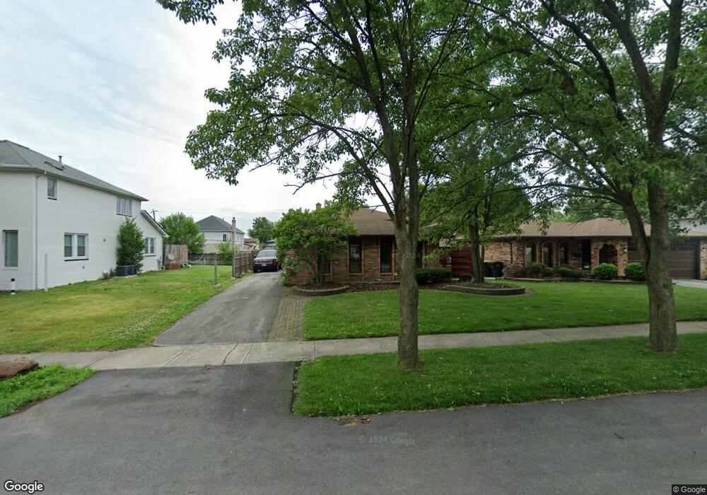
17819 Locust St Lansing, IL 60438
Estimated Value: $221,000 - $276,000
3
Beds
2
Baths
1,375
Sq Ft
$176/Sq Ft
Est. Value
About This Home
This home is located at 17819 Locust St, Lansing, IL 60438 and is currently estimated at $242,345, approximately $176 per square foot. 17819 Locust St is a home located in Cook County with nearby schools including Oak Glen Elementary School, Memorial Jr High School, and Thornton Fractnl So High School.
Ownership History
Date
Name
Owned For
Owner Type
Purchase Details
Closed on
Jun 10, 2004
Sold by
Citifinancial Mortgage Co Inc
Bought by
Walson Sherry Ann
Current Estimated Value
Home Financials for this Owner
Home Financials are based on the most recent Mortgage that was taken out on this home.
Original Mortgage
$121,200
Outstanding Balance
$58,730
Interest Rate
5.87%
Mortgage Type
Unknown
Estimated Equity
$183,615
Purchase Details
Closed on
Feb 28, 2003
Sold by
Luster Nicole
Bought by
Citifinancial Mortgage Co Inc and Associates Home Equity Services
Purchase Details
Closed on
Dec 9, 1998
Sold by
Griffin Richard D and Griffin Darcy L
Bought by
Luster Nicole
Home Financials for this Owner
Home Financials are based on the most recent Mortgage that was taken out on this home.
Original Mortgage
$115,650
Interest Rate
6.83%
Create a Home Valuation Report for This Property
The Home Valuation Report is an in-depth analysis detailing your home's value as well as a comparison with similar homes in the area
Home Values in the Area
Average Home Value in this Area
Purchase History
| Date | Buyer | Sale Price | Title Company |
|---|---|---|---|
| Walson Sherry Ann | -- | First American Title | |
| Citifinancial Mortgage Co Inc | -- | -- | |
| Citifinancial Mortgage Co Inc | -- | -- | |
| Luster Nicole | $128,500 | -- |
Source: Public Records
Mortgage History
| Date | Status | Borrower | Loan Amount |
|---|---|---|---|
| Open | Walson Sherry Ann | $121,200 | |
| Previous Owner | Luster Nicole | $115,650 | |
| Closed | Walson Sherry Ann | $30,300 |
Source: Public Records
Tax History Compared to Growth
Tax History
| Year | Tax Paid | Tax Assessment Tax Assessment Total Assessment is a certain percentage of the fair market value that is determined by local assessors to be the total taxable value of land and additions on the property. | Land | Improvement |
|---|---|---|---|---|
| 2024 | $7,589 | $18,071 | $3,124 | $14,947 |
| 2023 | $7,435 | $19,000 | $3,124 | $15,876 |
| 2022 | $7,435 | $14,860 | $2,756 | $12,104 |
| 2021 | $7,289 | $14,860 | $2,756 | $12,104 |
| 2020 | $6,898 | $14,860 | $2,756 | $12,104 |
| 2019 | $6,372 | $14,621 | $2,572 | $12,049 |
| 2018 | $6,250 | $14,621 | $2,572 | $12,049 |
| 2017 | $6,345 | $14,621 | $2,572 | $12,049 |
| 2016 | $6,118 | $13,687 | $2,388 | $11,299 |
| 2015 | $5,621 | $13,687 | $2,388 | $11,299 |
| 2014 | $5,571 | $13,687 | $2,388 | $11,299 |
| 2013 | $5,679 | $15,243 | $2,388 | $12,855 |
Source: Public Records
Map
Nearby Homes
- 17871 Locust St
- 17934 Locust St
- 2307 177th St
- 2036 Thornton Lansing Rd
- 2306 Holiday Terrace Unit 144
- 2306 Holiday Terrace Unit 163
- 2306 Holiday Terrace Unit 146
- 2201 Thornton Lansing Rd
- 17001 Glen Oak Ave
- 2237 175th St Unit 2B
- 2304 Holiday Terrace Unit 505
- 18005 Arcadia Ave
- 17750 Clyde Ave
- 17825 Oakley Ave
- 2290 182nd Place
- 18038 Whitman Ln
- 2155 Bernice Rd
- 17803 Escanaba Ave
- 1943 182nd St
- 18307 Locust St
- 17825 Locust St
- 17807 Locust St
- 17831 Locust St
- 17837 Locust St
- 17820 Rose St
- 17826 Rose St
- 17808 Rose St
- 17832 Rose St
- 17855 Locust St
- 17838 Rose St
- 17808 Locust St
- 17816 Locust St
- 17861 Locust St
- 17802 Locust St
- 17826 Locust St
- 17850 Rose St
- 17834 Locust St
- 17750 Locust St
- 17854 Rose St
- 17842 Locust St