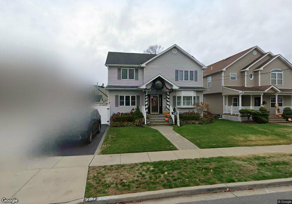
1782 Commonwealth Ave Merrick, NY 11566
Estimated Value: $945,668 - $1,038,000
5
Beds
3
Baths
2,500
Sq Ft
$397/Sq Ft
Est. Value
About This Home
This home is located at 1782 Commonwealth Ave, Merrick, NY 11566 and is currently estimated at $991,834, approximately $396 per square foot. 1782 Commonwealth Ave is a home located in Nassau County with nearby schools including Merrick Avenue Middle School, Sanford H Calhoun High School, and Grace Christian Academy.
Ownership History
Date
Name
Owned For
Owner Type
Purchase Details
Closed on
May 18, 2015
Sold by
Simmons Christopher and Simmons Jodi
Bought by
Langenohl Elise and Thompson Trevor
Current Estimated Value
Purchase Details
Closed on
Jul 29, 1996
Sold by
Lloyd Glenn and Lloyd Pamela
Bought by
Simmons Christopher and Simmons Jodi
Home Financials for this Owner
Home Financials are based on the most recent Mortgage that was taken out on this home.
Original Mortgage
$148,500
Interest Rate
8.24%
Create a Home Valuation Report for This Property
The Home Valuation Report is an in-depth analysis detailing your home's value as well as a comparison with similar homes in the area
Home Values in the Area
Average Home Value in this Area
Purchase History
| Date | Buyer | Sale Price | Title Company |
|---|---|---|---|
| Langenohl Elise | $610,000 | Stewart Title | |
| Simmons Christopher | $165,000 | -- |
Source: Public Records
Mortgage History
| Date | Status | Borrower | Loan Amount |
|---|---|---|---|
| Previous Owner | Simmons Christopher | $148,500 |
Source: Public Records
Tax History
| Year | Tax Paid | Tax Assessment Tax Assessment Total Assessment is a certain percentage of the fair market value that is determined by local assessors to be the total taxable value of land and additions on the property. | Land | Improvement |
|---|---|---|---|---|
| 2025 | $17,667 | $582 | $178 | $404 |
| 2024 | $4,073 | $596 | $182 | $414 |
| 2023 | $17,227 | $636 | $194 | $442 |
| 2022 | $17,227 | $614 | $188 | $426 |
| 2021 | $21,788 | $635 | $185 | $450 |
| 2020 | $16,565 | $860 | $493 | $367 |
| 2019 | $16,359 | $974 | $558 | $416 |
| 2018 | $17,401 | $949 | $0 | $0 |
| 2017 | $11,963 | $949 | $558 | $391 |
| 2016 | $16,405 | $949 | $413 | $536 |
| 2015 | $3,580 | $1,002 | $436 | $566 |
| 2014 | $3,580 | $1,002 | $436 | $566 |
| 2013 | $4,333 | $1,282 | $558 | $724 |
Source: Public Records
Map
Nearby Homes
- 160 Bedford Ave
- 1811 Bedford Ave
- 29 Babylon Turnpike
- 2203 Washington St
- 221 Thelma Ave
- 236 Thelma Ave
- 1931 Miller Place
- 80 Dobson Ave
- 2341 Dobson Ave
- 131 Gregory Ave
- 45 Gregory Ave
- 1729 Gormley Ave
- 1911 Carroll Ave
- 1763 E Berkshire Rd
- 24 Loines Ave
- 241 Commercial St
- 174 Babylon Turnpike
- 33 Willow Ave
- 1741 Bushwick Ave
- 16 Margaret Blvd
- 159 Commonwealth Ave
- 1778 Commonwealth Ave
- 2174 Madison St
- 1772 Commonwealth Ave
- 160 Commonwealth Ave
- 1800 Commonwealth Ave
- 1781 Stuyvesant Ave
- 1768 Commonwealth Ave
- 1775 Stuyvesant Ave
- 1783 Commonwealth Ave
- 1789 Stuyvesant Ave
- 2173 Madison St
- 1777 Commonwealth Ave
- 1806 Commonwealth Ave
- 1762 Commonwealth Ave
- 168 Stuyvesant Ave
- 1799 Commonwealth Ave
- 1799 Commonwealth Ave Unit Top
- 1769 Commonwealth Ave
- 1773 Commonwealth Ave
Your Personal Tour Guide
Ask me questions while you tour the home.