Estimated Value: $177,000 - $191,248
3
Beds
1
Bath
1,081
Sq Ft
$172/Sq Ft
Est. Value
About This Home
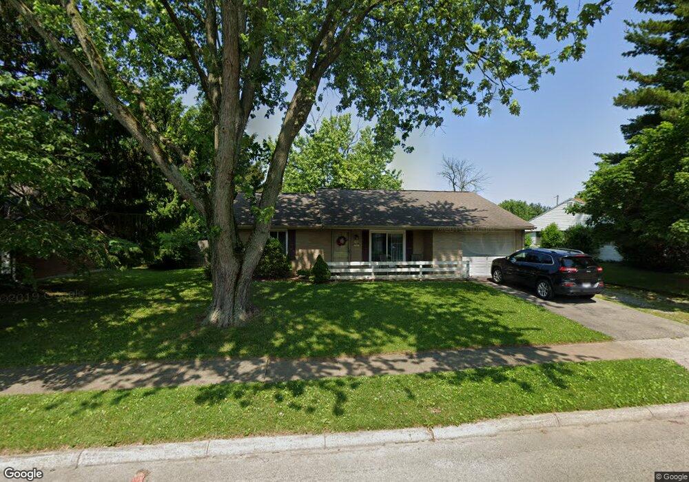
This home is located at 1782 Commonwealth Dr, Xenia, OH 45385 and is currently estimated at $185,812, approximately $171 per square foot. 1782 Commonwealth Dr is a home located in Greene County with nearby schools including Xenia High School and Summit Academy Community School for Alternative Learners - Xenia.
Ownership History
Date
Name
Owned For
Owner Type
Purchase Details
Closed on
Nov 24, 2021
Sold by
Brown Roger D and Brown Sandra K
Bought by
Brown Steven D and Brown Tara L
Current Estimated Value
Home Financials for this Owner
Home Financials are based on the most recent Mortgage that was taken out on this home.
Original Mortgage
$76,800
Outstanding Balance
$65,554
Interest Rate
3.14%
Mortgage Type
New Conventional
Estimated Equity
$120,258
Purchase Details
Closed on
Apr 27, 2009
Sold by
Brown Steven D and Brown Tara
Bought by
Brown Steven D and Brown Tara
Home Financials for this Owner
Home Financials are based on the most recent Mortgage that was taken out on this home.
Original Mortgage
$66,750
Interest Rate
4.9%
Mortgage Type
New Conventional
Purchase Details
Closed on
Oct 19, 2005
Sold by
Massarini Richard and Massarini Marcie
Bought by
Brown Roger D and Brown Sandra K
Home Financials for this Owner
Home Financials are based on the most recent Mortgage that was taken out on this home.
Original Mortgage
$50,000
Interest Rate
5.8%
Mortgage Type
Fannie Mae Freddie Mac
Purchase Details
Closed on
Oct 20, 2004
Sold by
Martin Howard
Bought by
Massarini Richard
Home Financials for this Owner
Home Financials are based on the most recent Mortgage that was taken out on this home.
Original Mortgage
$84,500
Interest Rate
8.3%
Mortgage Type
Unknown
Purchase Details
Closed on
Feb 9, 2004
Sold by
Estate Of Emmett R Martin
Bought by
Martin Howard
Purchase Details
Closed on
Oct 27, 2000
Sold by
Aleshire James D and Lee Candi Lee
Bought by
Martin Emmett R
Purchase Details
Closed on
May 8, 1998
Sold by
Whitt Mark A and Whitt Mariann L
Bought by
Aleshire James D and Aleshire Candi Lee
Home Financials for this Owner
Home Financials are based on the most recent Mortgage that was taken out on this home.
Original Mortgage
$75,450
Interest Rate
7.25%
Mortgage Type
VA
Purchase Details
Closed on
Jun 7, 1995
Sold by
Baker Kenneth A
Bought by
Whitt Mark A and Whitt L
Home Financials for this Owner
Home Financials are based on the most recent Mortgage that was taken out on this home.
Original Mortgage
$59,350
Interest Rate
8.26%
Mortgage Type
New Conventional
Create a Home Valuation Report for This Property
The Home Valuation Report is an in-depth analysis detailing your home's value as well as a comparison with similar homes in the area
Home Values in the Area
Average Home Value in this Area
Purchase History
| Date | Buyer | Sale Price | Title Company |
|---|---|---|---|
| Brown Steven D | -- | None Listed On Document | |
| Brown Steven D | -- | Lsi | |
| Brown Roger D | $85,400 | -- | |
| Massarini Richard | $84,500 | -- | |
| Martin Howard | -- | -- | |
| Martin Emmett R | $76,000 | -- | |
| Aleshire James D | $74,000 | -- | |
| Whitt Mark A | $62,500 | -- |
Source: Public Records
Mortgage History
| Date | Status | Borrower | Loan Amount |
|---|---|---|---|
| Open | Brown Steven D | $76,800 | |
| Previous Owner | Brown Steven D | $66,750 | |
| Previous Owner | Brown Roger D | $50,000 | |
| Previous Owner | Massarini Richard | $84,500 | |
| Previous Owner | Aleshire James D | $75,450 | |
| Previous Owner | Whitt Mark A | $59,350 |
Source: Public Records
Tax History Compared to Growth
Tax History
| Year | Tax Paid | Tax Assessment Tax Assessment Total Assessment is a certain percentage of the fair market value that is determined by local assessors to be the total taxable value of land and additions on the property. | Land | Improvement |
|---|---|---|---|---|
| 2024 | $2,047 | $47,840 | $11,550 | $36,290 |
| 2023 | $2,047 | $47,840 | $11,550 | $36,290 |
| 2022 | $1,698 | $33,850 | $6,790 | $27,060 |
| 2021 | $1,721 | $33,850 | $6,790 | $27,060 |
| 2020 | $1,649 | $33,850 | $6,790 | $27,060 |
| 2019 | $1,295 | $25,030 | $6,540 | $18,490 |
| 2018 | $1,300 | $25,030 | $6,540 | $18,490 |
| 2017 | $1,175 | $25,030 | $6,540 | $18,490 |
| 2016 | $1,176 | $22,210 | $6,540 | $15,670 |
| 2015 | $1,179 | $22,210 | $6,540 | $15,670 |
| 2014 | $1,129 | $22,210 | $6,540 | $15,670 |
Source: Public Records
Map
Nearby Homes
- 1866 Roxbury Dr
- 1403 Texas Dr
- 1778 Arapaho Dr
- 1829 Gayhart Dr
- 1769 Gayhart Dr
- 1908 Whitt St
- 1255 Colorado Dr
- 1107 Arkansas Dr
- 1618 Navajo Dr
- 1653 Seneca Dr
- 1272 Bellbrook Ave
- 1208 Bellbrook Ave
- 2499 Jenny Marie Dr
- 2257 Maryland Dr
- 2540 Jenny Marie Dr
- 2345 Tennessee Dr
- 2421 Louisiana Dr
- 2142 Michigan Dr
- 2540 Cornwall Dr
- 1568 Cheyenne Dr
- 1764 Commonwealth Dr
- 1792 Commonwealth Dr
- 1779 Roxbury Dr
- 1791 Roxbury Dr
- 1767 Roxbury Dr
- 1806 Commonwealth Dr
- 1746 Commonwealth Dr
- 1781 Commonwealth Dr
- 1767 Commonwealth Dr
- 1793 Commonwealth Dr
- 1803 Roxbury Dr
- 1753 Commonwealth Dr
- 1820 Commonwealth Dr
- 1807 Commonwealth Dr
- 1755 Roxbury Dr
- 1728 Commonwealth Dr
- 1815 Roxbury Dr
- 1739 Commonwealth Dr
- 1819 Commonwealth Dr
- 1788 Roxbury Dr