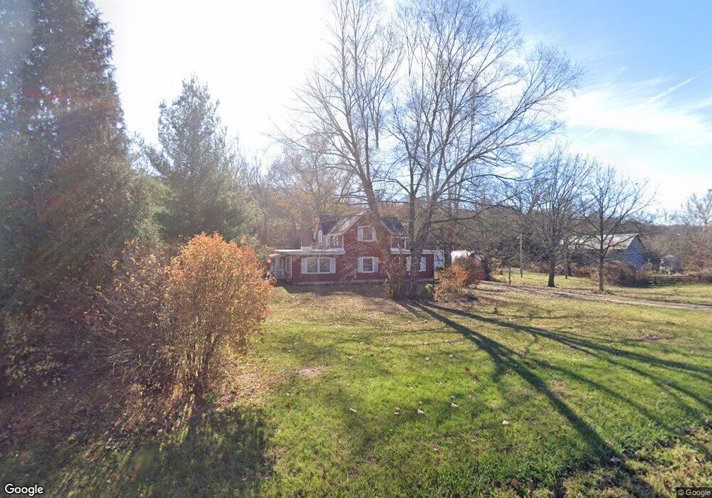
1782 Highway 100 Hermann, MO 65041
Estimated Value: $348,000 - $671,000
4
Beds
3
Baths
2,600
Sq Ft
$196/Sq Ft
Est. Value
About This Home
This home is located at 1782 Highway 100, Hermann, MO 65041 and is currently estimated at $508,868, approximately $195 per square foot. 1782 Highway 100 is a home located in Gasconade County with nearby schools including Hermann Elementary School, Hermann Middle School, and Hermann High School.
Ownership History
Date
Name
Owned For
Owner Type
Purchase Details
Closed on
Mar 4, 2016
Sold by
Hellesbusch Kenneth J and Hellesbusch Carol A
Bought by
Dial Raymond L and Dial Janet M
Current Estimated Value
Home Financials for this Owner
Home Financials are based on the most recent Mortgage that was taken out on this home.
Original Mortgage
$175,525
Outstanding Balance
$139,250
Interest Rate
3.72%
Mortgage Type
New Conventional
Estimated Equity
$369,618
Create a Home Valuation Report for This Property
The Home Valuation Report is an in-depth analysis detailing your home's value as well as a comparison with similar homes in the area
Home Values in the Area
Average Home Value in this Area
Purchase History
| Date | Buyer | Sale Price | Title Company |
|---|---|---|---|
| Dial Raymond L | -- | None Available |
Source: Public Records
Mortgage History
| Date | Status | Borrower | Loan Amount |
|---|---|---|---|
| Open | Dial Raymond L | $175,525 | |
| Previous Owner | Hellebusch Kenneth J | $198,000 |
Source: Public Records
Tax History Compared to Growth
Tax History
| Year | Tax Paid | Tax Assessment Tax Assessment Total Assessment is a certain percentage of the fair market value that is determined by local assessors to be the total taxable value of land and additions on the property. | Land | Improvement |
|---|---|---|---|---|
| 2025 | $1,510 | $26,130 | $0 | $0 |
| 2024 | $1,510 | $22,310 | $0 | $0 |
| 2023 | $1,504 | $24,070 | $0 | $0 |
| 2022 | $1,503 | $24,070 | $0 | $0 |
| 2021 | $1,507 | $24,075 | $1,816 | $22,259 |
| 2020 | $1,577 | $23,950 | $0 | $0 |
| 2019 | $1,576 | $23,950 | $0 | $0 |
| 2018 | $1,516 | $23,950 | $0 | $0 |
| 2017 | $0 | $23,890 | $0 | $0 |
| 2016 | $1,387 | $23,950 | $0 | $0 |
| 2015 | -- | $23,950 | $0 | $0 |
| 2014 | -- | $0 | $0 | $0 |
| 2013 | -- | $0 | $0 | $0 |
Source: Public Records
Map
Nearby Homes
- 2091 Frene Creek Rd
- 129 Ash St
- 1483 Cedar Ridge Dr
- 1933 First Creek Rd
- 2020 Choctaw Path
- 405 W 18th St
- 1105 Navajo Trail
- 0 Epple-Fricke Dr
- 1014 Jefferson St
- 524 W 8th St
- 518 W 7th St
- 33 Highway 100
- 28 Highway 100
- 606 Washington St
- 218 W 6th St
- 0 E 12th St Unit Lot 4 MAR25016068
- 217 W 6th St
- 1849 Benson Rd
- 205 E 8th St
- Lots 58 & 60 E 9th St
- 1782 Highway 100
- 1782 Highway 100
- 1782 Highway 100
- 1782 Highway 100
- 1737 Highway 100
- 1783 Highway 100
- 1783 Highway 100
- 1781 Highway 100
- 1781 Highway 100
- 1781 Highway 100
- 1787 Highway 100
- 1787 Highway 100
- 1787 Highway 100
- 1505 Lip A Tal Rd
- 1741 Highway 100
- 1500 Lip A Tal Rd
- 1797 Highway 100
- 1800 Highway 100
- 1800 Highway 100
- 1800 Highway 100