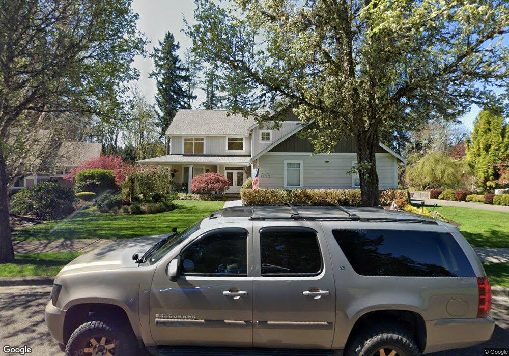
1782 Mcleod Cir Dupont, WA 98327
Estimated Value: $870,000 - $1,062,000
4
Beds
3
Baths
3,258
Sq Ft
$302/Sq Ft
Est. Value
About This Home
This home is located at 1782 Mcleod Cir, Dupont, WA 98327 and is currently estimated at $983,028, approximately $301 per square foot. 1782 Mcleod Cir is a home located in Pierce County with nearby schools including Chloe Clark Elementary School, Saltars Point Elementary School, and Pioneer Middle School.
Ownership History
Date
Name
Owned For
Owner Type
Purchase Details
Closed on
Sep 9, 2002
Sold by
Manchester Construction Llc
Bought by
Beard Garnet C and Beard Alpha N
Current Estimated Value
Home Financials for this Owner
Home Financials are based on the most recent Mortgage that was taken out on this home.
Original Mortgage
$257,200
Interest Rate
6.37%
Purchase Details
Closed on
Mar 20, 2002
Sold by
The Quadrant Corp
Bought by
Manchester Construction Llc
Create a Home Valuation Report for This Property
The Home Valuation Report is an in-depth analysis detailing your home's value as well as a comparison with similar homes in the area
Home Values in the Area
Average Home Value in this Area
Purchase History
| Date | Buyer | Sale Price | Title Company |
|---|---|---|---|
| Beard Garnet C | $410,000 | Fidelity National Title Co | |
| Manchester Construction Llc | $77,900 | Transnation Title Insurance |
Source: Public Records
Mortgage History
| Date | Status | Borrower | Loan Amount |
|---|---|---|---|
| Previous Owner | Beard Garnet C | $257,200 |
Source: Public Records
Tax History Compared to Growth
Tax History
| Year | Tax Paid | Tax Assessment Tax Assessment Total Assessment is a certain percentage of the fair market value that is determined by local assessors to be the total taxable value of land and additions on the property. | Land | Improvement |
|---|---|---|---|---|
| 2025 | $7,827 | $1,057,600 | $272,400 | $785,200 |
| 2024 | $7,827 | $1,005,400 | $262,400 | $743,000 |
| 2023 | $7,827 | $974,100 | $276,800 | $697,300 |
| 2022 | $7,889 | $995,100 | $276,800 | $718,300 |
| 2021 | $7,486 | $744,700 | $175,800 | $568,900 |
| 2019 | $6,702 | $687,800 | $146,500 | $541,300 |
| 2018 | $7,463 | $656,400 | $146,500 | $509,900 |
| 2017 | $6,729 | $640,200 | $126,000 | $514,200 |
| 2016 | $6,446 | $580,200 | $106,300 | $473,900 |
| 2014 | $5,805 | $573,300 | $106,300 | $467,000 |
| 2013 | $5,805 | $502,300 | $102,500 | $399,800 |
Source: Public Records
Map
Nearby Homes
- 1875 Mcneil Cir Unit E-1
- 1821 Mcneil Cir Unit D-3
- 1856 Spencer Ct Unit 12F
- 1607 Kincaid St Unit E-8
- 2055 Garry Oaks Ave Unit B
- 1625 Palisade Blvd
- 1451 Thompson Cir Unit 4A
- 1613 Palisade Blvd
- 1449 Bobs Hollow Ln
- 2176 McDonald Ave
- 2160 Anderson Ave
- 2104 Palisade Blvd Unit B-7
- 2357 Wallace St
- 2147 Hammond Ave Unit B10
- 2176 Palisade Blvd Unit F-3
- 2198 Palisade Blvd Unit C2
- 2420 Simmons St
- 2237 Tolmie St
- 2702 Meyer St
- 604 Dupont Ave
- 1778 Mcleod Cir
- 1774 Mcleod Cir
- 1794 Mcleod Cir
- 1770 Mcleod Cir
- 1798 Mcleod Cir
- 1766 Mcleod Cir
- 1746 Mcleod Cir
- 1750 Mcleod Cir
- 1830 Fisher Ave
- 1742 Mcleod Cir
- 1826 Fisher Ave
- 1754 Mcleod Cir
- 1762 Mcleod Cir
- 1758 Mcleod Cir
- 1834 Fisher St
- 1822 Fisher Ave
- 1738 Mcleod Cir
- 1734 Mcleod Cir
- 1730 Mcleod Cir