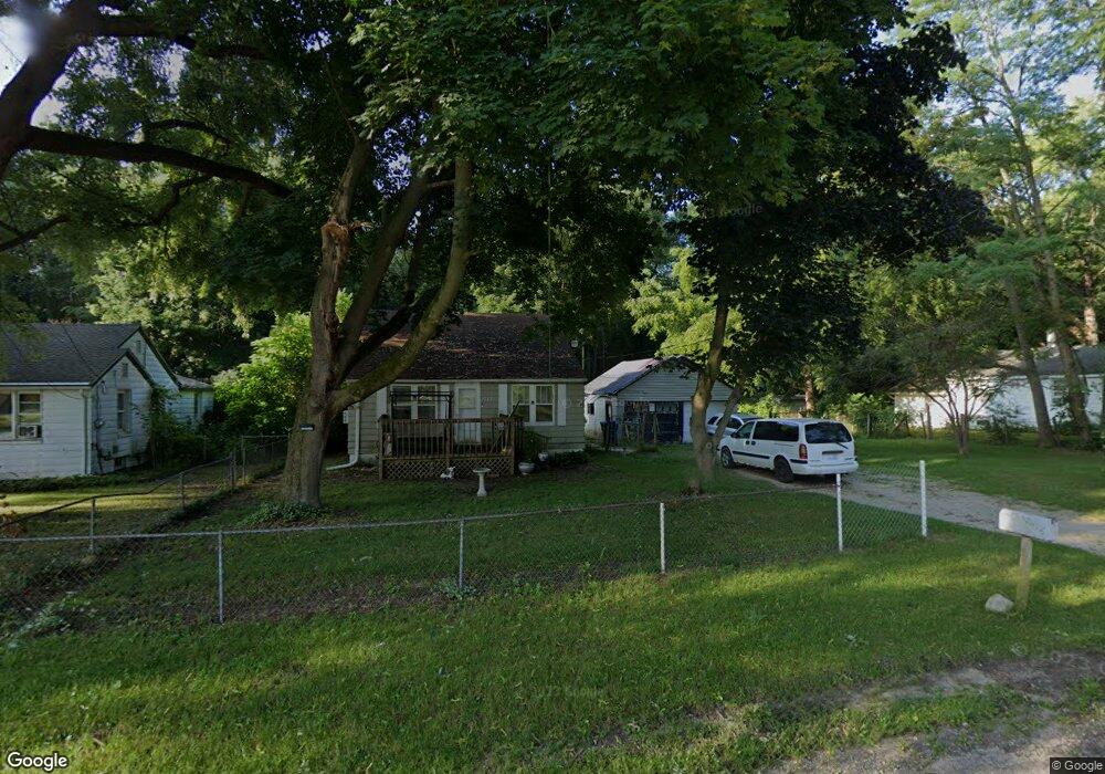
1782 Merrimac Rd Benton Harbor, MI 49022
Estimated Value: $108,000 - $128,693
5
Beds
2
Baths
1,084
Sq Ft
$112/Sq Ft
Est. Value
About This Home
This home is located at 1782 Merrimac Rd, Benton Harbor, MI 49022 and is currently estimated at $120,923, approximately $111 per square foot. 1782 Merrimac Rd is a home located in Berrien County with nearby schools including Fair Plain Middle School and Benton Harbor High School.
Ownership History
Date
Name
Owned For
Owner Type
Purchase Details
Closed on
Jul 19, 2022
Sold by
Armstrong Michael H
Bought by
Parsons Bonnie
Current Estimated Value
Purchase Details
Closed on
Dec 11, 2015
Sold by
Golliday Maurice L and Bgb Development Llc
Bought by
Armstrong Michael Henry and Parsons Bonnie
Purchase Details
Closed on
Oct 11, 2011
Sold by
Locklear Julius and Lcklear Hannah Franklin
Bought by
Bgb Developments Llc
Purchase Details
Closed on
Mar 24, 1989
Create a Home Valuation Report for This Property
The Home Valuation Report is an in-depth analysis detailing your home's value as well as a comparison with similar homes in the area
Home Values in the Area
Average Home Value in this Area
Purchase History
| Date | Buyer | Sale Price | Title Company |
|---|---|---|---|
| Parsons Bonnie | -- | New Title Company Name | |
| Armstrong Michael Henry | $25,000 | None Available | |
| Bgb Developments Llc | $10,000 | None Available | |
| -- | $100 | -- |
Source: Public Records
Tax History Compared to Growth
Tax History
| Year | Tax Paid | Tax Assessment Tax Assessment Total Assessment is a certain percentage of the fair market value that is determined by local assessors to be the total taxable value of land and additions on the property. | Land | Improvement |
|---|---|---|---|---|
| 2025 | $852 | $49,400 | $0 | $0 |
| 2024 | $463 | $41,700 | $0 | $0 |
| 2023 | $898 | $28,700 | $0 | $0 |
| 2022 | $360 | $27,200 | $0 | $0 |
| 2021 | $641 | $26,100 | $2,300 | $23,800 |
| 2020 | $632 | $25,700 | $0 | $0 |
| 2019 | $969 | $19,900 | $1,400 | $18,500 |
| 2018 | $941 | $19,900 | $0 | $0 |
| 2017 | $927 | $18,400 | $0 | $0 |
| 2016 | $910 | $18,200 | $0 | $0 |
| 2015 | $975 | $19,500 | $0 | $0 |
| 2014 | $684 | $19,400 | $0 | $0 |
Source: Public Records
Map
Nearby Homes
- 766 S Crystal Ave
- 1277 Parkway Dr
- 1292 Lynn Ave
- 1235 Ravina Ave
- 2508 Pipestone Rd
- 2872 Pipestone Rd
- 1783 Greenly Ave
- 1483 Rose Ave
- 1549 Reeder Ave
- 0 V/L E Empire Ave
- 1608 Reeder Ave
- 1613 Norton Ave
- 1504 Michigan 139
- 00 Michigan 139 Unit B
- 00 Michigan 139 Unit A
- 0 Fairplain Dr Unit 24044760
- 2431 E Britain Ave
- 1380 Milton St
- 1337 Agard Ave
- 688 S Fair Ave
- 1790 Merrimac Rd
- 1766 Merrimac Rd
- 1783 Merrimac Rd
- 1767 Merrimac Rd
- 1752 Merrimac Rd
- 1804 Merrimac Rd
- 1753 Merrimac Rd
- 1736 Merrimac Rd
- 1820 Merrimac Rd
- 1235 S Crystal Ave
- 1840 Merrimac Rd
- 1851 Merrimac Rd
- 1835 Merrimac Rd
- 1848/1882 Merrimac Rd
- 1848 Merrimac Rd
- 1861 Merrimac Rd
- 1882 Merrimac Rd
- 1200 S Crystal Ave
- 1131 Harbor Ct
- 1115 Harbor Ct